Flooding caused by excessive rainfall possible Thursday
LAFAYETTE, Ind. — Excessive rainfall expected for most of Central Indiana could affect low-lying areas along the Wabash River Thursday, particularly areas where the river winds its way through Tippecanoe, Parke, Warren, Fountain and Vermillion counties.
Wildcat Creek in Tippecanoe County could also be affected, according to the National Weather Service.
After a short flood watch period starting Wednesday night, the National Weather Service placed the Tippecanoe County area in a more serious flood warning through Sunday, as rain continues to move through Greater Lafayette. The heaviest rainfall is expected Wednesday night and into Thursday. As many as 2 inches, higher amounts possible in isolated parts of the warning area, are predicted to fall.
Subscription Sale: Get unlimited digital access with one our best deals of the year
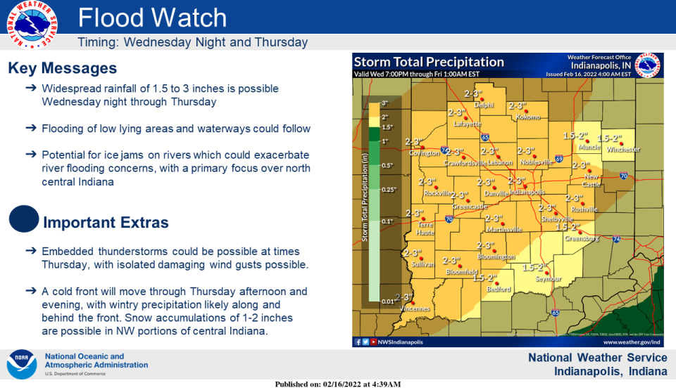
"Excessive runoff may result in flooding of rivers, creeks, streams, and other low-lying and flood-prone locations," the National Weather Service advised. "Creeks and streams may rise out of their banks. Low-water crossings may be flooded."
Those living in flood-prone areas should be prepared to move to higher ground.
The snowstorm earlier this month left precarious conditions on the river, as temperatures warm and river ice along the river banks breaks up. That thaw can increase additional flooding concerns along area streams, the weather service stated.
A wintry mix of precipitation into Thursday evening should only produce minor snow and ice accumulations.
For subscribers: Positive approach keeps Purdue basketball's Brandon Newman engaged
Rain showers and freezing rain could move in before 4 p.m. Thursday, transitioning to snow showers, freezing rain and sleet after 5 p.m., when temperatures are expected to fall to around 30.
Chance of precipitation is 100%, and new ice accumulation of less than a 0.1 of an inch possible.
Safety tips during flooding
The Wednesday's advisory emphasized these precautions during flooding conditions:
Motorists should not attempt to drive around barricades or drive cars through flooded areas
Turn around, don`t drown when encountering flooded roads.
Most flood deaths occur in vehicles.
Additional information is available at www.weather.gov/ind.
Deanna Watson is the executive editor at the Journal & Courier. Contact her at dwatson@gannett.com. Follow her on Twitter at @deannawatson66.
This article originally appeared on Lafayette Journal & Courier: Flooding from excessive rainfall possible for most of Central Indiana

