Oregon flood updates: Highway 101 reopens in Seaside, Lincoln City; closed in Tillamook
This story was updated at 5:55 p.m. on Wednesday, Dec. 6
Heavy rains from a second atmospheric river of moisture is bringing flooding to some parts of Oregon. Here's the latest on road closures, landslides and other issues.
The impact is most acute on the Oregon Coast.
"Anywhere you drive on the Oregon Coast, slow down for stormy conditions and standing water on the pavement," the Oregon Department of Transportation said.
Visit TripCheck.com for the latest information.
City of Salem reports 9 sewage overflows due to intense rainfall
The City of Salem said in a prepared statement Wednesday night that an undetermined amount of sewage began flowing into the Willamette River starting at 10 a.m. from Union and Church streets.
Eight other overflows, also of undetermined amounts, were reported from sewage manholes throughout the city into creeks, including Pringle, Claggett, and fork of the Little Pudding.
"During intense rainstorms, the saturated ground allows water to enter the sanitary sewer system through cracks and holes in the pipe network," the release said. "This overwhelms the sewer system’s capacity to transport sewage to the water pollution control facility, resulting in an overload."
The city said warning signs were posted to advise people to avoid contact with the water in the Willamette River, Pringle, Claggett, and Little Pudding due to the potential for high levels of bacteria.
McGilchrist St SE reopened from 16th St SE to 22nd St SE streets in Salem
McGilchrist St SE in south Salem was closed for a couple of hours Wednesday afternoon due to water on the roadway between 16th St SE and 22nd St SE.
Dallas Water Reclamation Facility overflows into Rickreall Creek
According to the City of Dallas, the city's Water Reclamation Facility began overflowing Wednesday morning into Rickreall Creek due to more than 2 inches of rain over the past 24 hours and soil already saturated by previous rains.
The city has reported the incident to the Oregon Department of Environmental Quality. Facility staff are monitoring stream conditions, according to the press release.
The Rickreall Creek Trail is closed between the Barberry and Hawthorne trailheads due to high water, the city said.
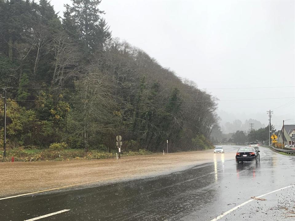
Highway 101 and 6 still closed in Tillamook
U.S. Highway 101 has closed in Tillamook due to flooding during high tide and heavy rain, ODOT said.
"Expect a detour and delays," the state agency said.
Also in Tillamook, Oregon Highway 6 near the junction with Highway 101 remains closed due to high water.
"A detour is available there as well," ODOT said.
Oregon Highway 229 south of Lincoln City closed
Oregon Highway 229, south of Lincoln City and north of Newport, is closed at at milepost 9, nine miles south of the intersection with U.S. 101, due to high water.
Highway 101 reopens to one lane north of Lincoln City
U.S. Highway 101 north of Lincoln City reopened to one lane on the Oregon Coast. The slowdown is due to high water.
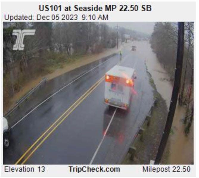
U.S. Highway 101 reopens in Seaside
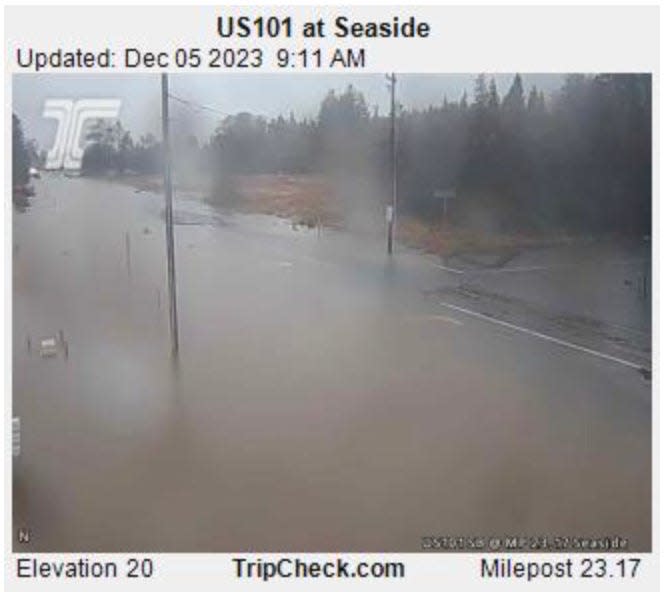
Water levels receded enough Wednesday morning to allow traffic through U.S. 101 between Seaside and the junction with U.S. 26.
"With heavy rain continuing throughout this week, we will continue to monitor the water level there and in other sections of highway in low elevations," ODOT said.
Highway 101 has multiple slowdowns due to high water
U.S. Highway 101 has reopened in many of the places it was closed Tuesday, but the Coastal highway has many slowdowns due to high and standing water on the roadway.
Landslide blocks Forest Road 19 near Cougar Dam, access to hot springs slowed
Forest Service Road 19 (Aufderheide Drive) at mile post 55.5 near Cougar Dam was closed Dec. 3 due to a landslide. Forest engineers worked to reopen the road, and traffic is currently reduced to one lane, the U.S. Forest Service said in a news release.
"Road repair work is expected to be ongoing and intermittent with the possibility of more rock fall," the federal agency said.
Terwilliger Hot Springs remains open but could be difficult to access, officials said. It's unclear how long the road will be impacted.
Willamette River projected to reach 19 feet in Salem
The Willamette River in Salem is projected to stay high but below "action stage" in Salem for the next four to five days. The river is forecasted to reach 19 feet, according to NOAA projections, which can impact roads in the Minto-Brown Island Area and keep ferry service closed.
Highway 101 slowed near Coos Bay
Water is on the road and traffic is slowed south of Coos Bay on U.S. Highway 101, according to TripCheck.
This story will be updated as information becomes available.
Zach Urness has been an outdoors reporter in Oregon for 15 years and is host of the Explore Oregon Podcast. To support his work, subscribe to the Statesman Journal. He can be reached at zurness@StatesmanJournal.com or (503) 399-6801. Find him on Twitter at @ZachsORoutdoors.
This article originally appeared on Salem Statesman Journal: Flood updates: US 101 and Highway 6 still closed in Tillamook

