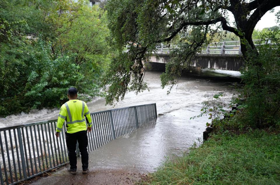
Weather service extends flood watch across all of Central Texas to midnight
The National Weather Service extended its flash flooding warnings for parts of Central Texas to the early evening on Thursday.
Parts of Williamson and northeastern Travis counties, including Pflugerville, Round Rock and Taylor, have a flash flood warning through 5 p.m. Parts of Hays and southeastern Travis counties, including San Marcos, Kyle and Buda, have a flash flood warning through 4 p.m., the weather service said.
Meanwhile, the weather service said a flood watch has been put in effect until midnight for all of Central Texas, including the counties of Travis, Williamson, Hays, Bastrop and Caldwell.
The National Weather Service confirmed that two "potential tornadoes occurred" in parts of Central Texas Thursday morning, and cautioned that while there weren't any specific warnings, areas along the Interstate 35 corridor and east of it remained under threat until the early afternoon.
A tornado warning was issued by the National Weather Service for parts of Hays and Caldwell counties through 11:30 a.m. near the cities of Uhland and Niederwald.
Keith White, a meteorologist with the National Weather Service, said that although there were no active tornado warnings as of 10:50 a.m., there's a possibility some could develop by about 2 p.m.
White said the weather service is sending ground teams to learn more details about the tornado in northern Caldwell County Thursday morning. He said there are also reports of a tornado in the San Antonio region.
Local law enforcement officials told the weather service a tornado touched down in northern Caldwell County, but there are no details about the size or damage caused by the tornado, the weather service said.
Burnet and Blanco counties are under a flood advisory, according to the weather service, while parts of the Hill Country have been placed under either a flash flood warning or a flood watch.
Counties along the Interstate 35 corridor remain under a flood watch, including Hays, Travis and Williamson counties.
Some parts of Travis and Williamson counties had already seen 2-4 inches of rain as of 10 a.m., according to the weather service. Some areas could see another 2-4 inches on Thursday, White said.
Scattered showers are expected throughout the day, with the heavy downpours and chances expected to taper off in the late afternoon and early evening, White said. There's also a chance for more rain on Friday, but White said the weather service currently does not expect it to be as severe as Thursday.
Whether you're on foot or in a car, if a road appears to be flooded, turn around. You can check whether roadways near you are flooded or closed on AtxFloods.com.
Rain chances in Austin remain high through the rest of Thursday morning and parts of the afternoon, with those chances continually decreasing until the evening, according to the weather service.
This is a developing story and will continually be updated as more information is made available.
This article originally appeared on Austin American-Statesman: Weather service: Flood watch for Central Texas extended to midnight

