Flooding reaches some Utah cities, but water managers welcome huge snowpack
March, which is typically Utah’s best month for precipitation, outdid itself this year.
By the time it was over, precipitation was 250% of normal, more than twice what the month generally delivers.
“I don’t know what we did to deserve March, but it was something. I don’t know what to say about March. I know our forecast staff was extremely tired. It was just phenomenal,” said Glen Merrill, senior hydrologist with the National Weather Service in Salt Lake City, adding not only was the wet weather outstanding, but the cool temperatures as well.
“We’re talking 8 to 13 degrees below normal for mean temperatures for the night,” he said. “I can’t remember a month that was anywhere close to them.”
Clayton, Merrill and a room full of other water experts met Friday in the monthly Water Supply Outlook meeting to discuss the snowpack, streamflow forecasts, reservoir capacity and, of course, flooding.
The relief of periodic warmups
The warmer temperatures last week kick-started the melt from lower and mid-elevations of a snowpack that exceeded that of the early ’80s and even, cautiously speaking, the big snow year of 1952, although at that time measurements were not taken as often and measure sites were not as plentiful.
Related
“So I think we can say with confidence that we are in uncharted territory for the state and definitely broke new records there,” added Jordan Clayton, supervisor of the Utah Snow Survey of the Natural Resources Conservation Service.
The active weather pattern is good news for what in recent years has been extremely dry soils, low reservoirs and tepid runoffs.
Cutting deficits
Clayton said from 2020 to the present, major basins in the state are cutting their precipitation deficits anywhere from 75% to 90% in most locations and the anticipation is that some of those locations will get out of a deficit and actually move into surplus.
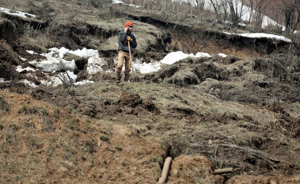
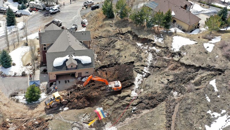
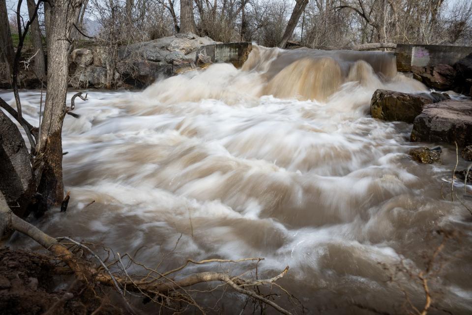
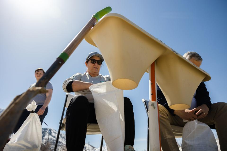
That snow coming off the mountains means extraordinarily high stream runoff forecasts in some areas and flooding that is already happening at Emigration Creek, resulting in the closure of some recreational trails near waterways and wary eyes cast on the Weber and Ogden rivers.
Given the snowmelt-driven nature of the rise in flow, these will continue to crest late each night and fall during the day, with flows reaching their lowest midday, with the current forecast showing this low point as below flood stage. #utwx pic.twitter.com/RBac2RURjq
— NWS Salt Lake City (@NWSSaltLakeCity) April 16, 2023
“Those are streamflow forecasts that are greater than 300% of normal, greater than three times the typical value at those locations. And again, that’s compared to average,” Clayton said. “So it’s really exciting, these forecasts. And I think nobody should be surprised to hear that we have the potential to set some records for runoff at certain locations.”
Related
Reservoirs releasing some water
All that water needs to go somewhere and reservoirs are already in an operational mode of controlled releases to make room for the coming melt.
The precipitation has also delivered enough water to lift the ailing Great Salt Lake by 3.5 feet and forecasters predict Lake Powell will receive 11 million acre-feet of water due to inflows.
Neither of those amounts are enough to get the Great Salt Lake or Lake Powell Reservoir out of trouble, but it will help.
And as the berm dividing the north arm of the Great Salt Lake from the south arm is expected to be eclipsed by the precipitation, water experts said some of that additional water will make it into the north arm — a good thing.
The episodic warming and cooling last week will be duplicated this week, with experts saying that is a good sign the snow may continue to come off gradually. While temperatures were expected to spike Monday inching toward the 70-degree mark, a cold front moves in bringing a chance of rain Tuesday into Thursday. Friday, forecasters say, will see temperatures climb back into the 60-degree area.
“It’s great that we have this episodic warmup because we’ve got a long few months to go,” Merrill said. “Keep pulling down what we can when we can. Every day that we hold on to snow this time of year is one more day that it’s going to take to melt that later. So, let’s do it as efficiently as possible.”
A wild ride ahead
Related
Gary Henrie, a civil engineer with the U.S. Bureau of Reclamation, often uses cars as a metaphor for how the snowpack is performing. For the last few years, he’s displayed a picture of an old clunker badly in need of help. This year, he said he should have showed a photo of a sleek, high performance sports car.
Instead he showed a picture of a bull rider.
“I think we are in for a pretty big ride this spring when the (snow) starts moving,” he said. “I guess the take home is let’s make sure we are wearing our helmet. It’s going to be a wild ride. Hang on.”