Florida Keys escaped the worst of Tropical Storm Eta. But there’s still cleanup to do
For Keys residents who went through a Category 4 hurricane three years ago, Tropical Storm Eta wasn’t much to talk about.
Downed trees. Some home damage. Branches here and there. Flooded local streets.
The Florida Keys prepared for a major storm, closing schools, opening shelters, calling for the evacuation of some people. But the island chain escaped the worst of Eta Sunday night and Monday morning. And for those affected, it meant some cleanup but no disaster to worry about.
“I have trees down, and some damage to my fence and patio,” said Renita Sanders, 45, of Key Largo.
The center of Tropical Storm Eta passed over Lower Matecumbe Key late Sunday night, but the late-season system largely spared the Keys. The National Weather Service discontinued its tropical storm warning Monday afternoon from north Key Largo to Key West, but kept it in effect for the Dry Tortugas. The center of the storm did not contain much heavy weather, nor did the south and west sides of the system.
The north and east sides of Eta, however, came with high winds and heavy rainfall, causing flooding and downed trees from Islamorada to Ocean Reef in the Keys and from Homestead to Palm Beach on the mainland, said Jon Rizzo, warning coordination meteorologist with the National Weather Service in Key West.
In Key Largo, neighborhood roads, downed trees and branches littered parking lots and parts of U.S. 1.
Howard Sanders, 63, has lived in Key Largo for most of his life. He’s been through many hurricanes and tropical storms. Asked which one was the worst, without hesitation, he bluntly replied, “Irma.”
Irma hit the Keys in September 2017 as a Cat 4 hurricane, destroying many homes and businesses up and down the island chain.
On Monday, Sanders, along with his niece Renita Sanders and cousin Larry Sanders, was cleaning up debris left over from Tropical Storm Eta. The storm left a mess, but the Sanders family said they have had to deal with much worse.
Rizzo said several wind gusts of more than 50 mph were recorded in Key Largo. And a maximum gust of 71 mph was measured on Carysfort Reef Lighthouse, about six nautical miles off Key Largo.
He also said Key Largo had the most amount of rain in Monroe County — 6.47 inches at John Pennekamp Coral Reef State Park.
A tree branch went into the side of one of Sanders’ neighbors’ home, but she was not injured. A large tree limb also landed on the roof of a mobile home on Tarpon Basin Drive in the Key Largo Village subdivision. Neighbor Chris Labrum said the couple who lives there weren’t hurt, but they had to temporarily move into a hotel.
Labrum moved to the Keys from the Philadelphia area three years ago, shortly after Irma.
“So, this is my first experience with South Florida storms,” he said.
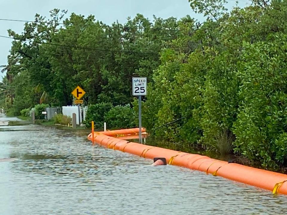
The Upper Keys also experienced high storm surge both from the ocean and in Florida Bay, particularly in Blackwater Sound and Barnes Sound in Key Largo. The streets of the Stillwright Point, a low-lying neighborhood with direct access to Blackwater Sound, were underwater Monday morning.
The neighborhood had already been dealing with floodwaters due to seasonal high tides, known as king tides. Monroe County had placed temporary flood barriers along North Blackwater Lane last month to stop the bay water from pouring onto the roads, but on Monday, there was standing water on either sides of the inflatable barricades.
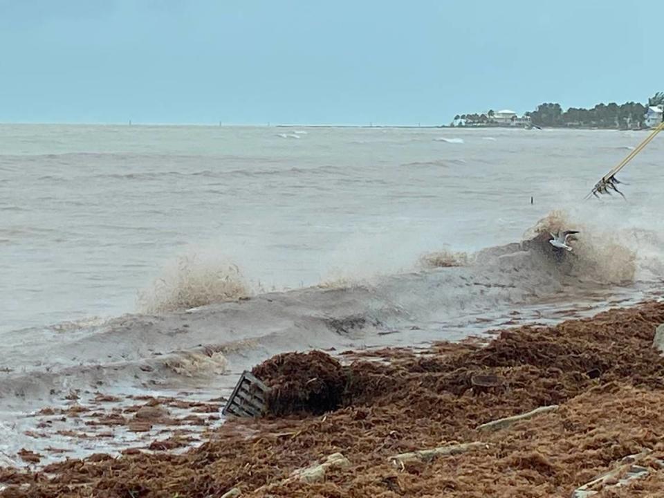
Ocean side surge flooded Anne’s Beach on Lower Matecumbe Key and blanketed Sea Oats Beach, also on Lower Matecumbe, with sargassum and other debris.
“We didn’t see any kind of coastal floods like this as you got farther down the island chain,” Rizzo said.
On Sunday afternoon, with the storm approaching, a few tourists strolled around the boardwalk above Anne’s Beach in the drizzly weather looking out in the water at some manatees that were hanging out in the shallow water about 50 from the shoreline.
Jenny and Will Wilcox, from Tennessee, were enjoying the tail end of their vacation celebrating their 19th wedding anniversary. With only a few days left, they said they were sticking around.
“I’ve lived in Florida on and off half my life, so we’ve been through hurricanes, and I don’t think this will be a big deal,” Will Wilcox, 41, said.
For Whitney and Burges Burrows, from Charlotte, North Carolina, this week seemed to be the continuation of some bad luck that’s plagued their vacations since the summer.
“We took our family vacation in August to Topsail, North Carolina, when tropical storm Isaias came through, and now we’re in Key Largo with tropical storm Eta coming through,” Burges Burrows said. “So, we’re two for two.”
In Key West, the sun was out Monday morning and the streets were relatively dry. But a steady rain broke out in the afternoon.
The city warned that although coastal flood warnings had been lifted by the National Weather Service, heavy rain was expected to cause local flooding.
“Please avoid driving in flooded areas,” the city posted on its Facebook page. “And if you must, proceed slowly to avoid driving wakes into homes and businesses.”
On Tuesday, City Hall will resume regular hours and bus service will return to normal routes.
The Key West City Commission’s special meeting on whether to install a nightly curfew from midnight to 7 a.m. will be held as planned at 10 a.m. Tuesday at City Hall and on Zoom.
The Monroe County School District also announced Monday that both in-person and online classes will resume Tuesday. Students will have another day off Wednesday, however, because of the Veterans Day holiday.
