Forecast calls for a damp end to an unusually wet water year. Here's what to know
Ventura County got drenched during a wet 2022-23, defying early predictions of another in a string of dry years for the region.
Now, the forecast calls for another bout of showers at the end of the water year, which runs from October through September. The National Weather Service expects local areas could see a quarter-inch to a half-inch of rain this weekend.
That may bump up 2022-23 rainfall totals. As of Friday, some local spots already had reached double that of a normal season, according to preliminary figures from the Ventura County Watershed Protection District. Ojai recorded more than 44 inches and Santa Paula had received 38 inches, more than double their normal rainfall.
The totals may not break records but likely made the top 10 list for annual rainfall in some locations. This past year, December through March – normally the wettest months – overachieved, said climatologist William Patzert.
The wet winter helped recharge groundwater supplies and boost local reservoirs. By March, Lake Casitas exceeded half-full for the first time since 2015. The reservoir that provides water to the Ojai Valley and parts of Ventura later passed the 70% mark.
“It definitely helped a lot on water supply,” said Scott Holder, a hydrologist with the county's watershed protection district.
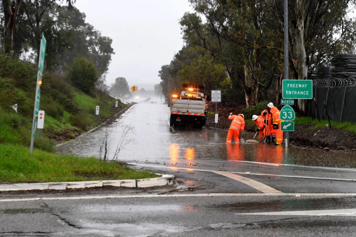
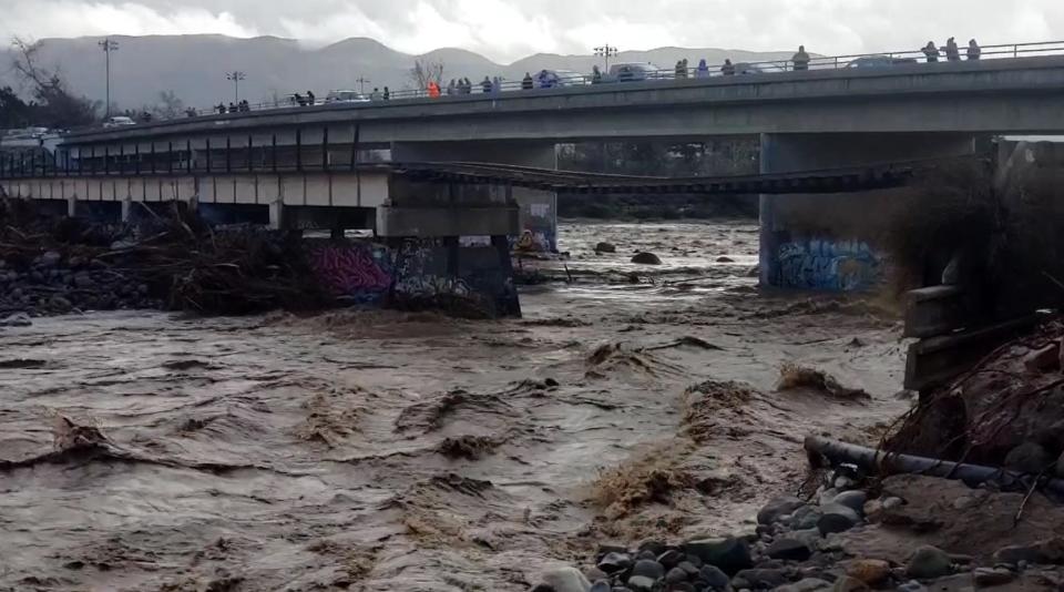
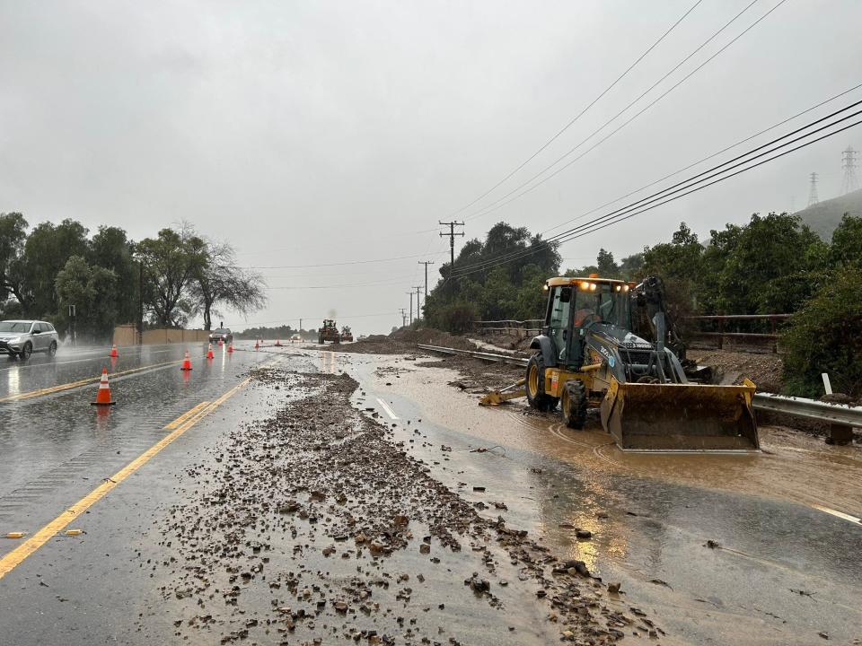
Unfortunately, storms also brought flooding in parts of the county, particularly along the Ventura River, he said.
SoCal gets surprise deluge
This time last year, experts were calling for yet another dry winter. It was expected to be a third consecutive year of La Niña conditions – cooler waters at the equator that typically mean drier conditions in the region.
The string of dry years had extended drought conditions and shrunk local water supplies. The county recorded below-average rainfall in 2021-22 and experienced one of its driest seasons on record a year earlier.
After a couple decades of on again, off again droughts in Southern California, water managers were ecstatic with this past winter, said Patzert, formerly at NASA’s Jet Propulsion Laboratory in Pasadena.
"The cherry on the cake was a surprise deluge in August, normally one of our driest months, when an unusual tropical storm broke up over the Southland,” he said.
Locally, coastal areas recorded roughly 1 to 3 inches of rain. Foothills and mountains received closer to 2 to 4 inches, dousing the vegetation and – at least temporarily – reducing the threat of wildfires.
But that late rain is a double-edged sword, Patzert said. It may suppress an early fire season but also brings a jolt of growth for the vegetation.
“August rain is October’s fuel,” he said.
More rain on the way
If warm, dry Santa Ana winds kick up later this fall, fires can ignite easier and flames can burn faster and farther as the vegetation dries out.
Over the weekend, most of Ventura County is expected to receive less than a quarter-inch of rainfall. Foothill and mountain areas could see higher amounts, said Rich Thompson, a meteorologist with the National Weather Service in Oxnard.
As of midday Saturday, the forecast called for a 40-60% chance of light rain with showers expected mostly Saturday afternoon and evening, Thompson said. Only trace amounts had fallen in a few areas overnight Friday. Some showers could linger through the day on Sunday.
Temperatures also will cool down, dropping roughly 10 degrees below normal, before conditions warm up and dry out next week.
Whether the storm will be a preview of coming attractions remains to be seen.
This summer, a significant El Niño popped up in the eastern tropical Pacific Ocean, Patzert said. That typically means more rain and snow on the way for the region.
"But a run on umbrellas and sandbags is not guaranteed,” he said.
In the late 1990s, a large El Niño dumped record rainfall. But in 2015-16, a monster-sized El Niño showed up but storms largely bypassed local areas. Plus, there is more going on this year as oceans warm, and it is unclear how those patterns interact.
“I definitely see the potential for some spectacular rainfall events this winter,” Patzert said. “The question is where.”
Cheri Carlson covers the environment and county government for the Ventura County Star. Reach her at cheri.carlson@vcstar.com or 805-437-0260.
This article originally appeared on Ventura County Star: Forecast calls for a damp end to an unusually wet water year

