Forecaster ‘flabbergasted’ by massive Moab avalanche

MOAB, Utah (ABC4) — A forecaster with the Utah Avalanche Center said he was flabbergasted by the second-largest avalanche he had ever seen over the weekend.
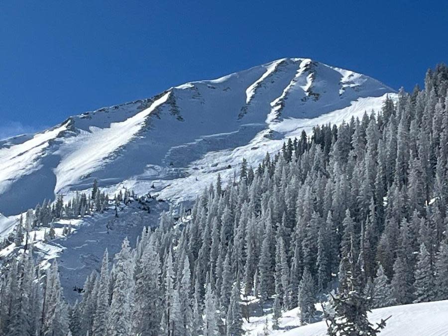
In a video posted on Sunday, Feb. 4, Eric Trenbeath said 11 inches of snow and one inch of water fell in the Gold Basin area near Moab within a 36-hour period.
“In the forecast, I mentioned that this might be enough of a load to release some natural avalanches down into old snow, but quite frankly, I am flabbergasted by what I see here,” said Trenbeath.
Man hospitalized after Wasatch Co. snowmobile accident
Trenbeath was standing at the base of the avalanche in the video. According to the Utah Avalanche Center, the avalanche was six feet in depth, at least 1,000 feet wide and 1,500 vertical. It was caused by a skier in the area after they reportedly found just the right trigger point.
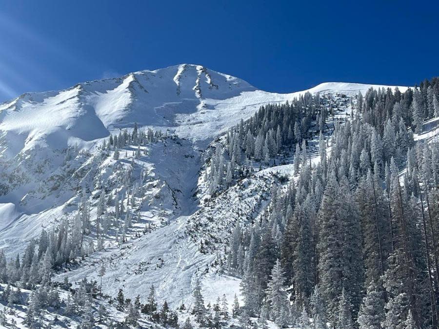
In his report on the avalanche, Trenbeath explained that his group happened upon the area at around 12:30 p.m. on Sunday, The debris seemed recent, but there was no sign of tracks and a signal search came back with no results. Trenbeath said light was poor so they contacted the Grand County Winter Rescue Team at about 1:30 p.m. for a flyover just to ensure no one was caught up in the avalanche.
The flyover noted tracks from a solo skier and concluded that it was them who triggered the avalanche, but they were fortunately not caught by it.
“This is what we mean when we say slabs of new and wind-drifted snow add additional stress to very persistent weak layers,” explained Trenbeath. “All it takes is you finding the right trigger point, say a steep, rocky, shallower area, to possibly trigger a massive avalanche like this.”
Man arrested for allegedly harboring missing, underage Layton girl
Trenbeath said the snowpack this season has been characterized by a weak, faceted base that formed during a dry early season. Thanks to a couple of different layers that formed in November and December, followed by 50 to 60 inches of snow in January over top, collapsing of the snowpack was widespread.
As of Monday, Feb. 5, the avalanche danger remains “considerable” in the Moab area, mainly on steep northerly aspects above the tree line.
“In these areas, slabs of recent and wind drifted snow have added stress to buried persistent weak layers, increasing the likelihood for deeper and more dangerous human triggered avalanches,” said Trenbeath.
For the latest news, weather, sports, and streaming video, head to ABC4 Utah.

