Forecasters: Bucks should prepare for another summer of tornadoes, storms and flash floods
When an EF2 tornado landed on River Road in New Hope on the evening of July 29, that area was already closed to traffic.
The same stretch of highway had been damaged by a similar EF2 tornado ― with winds ranging from 111 to 135 mph ― only 30 days earlier, on June 29, according to the National Weather Service.
It was only the beginning of seemingly unreal season of extreme weather in Bucks County.
The summer of 2021 was perhaps the wildest ever for our region, with extraordinary heat and humidity, flash floods, tropical storms, and a record seven tornadoes in the county. Three twisters appeared in Bucks County on a single night in what the National Weather Service termed a "tornado outbreak."
Sadly, there's also good reason to think it could all happen again this summer, forecasters say.
Sophisticated weather models for summer 2022 are similar to projections made before last summer, said Sarah Johnson, warning coordination meteorologist of the National Weather Service Mount Holly Station.
"The outlook for 2021 is pretty close to the outlook for 2022," Johnson said.
A look inside:Did you know Bucks County still has Cold War-era bomb shelters?
For subscribers:Bristol Township cop celebrates arrest in 1991 murder
What's causing the severe weather?
Increasingly wild and unstable weather patterns in our region are driven by three ongoing factors, said Paul Pasetlok, senior long-range forecaster for AccuWeather.
Number one, temperatures on the ground are rising. Two, waters of the Atlantic Ocean off the East Coast are getting warmer. Three, conditions on the West Coast have altered the jet stream, said Pastelok. Air that normally flows west to east across the U.S. is now flowing down from Canada and is much cooler.
Extreme weather can occur when that cooler air from Canada collides with hot and humid air on the East Coast, Pastelok explained.
Hotter air carries more water. Warmer ocean water also feeds clouds.
"We have pockets of water off the East Coast that are much warmer and this is giving a boost when it comes to rainfall and these extreme weather events," Pastelok said.
"Going into the summer, we have to be cautious of severe rain events," Pastelok added. "We are in a high-risk season."
Looking back:Lower Bucks County hit with '100-year flood' as Bristol, Bensalem and Croydon residents forced out of homes
We should expect between 14 and 21 named tropical storms or hurricanes this summer, estimates the National Oceanic and Atmospheric Administrations Climate Prediction Center.
It's the seventh year in a row that NOAA forecasters have predicted an increased risk for hurricanes. Expect between three and six major hurricanes in 2022, the agency forecasts.
Such storms will feed off warmer sea surface temperatures, weaker tropical trade winds, and monsoons in West Africa, said NOAA Administrator Rick Spinrad in a press release.
“As we reflect on another potentially busy hurricane season, past storms — such as Superstorm Sandy, which devastated the New York metro area 10 years ago — remind us that the impact of one storm can be felt for years,” said Spinrad. “Since Sandy, NOAA’s forecasting accuracy has continued to improve, allowing us to better predict the impacts of major hurricanes to lives and livelihoods.”
Story continues below graphic

Why we're seeing more tornadoes in Pennsylvania
Forget everything you learned about tornadoes in the "Wizard of Oz," said Johnson.
Tornadoes reported on the U.S. East Coast do much of their damage within a very short window of time ― lasting perhaps one or two minutes, Johnson said. Such storms can land on one town and seemingly hop to a second or third location without warning. You're unlikely to see a pillar of wind and debris rolling across the landscape.
For subscribers:17 Days in Bensalem: Floods, violent winds, tornado severely tested area's resolve in July
Tornadoes also have been historically rare for our region, until now.
Data collected by the National Weather Service since the 1950s shows Bucks County averaging one tornado every three years.
Only 11 tornadoes were reported in Bucks County between 1970 and 1999.
Nine were spotted in Bucks County in the last three years.

Pennsylvania should average 16 tornadoes per year, according to National Oceanic and Atmospheric Administration.
Yet 29 tornadoes were reported in the state in 2017. In 2018, 33 were spotted, and 37 twisters were seen in 2019.
Science offers some clues on the increase in tornadoes outside the Midwest and so-called "Tornado Alley. "
In April 2021, the journal Atmosphere published the study “Geographic Shift and Environment Change of U.S. Tornado Activities in a Warming Climate.” An increase in tornadoes across a wider swath of the United States could be due to rising surface air temperatures, researchers said.
More common in the Midwest, wedge tornadoes are considered the most destructive, with winds of 164 mph or greater. Wedge tornadoes are wide from top to bottom and born from so-called supercells of churning tunnels of continuous updraft.
In Pennsylvania, 20 years of data shows that most tornados occurred in the summer months and during the mid- to late-afternoon.
Three-quarters of reported tornadoes occurred between May and September. Most — 67% — happened between 2 and 6 p.m., records show.
For Subcribers:Is climate change to blame for increase in tornadoes in Pennsylvania?
Why am I getting more National Weather Service alerts?
Last year, the National Weather Service in Mount Holly it issued 324 severe thunderstorm warnings ― the second most alerts on record. The service issued 91 flash flood warnings, the most since 2019. There were 52 tornado warnings, the most ever, Johnson said.
The increase in severe weather threats is just one reason for the jump in alerts.
In August 2021, the National Weather Service updated its system for alerting Americans about extreme thunderstorms. Changes in the way such storms are categorized has increased the number of alerts issued by the government.
Some thunderstorms and hail events are now tagged with a "damage threat" previously reserved for tornadoes and flash flood warnings.
Nightmare on Main Street:Hulmeville residents recount Ida flood
First of 2022:Tornado touched down in Bedminster area
Storms are considered destructive when there is chance of winds greater than 80 mph and/or hail the size of baseballs. Such storms now trigger warnings on smartphones.
Regardless of those rising numbers, people should always be prepared, said Johnson. She pointed to summers with just one or two highly destructive events.
"In 1992, we had very few storms," said Johnson. "The first named storm in 1992 did not appear until August and it was Hurricane Andrew.
"Andrew was a category five hurricane and made landfall in the Miami region, causing an extreme amount of damage," Johnson continued. "It only takes one storm to make a bad year. People should be prepared."
How can I prepare for extreme weather events?
Many from the Philadelphia region were never trained on how to act during or after a tornado.
Here are some recommendations from the National Weather Service:
If at home, you should move to a basement or interior hallway away from windows.
If you're at work or school, avoid windows and large, open rooms such as cafeterias or gymnasiums.
Cars and trucks are not considered safe spaces during a tornado. If trapped in your vehicle, get low and cover your ahead.
After such an event, you want to avoid downed power lines and do not enter damaged structures which could collapse.
Looking back: 'Everything is upside down': Flash flood leaves 66-unit Bensalem condos uninhabitable
A look back at the floods, hurricanes and tornadoes of 2021
Here's a look back at the extreme events reported in Bucks County by the National Weather Service Mount Holly Station:
May 26, 2021: After two weeks of unseasonably hot spring weather above 90 degrees, a cold front swept into the area producing a series of severe thunderstorms. Wind gusts of 65 mph were recorded in Durham. Downed trees and power line damage were reported in Milford, Richland, Sellersville, and West Rockhill.
June 29: A short-lived EF2 tornado was reported in New Hope with winds ranging from 111 to 135 mph. The storm lasted approximately three minutes and damages trees on River Road. On that day, the National Weather Service also issued an excessive heat warning for Lower Bucks County with temperatures above 95 degrees and extreme humidity. The weather service reported a 105 degree "heat index," the temperature experienced by the human body when the heat is compounded by humidity.
July 1: A second heat wave clashed with cold front and prompts tornado warnings across eastern Pennsylvania. Storms knocked down trees and power lines in Levittown and Fairless Hills. More trees were toppled in Bensalem.
July 12: A column of individual thunderstorms rapidly dropped 10 inches of rain on parts of Bensalem and Bristol Township. Drivers were trapped vehicles in Croydon and saved via rescue boats. Waist-high water was reported on some Croydon and Levittown streets. Flooding closed at least a dozen roads, including I-95 in Bensalem.
July 17: A third heat wave clashed with a cold front producing extreme weather. Doylestown experienced a storm with pea-sized ice pellets. In Bensalem, wind gusts of up to 60 mph rip the siding off of a house and knock out power to several neighborhoods. In Levittown, floods close portions of Trenton Road floods.
July 29: Three tornadoes were reported in three hours in Bucks County. The first tornado was spotted at 5:40 p.m. in a Plumstead cornfield and reached EF1 status with winds ranging between 86 and 110 mph. The twister crossed into Buckingham, damaging homes and a farmers market before lifting off. The second tornado was spotted at 5:59 p.m. off River Road in New Hope. The twister landed in an area of River Road previously closed due to an earlier tornado. The EF2 twister passed through Washington State Park and lifted off as it approached Trenton-Mercer Airport. A third twister was first spotted at 7:04 p.m. in an industrial park in Philadelphia's Somerton section. The EF3 twister with winds ranging between 136 and 165 mph crossed into Bensalem at the Pennsylvania Turnpike. The twister picked up and tossed a highway sign more than 3,000 feet, then pummeled a Street Road car dealership, flipped vehicles, tore through four showrooms and a repair shop. The storm carried on through Bensalem, damaging a nearby mobile home park and lifting off as it passed over the Neshaminy Mall.
Aug. 11: Another heat wave combined with high humidity led to health warnings by the National Weather Service with a heat index of 105 degrees on two consecutive days.
Aug. 18: An EF1 tornado was spotted in a Telford mobile home park, where it ripped up trees and damaged property. The twister continued approximately six miles into Hilltown and Silverdale, ripping the roof of garage and damaging an auto repair shop.
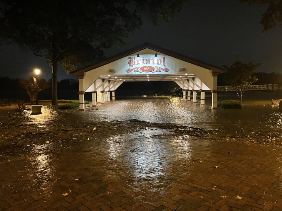
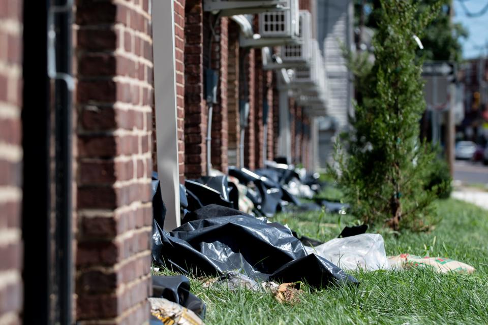
Aug. 31: Three days after first making landfall in Louisiana, the remains of Hurricane Ida reached Pennsylvania. Ida dropped extreme amounts of rain on the region and brought flooding to nearly every corner of Bucks County. On the evening of Sept.1 , flooding was reported and some roads were impassable in Bensalem, Bridgeton, East Rockhill, Hilltown, Perkasie, Richland, Richboro, Souderton, Sellersville, Silverdale, Tullytown, and Warrington. In the days that followed, rain swelled creeks and streams throughout the region. In Bucks County, the Neshaminy Creek overflowed its banks, damaging hundreds of homes and businesses in Bensalem, Bristol Township, Hulmeville and Middletown. The waters of the Delaware River also rose, bringing even more flood damage to Bristol Borough.
Sept. 1: Two more tornadoes are reported. The first twister was spotted along the Delaware River near the Burlington-Bristol Bridge. The EF1 tornado begins to lift off just before reaching downtown Bristol Borough after snapping trees along the Bristol Wharf. A second twister is reported near the Neshaminy Creek in Doylestown. The EFI twister traveled approximately four miles and destroyed hundreds of trees before lifting off as it approached Route 202.
This article originally appeared on Bucks County Courier Times: Bucks County tornadoes, tropical storms and severe weather to continue

