Fort Collins rain causes minor flooding after 2-plus inches fall over weekend
Fort Collins and the surrounding area have received rain the first four days of June, including nearly 2 inches Sunday that caused minor flooding of trails and low-lying areas.
And there are good chances of more rain in the forecast the rest of the week.
Fort Collins sees minor flooding after nearly 2 inches of rain Sunday
Fort Collins officially recorded 1.98 inches of rain Sunday.
The Poudre River has not flooded in Fort Collins but is running at 2,000 cubic feet per second as of Monday morning, the highest flow recorded this season and nearly three times faster than its norm for this time of year.
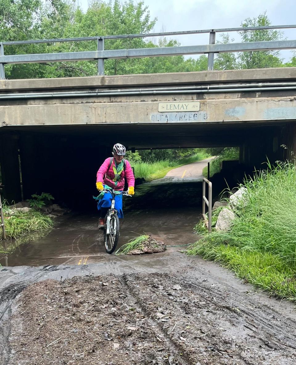
Weekend rains pushed Spring Creek out of its banks in low-lying areas along the Fort Collins trail system. Trail users should not attempt to ride or walk through the water and mud along Spring Creek Trail underpasses.
Several reports showed minor flooding around the hotel district on East Mulberry Street near Interstate 25 on Sunday.
Fort Collins saw more rain Sunday than any day since May 2017, when CSU campus flooded
Fort Collins had more rain Sunday (1.98 inches) than the average for all of June (1.90 inches), according to the Colorado Climate Center.
Sunday was the wettest single day recorded at the city's official reporting station on the CSU campus since May 17, 2017. That day saw 2.77 inches of rain cause significant flooding on the CSU campus, according to the Colorado Climate Center.
Fort Collins has recorded 2.63 inches of rain in June. The city saw 3.32 inches of rain in May, compared with its average of 2.72 inches.
Since Jan. 1, Fort Collins is more than 2 inches above average for precipitation, with 9.57 inches compared with an average of 7.34 inches. Precipitation includes moisture from rain and snowmelt.
Larimer County sees impressive rainfall totals over the weekend
Rainfall totals surpassed 2 inches in many locations from the weekend soaking:
A Community Collaborative Rain, Hail & Snow Network station near Drake in the Big Thompson Valley below Estes Park recorded 3.25 inches of precipitation.
A station in south Fort Collins recorded 2.69 inches over the two days, and one southwest of Windsor recorded 2.41 inches.
The triangle between south Loveland, north Loveland and west Windsor generally showed the highest amount of rain, with many stations recording well over 2 inches of rain during the weekend.
More: What to know about Colorado's deadliest natural disasters, including key safety tips
Why is Colorado seeing so much rain this spring?
Dave Barjenburch, National Weather Service meteorologist in Boulder, said our moisture streak is much more related to where high- and low-pressure ridges are located than to the transition from a La Nina pattern to El Nino.
Typically, he said, Colorado weather this time of year is dominated by a high-pressure ridge in the Southwest, which produces warmer and drier conditions for Colorado. This spring, that high-pressure ridge has moved north into the upper Midwest, which has blocked or slowed our storm track over Colorado while creating above-average temperatures and below-average moisture in Canada, resulting in devastating wildfires.
A deep low-pressure ridge in the western U.S. combined with the high pressure in the upper Midwest have funneled a consistent plume of Gulf of Mexico moisture into Colorado for several weeks, and Barjenburch said that pattern "isn't going anywhere in a hurry.''
Much of Larimer County under a flash flood watch Monday
The National Weather Service has issued a flash flood watch from noon to 10 p.m. Monday for much of the northern Front Range foothills and mountains, including all of Larimer County west of Fort Collins and the Cameron Peak Fire burn scar.
The main threat is expected from 1 to 6 p.m.
The weather service has raised the flash flood risk in the Cameron Peak and East Troublesome fire burn scars to elevated, second from highest, for Monday through Wednesday.
⚠️Flash Flood Watch ⚠️
A Flash Flood Watch has been issued for a portion of the Front Range Mountains & Foothills, with main threat for Cameron Peak, East Troublesome, and Calwood burn areas. Good guidance below if you live/travel in or near a recent burn area. #COwx pic.twitter.com/qLYdAukjlW— NWS Boulder (@NWSBoulder) June 5, 2023
Flash flood advisory for Poudre River between Windsor and Greeley on Monday
The National Weather Service has issued a flash flood advisory for low-lying areas along the Poudre River between Windsor and Greeley until 6:30 p.m. Monday.
Parts of the Poudre River Trail are under water, including under the Seventh Street bridge in Windsor as well as the several sections in and near Greeley. Caution is advised.
This article originally appeared on Fort Collins Coloradoan: Colorado weather: Meteorologist explains why we've had so much rain

