Fort Pickens, State Road 399 between Pensacola Beach and Navarre closed due to flooding
Update: Highway 399 has reopened. Patrons should still use caution when driving as the road is wet. The Opal Beach Area and Fort Pickens Area is still closed for use.
Original story
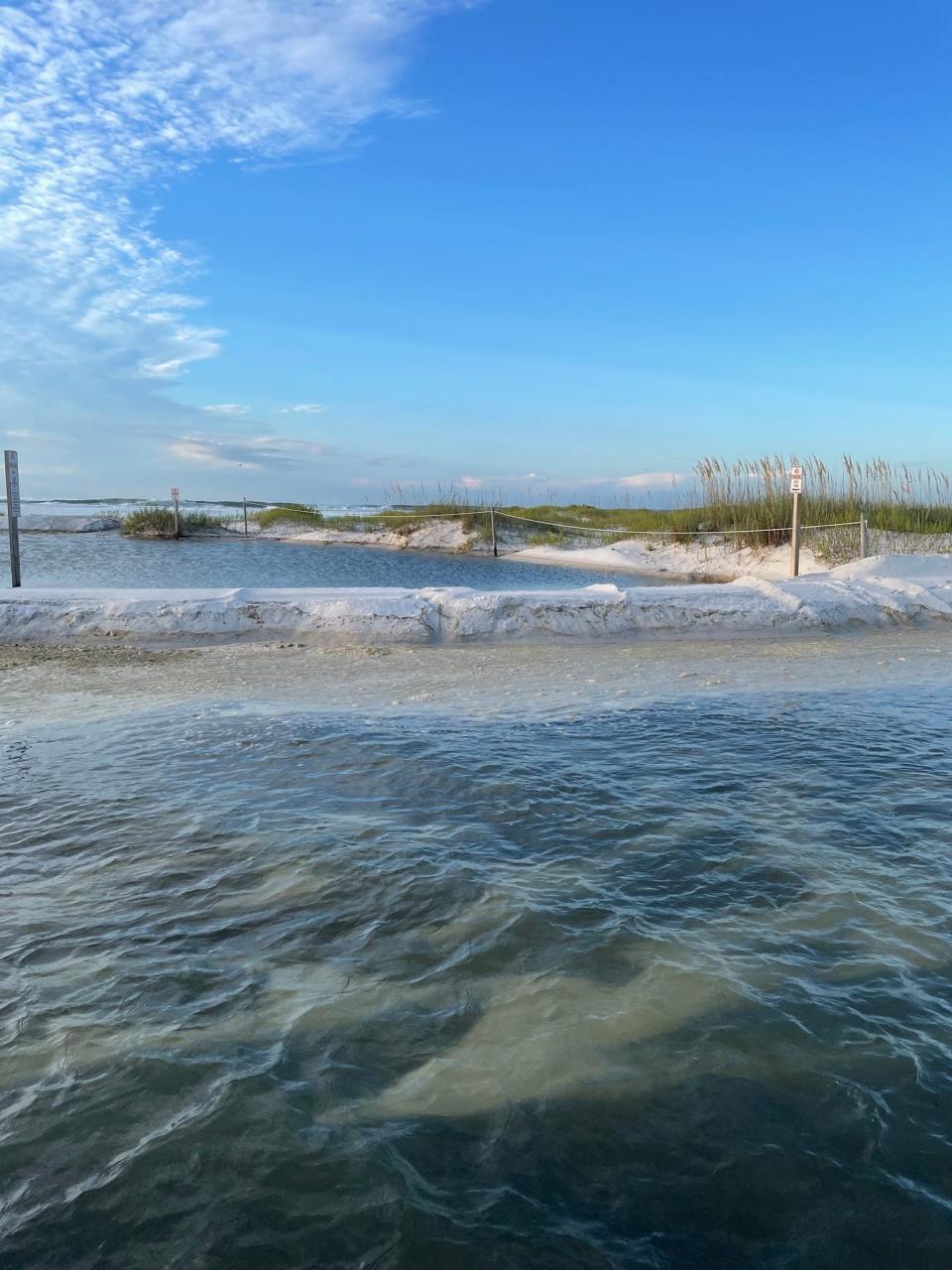
The Gulf Islands National Seashore Santa Rosa Area including Opal Beach Area, State Road between Navarre Beach and Pensacola Beach, and Fort Pickens Area are closed until further notice due to storm surge from Hurricane Idalia creating standing water up to 2 feet deep in certain areas.
Navarre Beach Fire and Rescue Chief Danny Fureigh said he received notification of the closure at 6:30 a.m., Wednesday. As of 9 a.m., the county was awaiting notification from the National Seashore before consideration would be given to re-opening the roadway, according to Santa Rosa County spokeswoman Sarah Whitfield.
Campground reservations for Fort Pickens will be postponed or canceled through Thursday, Aug. 31. Current campers are advised to shelter in place until able to safely evacuate.
Park staff will continue to assess conditions and will reevaluate all park areas for reopening conditions and announce updates as appropriate.
All other areas of the park are open for day use only.
"Longer period swells" are believed responsible for pushing Gulf of Mexico waters up to and over the beach road and forcing its closure.
Storms like Hurricane Idalia, which made landfall early Wednesday on the Florida Big Bend Coast, send out the longer period swells (wave intervals between 10 and 20 seconds) that pile up and raise water levels, said Steve Miller, a meteorologist with the National Weather Service in Mobile.
Those longer period swells get "overridden" at the shoreline by waves, which produce flooding. Miller estimated the water coming ashore on National Seashore property to have reached 11 feet.
"The larger the storm, the more intense its wind is and the longer it lasts, the larger and longer period the swell will be," according to the website of Surfrider, a nonprofit focused on protecting the world's oceans and beaches.
Fort Pickens Road was also closed within Gulf Islands National Seashore on Wednesday morning due to storm surge and flooding, according to Escambia County officials.
Hurricane Idalia updates: Live updates: Hurricane Idalia roars over wide swath of Florida; water inundating communities
Hurricane Idalia made landfall as a Category 3 storm with sustained winds of 120 mph. The storm had reached Category 4 strength earlier.
The hurricane was moving northeast at 18 mph Wednesday morning and was expected to move into southern Georgia later that day, then along the coasts of South and North Carolina into Thursday. Rain bands were still moving through the Sarasota-Manatee area.
According to the National Weather Service in Mobile, Idalia's track left Pensacola out of any damaging areas for wind, rain or storm surge, but the storm's presence in the Gulf of Mexico could bring dangerous rip currents to our area, Miller told the News Journal.
"As Idalia moves into the Gulf, we'll see increased swell, and that's going to bring a high risk of rip currents along area beaches with a good chance of rough surf," Miller said Tuesday.
This article originally appeared on Pensacola News Journal: Hurricane Idalia: 399 between Navarre Beach and Pensacola Beach closed

