Saturday storms spawned 7 tornadoes in region, including Belleville and Swansea
Severe thunderstorms Saturday spawned four tornadoes in southwestern Illinois and three in Missouri, according to the latest update from the National Weather Service in St. Louis.
No injuries or fatalities were reported.
Teams were surveying damages in the region on Sunday to help determine where tornadoes struck during severe storms Saturday night. The teams were continuing their work on Monday, the National Weather Service stated.
Belleville and Swansea were added to the list Sunday night, bringing the total number of tornadoes in southwestern Illinois to four, according to preliminary survey results. Hillsboro, Missouri was also added Sunday night, bringing the total in Missouri to three.
Four of the seven tornadoes were rated EF-1 on the Enhanced Fujita Scale. The others were EF-0. The National Weather Service uses the EF scale to rate tornadoes based on wind speeds and damage left behind. The scale ranges from EF-0, with wind gusts of 65-85 mph, to EF-5, with gusts over 200 mph.
Updated 742PM -Preliminary results: 7 tornadoes around the area, highest rating EF1. More surveying to come. #mowx #ilwx #stlwx pic.twitter.com/mPkJO3Y8Q3
— NWS St. Louis (@NWSStLouis) April 17, 2023
Here’s what the National Weather Service said about Illinois tornadoes in Sunday Twitter posts:
The Belleville area tornado was an EF-1, with estimated peak winds at 98 miles per hour. Its path was 3.04 miles, with a width up to 200 yards.
The Swansea area tornado was an EF-0, with peak winds at 85 mph. It’s path was 1.12 miles with a maximum width of 90 yards..
In Monroe County, one tornado started at 6:34 p.m. southwest of Maeystown and continued 19.5 miles northeast, ending just over the St. Clair County line outside of Hecker at 6:59 p.m. Its maximum width was 100 yards, with an estimated peak wind of 100 mph. Its rating was EF-1.
The other southwestern Illinois tornado was south of Valmeyer in Monroe County. Its path was about five miles long, with an estimated maximum width of 150 yards. It was rated an EF-0 and had a maximum wind speed of about 85 mph.
In Missouri, in addition to Hillsboro, a tornado struck the the Pevely area while the other began near Fenton and ended near Sunset Hills.
Preliminary results: 4 tornadoes around the area, highest rating EF1. More surveying to come. #mowx #ilwx #stlwx pic.twitter.com/Jk3IgNsU8z
— NWS St. Louis (@NWSStLouis) April 16, 2023
The seven tornadoes were confirmed by teams that surveyed Missouri and Illinois on Sunday following severe thunderstorms Saturday night that led to tornado and thunderstorm warnings, wind damage and power outages.
Team members were scheduled to start their Illinois survey in Hecker, then look for damages in Belleville, Collinsville and St. Jacob.
A second team did the same on the Missouri side of the Mississippi River, starting in Valley Park, about 20 miles southwest of St. Louis.
“Lots of storm damage reported throughout the county from last nights storm,” the St. Clair County Emergency Management Agency said in a Sunday Facebook post. “National Weather Service is surveying damage in Hecker and Belleville for possible tornado related damage. Ameren is working as quickly as possible to restore power as over 3,000 residents remain without power.”
One area of Belleville that saw damages was along Lebanon Avenue.
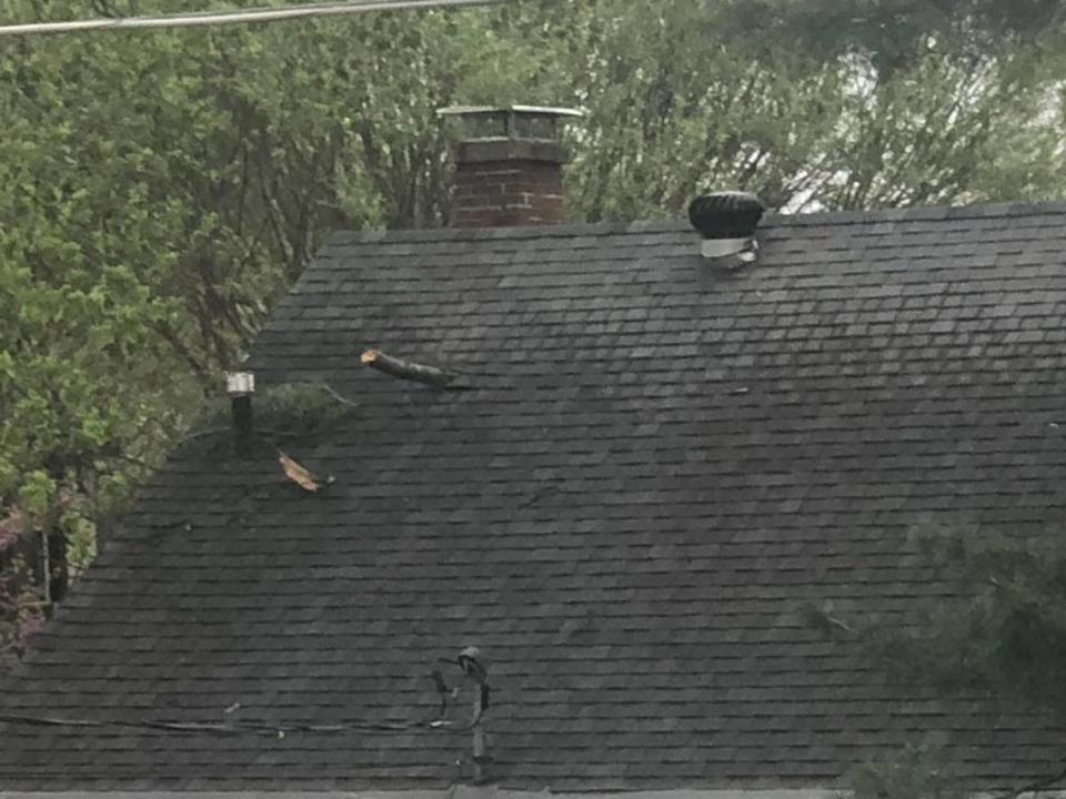
The tornado in Belleville snapped and uprooted trees, broke huge branches and damaged roofs on homes, apartments and businesses along its path, according to information posted on the National Weather Service Damage Assessment Tool Kit. The information is gathered by teams doing the post-storm surveys and is considered preliminary.
The Belleville tornado appeared to have started around North Second Street southwest of North Illinois Street, according to the map included in the tool kit. Then it continued northeast on a path that was generally parallel to Lebanon Avenue , crossing over it at least twice before ending near Adeline Drive in Shiloh.
The Swansea tornado appeared to have started in Belleville, near Pleasant Hill Park, before entering Swansea heading northeast, crossing over North Illinois Street and ending near Anna Street, uprooting and snapping trees and causing other damage along the way, according to the tool kit information.
St. Clair County Emergency Management Agency asked Facebook visitors to share photos on its site. People from around the area did just that. By Sunday night, there were more than 30 posted photos.
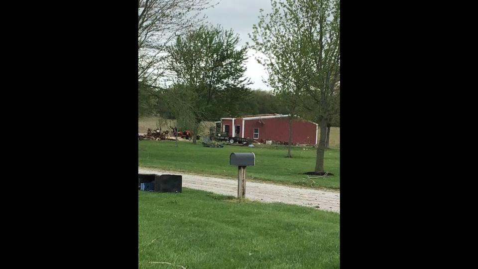
The Swansea Fire Department posted photos of a heavily damaged mobile home along North Illinois Street on the southern end of town.
The two tornadoes that touched down in Monroe County damaged trees and building, the survey team reported. Here’s an example of the kinds of damages the team reported.