Fourth of July weather dampens firework shows, produces impressive rainfall totals
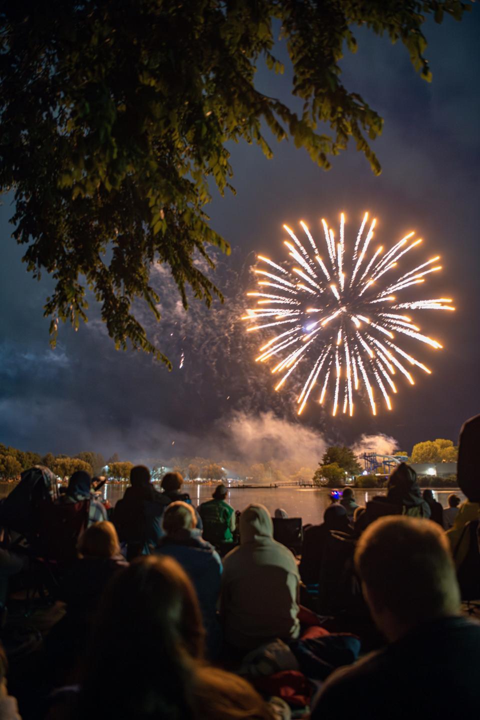
Northern Colorado municipal Fourth of July fireworks shows mostly went on Tuesday, though some were delayed or started early to fit between waves of storms that produced thunder, lightning and more than 1 inch of rain in the Loveland and Windsor area.
The fireworks shows went on at Fort Collins, Loveland, Wellington, Timnath and Windsor, while Estes Park postponed its show to July 15.
Rain and lightning caused City Park in Fort Collins to be cleared twice and washed out a scheduled concert, but the fireworks show ultimately took place.
The city's official weather station on Colorado State University's main campus, recorded 0.56 inches of rain, according to Russ Schumacher, professor in CSU's Department of Atmospheric Science and Colorado's state climatologist.
A Community Collaborative Rain, Hail & Snow Network rain gauge in Loveland recorded 1.67 inches of rain. Among the more than 700 gauge reports from the network, only three other reports exceeded more than Loveland's total: Two gauges in Broomfield, 1.77 inches and 1.68 inches, and one from Thornton that had the highest total of 1.82 inches.
How this year's wet weather compares to Fort Collins' wettest years
If Fort Collins doesn't receive any rain July 5, this year will be the 15th wettest start for year to date. The record of 17.21 inches occurred Jan. 1 through July 5, 1923.
Fort Collins has received 13.14 inches of precipitation so far this year. The average for year to date is 9.13 inches.
Fort Collins' annual average precipitation is 15.88 inches based on the 1991-2020 period.
Colorado rainfall totals: Loveland, Berthoud, Windsor areas get more than an inch
Rainfall totals Community Collaborative Rain, Hail & Snow Network, as of 7 a.m. July 5:
Loveland (2.7 miles east): 1.67 inches
Loveland (0.5 miles west): 1.46 inches
Loveland (3.8 miles southwest): 1.34 inches
Berthoud (2.5 miles north): 1.27 inches
Windsor (1.5 miles west-northwest): 1.26 inches
Loveland (1.7 miles southwest): 1.23 inches
Windsor (3.7 miles south-southwest): 1.15 inches
Drake : (1.8 miles north-northeast): 1.10 inches
Fort Collins (8.1 miles southeast): 1.02 inches
Greeley (3 miles south-southwest): 0.98 inches
Timnath (4.1 miles north-northeast): 0.93 inches
Berthoud (2.4 miles south-southwest): 0.84 inches
Ault (1.1 miles west-southwest): 0.83 inches
Estes Park 1.8 miles south): 0.83 inches
Windsor (3.2 miles south): 0.82 inches
Fort Collins (0.7 miles south-southwest): 0.76 inches
Timnath (2.1 miles southeast): 0.74 inches
Fort Collins (2.5 miles northwest): 0.67 inches
Drake (4.3 miles west-southwest): 0.65 inches
Fort Collins (2.7 miles southeast): 0.62 inches
Laporte (1.4 miles northwest): 0.58 inches
Wellington (3.7 miles west-northwest): 0.55 inches
Fort Collins (2.8 miles west): 0.49 inches
Fort Collins (5.4 miles north): 0.46 inches
Fort Collins (3.1 miles west-southwest): 0.44 inches
Horsetooth Mountain (3.2 north-northwest): 0.42 inches
Bellvue (2.3 miles south-southwest): 0.36 inches
Rain chances sticking around in Fort Collins forecast, according to the National Weather Service
Wednesday: 50% chance of showers and thunderstorms during the day and 40% chance at night. Cloudy, with a high near 61 and east wind 9 to 11 mph, gusting to as high as 18 mph. Fort Collins' record low maximum temperature for July 5 is 66 degrees, according to the Colorado Climate Center.
Thursday: 40% chance of showers and thunderstorms from afternoon until midnight. Partly sunny, with a high near 80 and wind becoming east-southeast 8 to 13 mph in the morning, gusting as high as 21 mph.
Friday: 30% chance of showers and thunderstorms after noon, increasing to 40% at night. Partly sunny, with a high near 79 and wind becoming east-northeast 9 to 14 mph in the morning, gusting to 22 mph.
Saturday: 50% chance of showers and thunderstorms after noon until midnight. Partly sunny, with a high near 79.
Sunday: Slight chance of showers and thunderstorms after noon. Sunny, with a high near 85.
This article originally appeared on Fort Collins Coloradoan: Fourth of July rain totals in Fort Collins, Windsor, Loveland and more

