Frigid weather: How the forecasted nor'easter could affect the Tri-State area
The Tri-State area is still expected to see some light snow heading into the weekend, but likely will escape what forecasters are referring to as a coastal storm that could bring much higher snow totals up the East Coast.
However, Saturday night in the Tri-State will be frigid with forecasted wind chills near zero, according to National Weather Service meteorologists. The wind chill in Fulton County, Pa., could reach minus 3 degrees, said meteorologist Bill Gartner with the State College, Pa., forecast office.
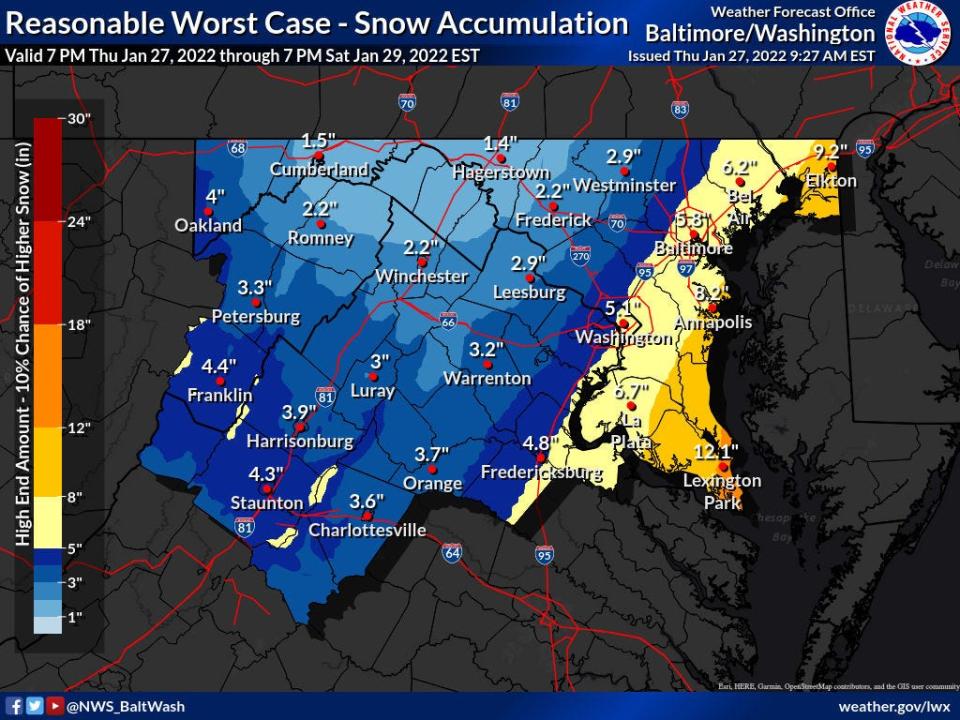
As of late Thursday morning, the "worst case" forecast called for 1 to 2 inches in Washington County and West Virginia's Eastern Panhandle, said meteorologist Cody Ledbetter with the Baltimore/Washington forecast office. That would require the storm to move farther West, which is not the likely scenario, he said.
"Honestly, you're probably not going to see much out that way," Ledbetter said.
Franklin and Fulton counties could see around 0.4 inches of snow, up to an inch in the worst-case scenario, according to weather service's State College website and Gartner.
Light snow could start overnight into Friday, occurring on and off through the day, but is expected to be over in the area by Saturday afternoon, Gartner said.

Snow days: Washington County Public Schools might be able to replace snow days with virtual learning
Winter weather: What is a nor'easter? Storms can batter East Coast with snow, impact millions of people
Winter forecast: Unexpected cold snap or snow? You can use these common household items to remove snow and ice
Winter weather preporation: How to prepare in case you get stranded in your car during a snowstorm
Saturday's high temperature in the Washington County and Panhandle area could reach the low 20s, while Saturday night it will be in the single digits without the wind chill, Ledbetter said.
Temperatures are expected to gradually warm up after Saturday and could be close to 50 by the middle of next week, he said.
This article originally appeared on The Herald-Mail: Tri-State forecast for weekend with nor'easter expected in Northeast

