Georgia weather forecast: Tuesday storms likely to bring localized flooding, high winds
A "potent" system with significant rounds of storms is expected to impact much of Georgia Monday night through Tuesday night, according to the National Weather Service.
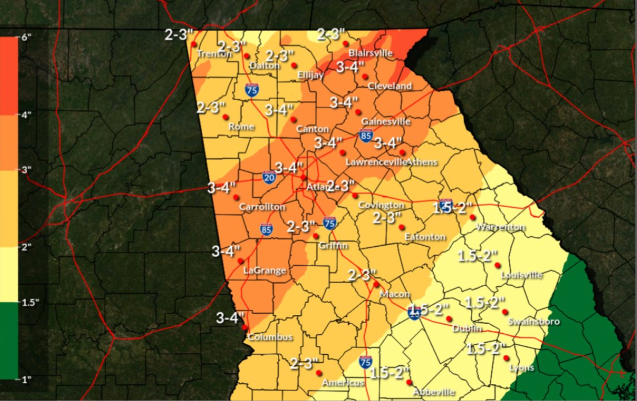
With the most impact likely to be seen in south Georgia, flooding in localized areas and damaging wind gusts between 45 and 55 mph are expected sweep through Bainbridge, Albany and to the Valdosta areas, which are forecast to get up to two inches of rain.
Jan 8th 7am ET - Good morning. Not many changes in the forecast overnight. Strong non-thunderstorm winds along with potentially significant round(s) of severe storms is still upcoming. Strong winds ahead of the severe threat a large concern as well. #FLwx #ALwx #GAwx https://t.co/VA5OAJ5I98 pic.twitter.com/GHqDxmcb9f
— NWS Tallahassee (@NWSTallahassee) January 8, 2024
More than a dozen school systems have reported closures across the southern part of the state, as of mid-day Monday.
The thunderstorms are expected to sweep into the north to central parts of Georgia with the possibility of flooding and tornadoes, according to NWS.
"Widespread rainfall" of up to three inches of rain is expected in northeast and central Georgia, some areas will see up to four inches of rain, including the LaGrange, Atlanta and Athens areas.
A high wind watch will also go into effect tonight in north Georgia, according to NWS.
❗️Post #1 of 3❗️ A powerful storm system is expected to impact north & central GA Mon night thru Tue night. This system will bring multiple types of hazardous weather -- the first being strong to severe thunderstorms w/ damaging wind gusts & the potential for tornadoes. ⛈ #gawx pic.twitter.com/b4hU4OgJ9h
— NWS Atlanta (@NWSAtlanta) January 7, 2024
This article originally appeared on Athens Banner-Herald: Georgia weather forecast: Storms likely to bring flooding, high winds

