Giant hail filmed smashing down on Florida town in freak weather incident
- Oops!Something went wrong.Please try again later.
Tennis ball-sized hail pummeled parts of Florida and Texas on Wednesday in a rare weather event for the regions.
More than 60 hail reports were issued across the South on Wednesday, including sightings of softball-sized hail — approximatley 4.5 inches in diameter — in Bellmead, Texas. Hail approximately 2.5 inches hit communities in Florida, according to CNN.
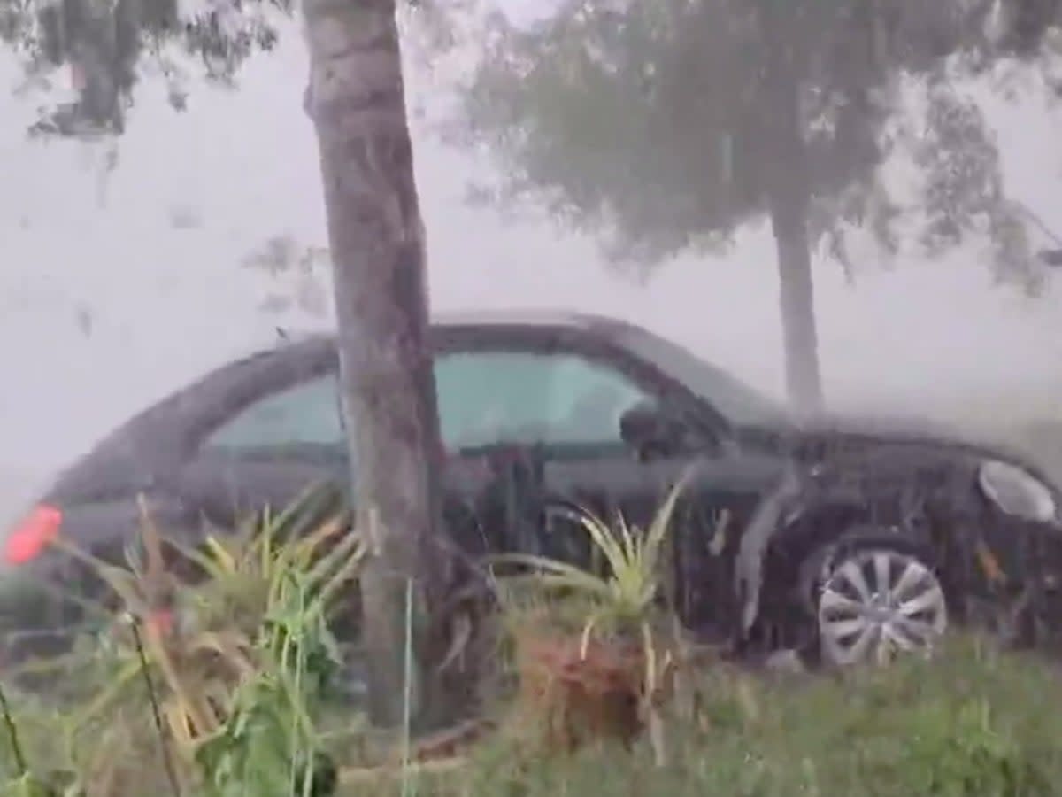
Social media users captured video of the freak weather event. One Twitter user shared footage of giant hail balls smashing down outside his home, striking a vehicle parked just beyond his door.
Earlier, when the storm was picking up. Didn't get a chance to grab the winds at their peak, as it was a little too dangerous. Love me some severe storms though #flwx #hailstorm #severewx
-from Melbourne, FL pic.twitter.com/hHNqiopTEY— Sigloomic (@Sigloomic) April 26, 2023
Another video captured hail falling in such huge amounts in West Melbourne, Florida, that it resembled a heavy snowfall — a strange sight in the sunshine state.
WFTV meteorologist Brian Shields shared an image from a middle school in the city in which hail coated the ground, leaving a bright white layer resembling a fresh snowfall.
Severe thunderstorms were also reported in the region, according to the National Weather Service in Miami.
"Unsettled weather continues, as scattered/numerous t-storms are expected to develop this afternoon. Several severe storms are possible today. Impacts include lightning, damaging winds, hail, localized flooding, and a brief tornado. Damaging hail cannot be ruled out," the NWS reported Wednesday.
Similar images came out of Texas.
A video shot in Dublin, Texas showed massive hail balls splashing into a resident's pool. Just beyond their fence a cow can be seen running for shelter as its pelted by the icy precipitation.
Massive hail fell in some areas of Texas on Wednesday — and parts of Florida saw hail for the second day in a row.
There could be more of it today — and tornadoes are also possible along the Gulf Coast. pic.twitter.com/VFFlrzkWwP— CBS Mornings (@CBSMornings) April 27, 2023
Back in Florida, Fox13's chief meteorologist Paul Dellegatto shared an image in which a resident uses a ruler to measure the deep hail buildup on the ground in Palm Bay.
"Not too often we use a ruler to measure frozen stuff on the ground in Florida," he wrote. "Nearly six inches of hail in Palm Bay this afternoon."
Not too often we use a ruler to measure frozen stuff on the ground in #Florida. Nearly six inches of #hail in Palm Bay this afternoon. Credit: Donna Kearns and @wxkaitlin pic.twitter.com/qC76yIdnZD
— Paul Dellegatto⚡️FOX (@PaulFox13) April 26, 2023
The same storm system that hit Florida and Texas threatens more severe storms — including potential hail — on Thursday.
"Severe weather is possible from late this afternoon into Thursday morning. The possibility of discrete storms this afternoon is uncertain, but a line of severe storms is expected to move across the area tonight. Damaging winds, large hail, and tornadoes will be possible," the National Weather Service in Shreveport, Louisiana, reports.
WESH predicts that severe weather will begin again in central Florida around 1pm today and is expected to last until 7pm. That system is expected to bring scattered, sever storms. The second round of storms is expected around 8pm and is predicted to last until 1am. That round of storms will also include severe weather.
High winds and hail are expected during the storms, as well as an isolated tornado threat.
The severe weather is expected to last through the weekend.

