Giant ‘playing-card’ shapes found on Google Earth reveal ancient military occupation
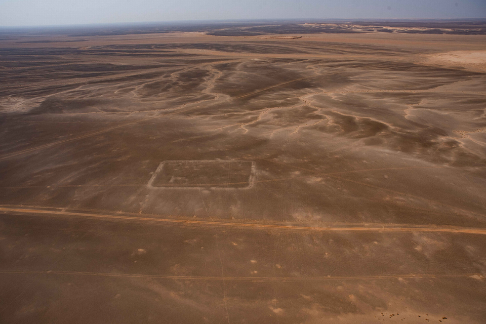
A series of rectangular shapes — roughly the size of football fields — was recently discovered in the Jordanian desert by researchers using Google Earth.
While these peculiar formations look like indentations formed by giant iPads that fell into the sand, they are more likely the remains of Roman military camps, according to a study published on April 27 in the journal Antiquity.
“We are almost certain they were built by the Roman army, given the typical playing card shape of the enclosures with opposing entrances along each side,” Dr. Michael Fradley, the researcher who discovered the shapes, said in a University of Oxford news release.
The remains of three camps were found in a remote area of Jordan, the largest of which measures about 410 by 345 feet in size.
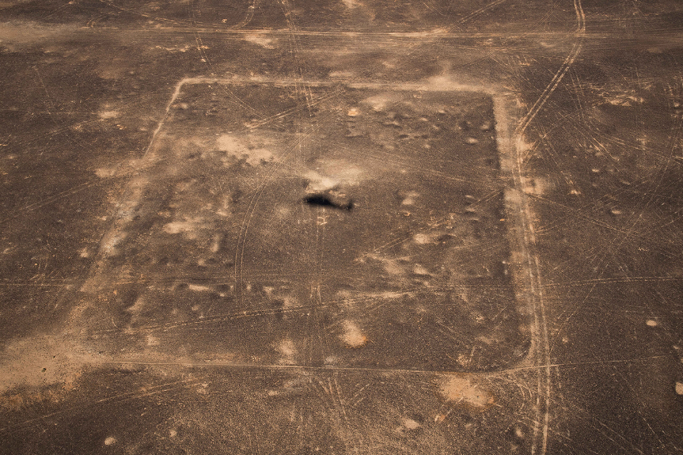
The sites, which are located on chalk and limestone outcroppings, have been disturbed by some vehicle tracks but are preserved fairly well.
“The near-complete absence of other structural remains of any period on the satellite imagery is in contrast to surrounding regions and suggests that the landscape was relatively uninhabited for millennia,” researchers wrote.
The camps were likely constructed about 2,000 years ago, briefly playing host to a large foreign fighting force.
The two smaller camps likely each hosted one cohort, a military unit comprised of about 480 soldiers, while the largest camp probably accommodated two cohorts.
The soldiers stationed there may have been mounted on camels, which would have enabled them to trek through the barren desert faster than on foot.
“The camps would be filled with tents and equipment, as well as mounts if we are correct in assuming that they were built by a cavalry unit,” Fradley told McClatchy News in an email. “They were very much temporary camps, so very different to the large permanent forts that we think of across the empire and along forts such as Hadrian’s Wall.”
The discovery of the camps, which are incredibly rare for the region, sparked speculation about what the Roman army might have been doing in the Arabian wilderness several thousand years ago.
The prevailing theory is that the troops were sent to the region to support the occupation of the Nabataean kingdom around 106 A.D.
The Nabataeans were originally a group of merchants who shipped spices between Arabia and the Mediterranean, according to a study published in 2016 in the Encyclopedia of Empire. They later formed a political entity annexed by Rome in 106 A.D. as part of the province of Arabia.
“It seems likely that the takeover was largely an economic operation by Rome to take full control of Arabia trade routes,” Fradley said.
The annexation of the kingdom by Roman Emperor Trajan was thought to have been peaceful, according to a study published in 2019 in the journal Levant.
But the new discovery of camps, which indicate a Roman military presence in the region, suggest the takeover may have been violent, researchers said.
“These marching camps — if we are correct in dating them to the early second century — suggest the Roman annexation of the Nabataean Kingdom following the death of the last king, Rabbel II Soter in AD 106, was not an entirely straightforward affair, and that Rome moved quickly to secure the kingdom,” professor Andrew Wilson, a coauthor of the study, said in the University of Oxford release.
Future analysis of the sites could help confirm this theory, researchers said.
Ancient Roman doctor made mysterious trek to Hungary. Photos show his rare grave
Watch as ‘super rare’ sea creature gives diver the ‘shock of a lifetime’ in Malaysia
Rare ‘mythological creature’ — an abandoned pet — rescued from Welsh countryside

