Goodbye El Nino, hello La Nina. But what does that really mean to Texas weather?
Extreme weather in Texas can be traced to recurring climate patterns such as El Nino and La Nina along with the more enigmatic polar vortex that on occasion have stretched its frigid fingers south, leaving in its wake wintry nightmares of misery.
It is with this thought that many in the state — farmers, politicians and commuters alike — are conditioned to keep a wary eye on the weather events these climate changes can spawn.
“The biggest reason why Texas should care about the transition to La Nina is because it is going to largely control the drought situation, particularly in North and Central Texas,” Fort Worth meteorologist David Bonnette told the Start-Telegram.
Generally, El Niño and La Niña weather patterns have significant impacts on Texas, with El Niño favoring more coastal storms in the southern tier and La Niña shifting the pattern further north, said Erica Grow Cei, of the Climate Prediction Center.
⚡ More trending stories:
→ Texas to 'spring forward': When daylight saving time begins
→ TikTok star Keith Lee gives love to 'dopest restaurant' in Fort Worth
→ Think Fort Worth has had enough Arctic blasts? Wait for polar vortex
Earlier this week, the National Weather Service issued a La Nina notice, which it predicts will arrive in the fall. But what exactly does that mean for the weather in Texas?
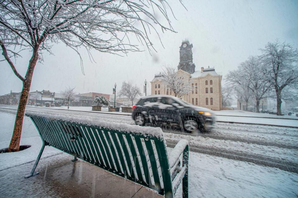
The last time the La Nina weather pattern was dominant it stuck around for three long years. It started in 2021 and ended last December. In that time, Texas endured expanding droughts in the summer and hung on for survival as ice and snow created chaos with the state’s fragile electric grid in the winter.
More than 200 people died during the winter storm of 2021, according to a report from the state. Similarly, hundreds in Texas died in the oppressive heat last summer, including scores of Fort Worth homeless.
The cold spells were triggered by Arctic intrusions caused by unstable air in the stratosphere above the north pole that unleashed the polar vortex to the southern states of the U.S.
“Even in La Nina years, the jet stream stays active,” Bonnette explained. “Every once in a while you get these Arctic punches, these Arctic outbreaks at least once a year and we’ll get some snow or ice.”
Although there is not necessarily a connection with climate patterns and Arctic air activity, Grow Cei said, the timing of an Arctic blast can make all the difference.
“What I can tell you is that El Nino conditions tend to favor more coastal storms,” she said. “But you know, for you down in Texas, (it) generally leads to a more active pattern for your area.”
But a transition to La Nina year does not mean a quieter winter, as we have experienced in recent years.
“(During La Nina) the pattern generally shifts further north. That doesn’t necessarily mean less precipitation,” Grow Cei said.
What are El Nino and La Nina climate patterns?
It is not surprising that La Nina is back so soon, replacing the El Nino pattern we’ve had since last December. They tend to occur every nine to 12 months, but can last for years, with El Nino years occurring more often.
The El Niño-Southern-Oscillation, or ENSO, has great pull in how weather forms around the world. During normal or neutral years, warm waters from the South Pacific pushes towards Asia and colder, deeper water rises to replace it. El Nino and La Nina, the two opposing weather patterns, break these normal conditions.
During an El Nino year, weakened trade winds allow warm water to be pushed into the west coast of the Americas, causing the Pacific jet stream to drop farther south than on normal years. This tends to bring dry and warmer weather to northern regions and wetter conditions in the southern reaches.
In a La Nina year, the reverse occurs: Stronger trade winds push warm water towards Asia forcing cold water to rise and nudging the jet stream northward. It usually means colder winters in the north and warmer ones in the south, which also translates to frequent and stronger hurricanes.
What really turns the weather patterns dangerous is when air high up in Arctic is roiled to instability. We have seen that turn when pressure weakens in the north pole destabilizing the polar vortex and forcing it south. When this rush of frigid air meets wet weather conditions — even during a La Nina year — is when Texas gets buried in snow and ice.
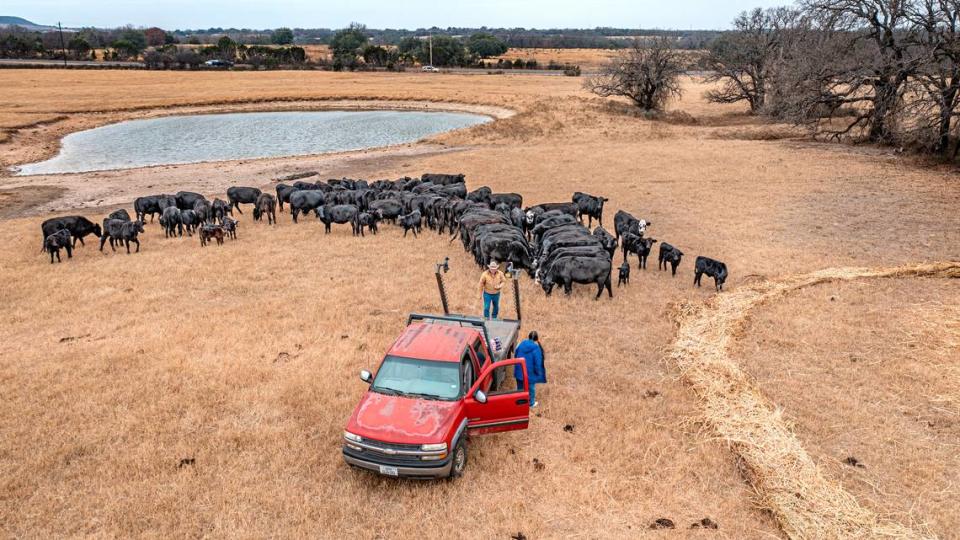
In Texas, La Nina generally means drought
As the ground dries up with lack of rain during a La Nina year, it generates an abundance of heat. North Texas experienced that in the summer of 2023 as the region recorded 26 days straight of 100-degree temperatures.
Droughts spell trouble for Texas ranchers who have to water their stock in order for their livelihoods to continue to be viable.
“A lot of public supply wells and a lot of even domestic wells have started going dry,” Natalie Ballew, director of the groundwater division at the Texas Water Development Board, told the Star-Telegram in 2022.
Many communities, specifically in South Texas, are experiencing significant water supply issues and they’re having to truck water in from other places, Ballew said. That includes areas like Concan and Utopia in Uvalde County, and Leakey in Real County. That’s causing a myriad of issues for those residents, with ranchers going as far as selling off their cattle because they don’t have water for them.
Even the few months of El Nino climate conditions have helped reverse much of the damage the three years of La Nina wrought in Texas. More than 17 inches of rain have fallen in North Texas since October of last year. Compare that to the period from October 2021 to March 2022, during a La Nina year, when the area recorded a measly 9.08 inches.
“So, that’s part of the reason of why we look at” the transition between climate patterns, said Bonnette, the Fort Worth meteorologist.

