Growth slows significantly on Black Fire, containment sees slight increase
GILA NATIONAL FOREST - Growth has slowed down significantly on the Black Fire this week, gaining fewer than 10,000 acres since Wednesday.
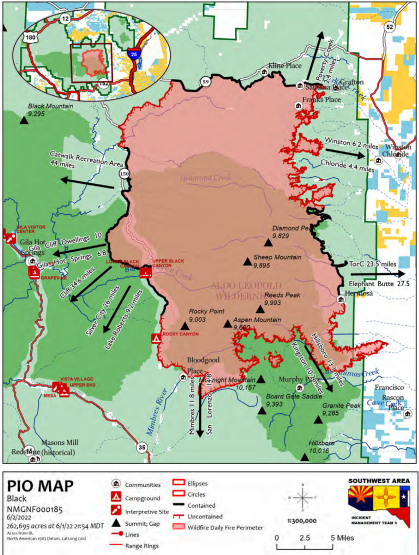
While the fire still continues to grow, it is down from the more than 15,000 acres the wildfire was gaining almost daily just a week before. As of Friday morning, June 3, the fire has burned 264,657 acres of Gila National Forest land. Perimeter containment is up slightly at 29%.
The fire has officially been burning for three weeks now. The exact cause of the fire is still under investigation but is described as human-caused.
According to the U.S. Forest Service’s daily update, growth has largely focused on the southeast portion of the fire, below Hermosa. The fire has moved east of the area near Animas Creek where the fuels are largely grasses. The change from timber to grass has given firefighters a chance to build direct control lines limiting growth.
More: Black Fire officially third largest wildfire in New Mexico history
Crews are also scouting for opportunities to limit fire growth toward Kingston. No growth has been reported over the last few days at the fire’s northern perimeter
Isolated showers and thunderstorms in the area will be possible beginning Friday afternoon. The increase in this “monsoonal-type” weather heading into the weekend may cause fuels in the interior of the fire to flare up. Forest Service personnel state that activity is likely to develop east of the Black Fire and continue moving eastward. Gusty outflow winds could cause more activity.
More: How close is Black Fire to Hillsboro, Gila Cliff Dwellings, Silver City? See updates
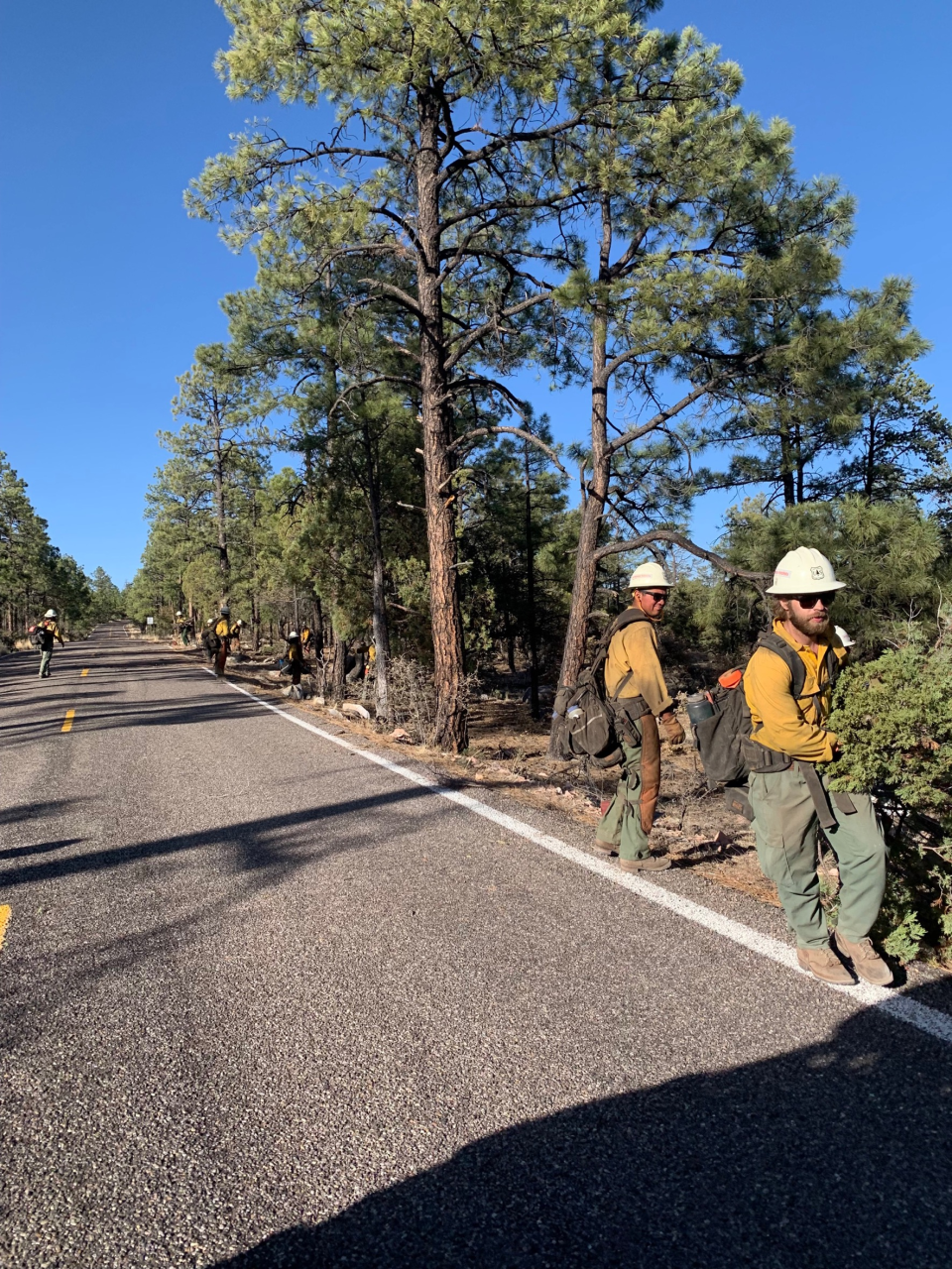
Aerial crews continue to monitor the fire, particularly areas showing heat. Ground crews still patrol the perimeter and extinguish any hotspots identified along the perimeter.
An interactive map created to provide real-time evacuation updates for communities affected by the fire is still operating. It can be found online at https://nifc.maps.arcgis.com/apps/webappviewer/index.html?id=d375d3d880a649aa914f693db309b892. In general, Catron and Grant county sheriffs have downgraded several areas.
A community meeting will be held Friday evening, June 3 at 6 p.m. Officials will provide an update at the Black Range Lodge in Kingston.
Farther south in New Mexico’s bootheel, the Foster Fire is nearing full perimeter containment in the Coronado National Forest. It remains just slightly over 7,500 acres in size with 82% containment reported.
The forest service announced Friday that resources assigned to this wildfire are starting to be released and reassigned to other incidents. Remaining crews will continue to secure the perimeter and mop up.
Leah Romero is the trending reporter at the Las Cruces Sun-News and can be reached at 575-418-3442, LRomero@lcsun-news.com or @rromero_leah on Twitter.
Others are reading:
State Department of Health identifies five rabid animals in southwest New Mexico
Hurt people raising hurt people: Advocates and parents decry a dire lack of mental health services
'Do not take them': Fostered dogs being returned to abusive owner, advocates say
This article originally appeared on Silver City Sun-News: Growth slows significantly on Black Fire, containment sees increase

