Guest column: The view from the ground often suprises how far Newark Earthworks extends
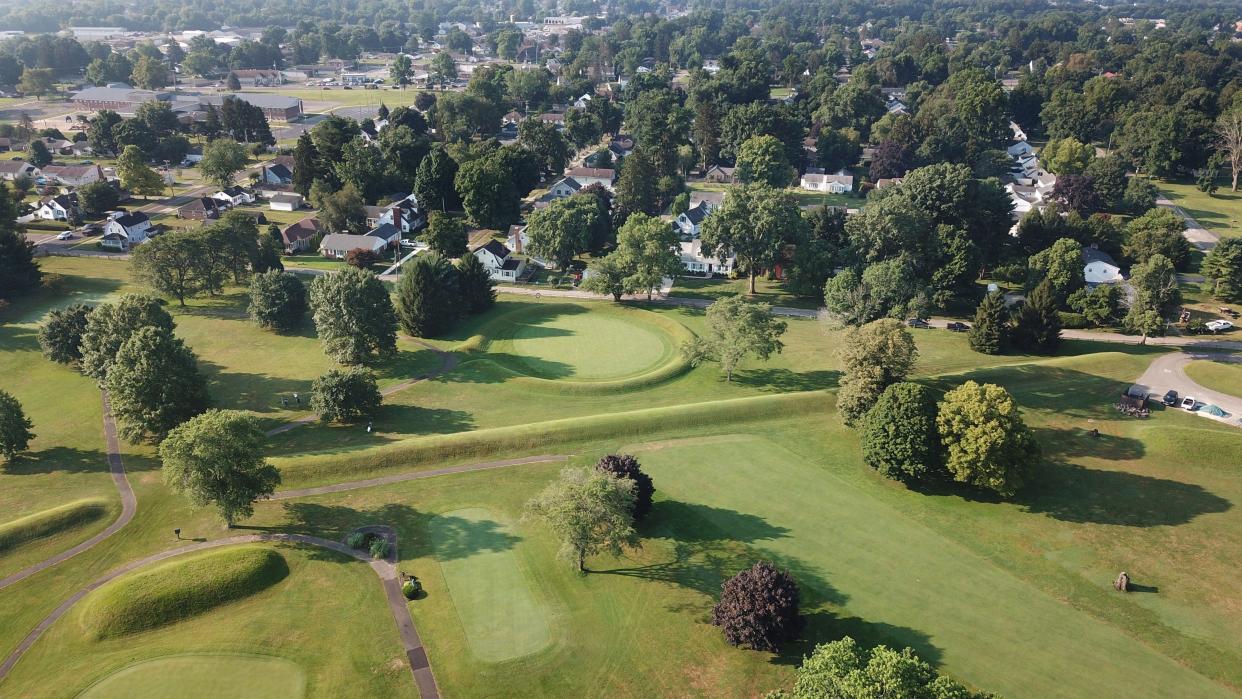
While I have greatly enjoyed airplane flights over Newark, and even a hot air balloon perspective of the Octagon, my favorite views of the Newark Earthworks are on foot.
There are many places where fragments and remnants can be seen and traced which you miss unless you’re paying close attention to the landscape and the ups and downs of the terrain, which are too subtle to catch at 35 miles per hour in a car.
I’ve talked about places in the 4½-square-mile complex of the Newark Earthworks, extending between and encompassing both the Octagon and the Great Circle, where the land slopes. And I’ve had long-time local residents say, “What slope?” When you are walking along a road or down a sidewalk, you notice a grade right away, where if you just drive it, even if it’s a couple times a day for years, you just mentally register it all as “level.” But it isn’t.
Many of the historic maps of the earthen enclosures which date to the 1800s, showing portions now destroyed above ground level, also show hatch-marks and other shadings indicating changes in the terrain. These can give us a way to relate the modern neighborhoods to the former fields. Just west of Route 79 both south and north of West Main there's a fairly meaningful slope, almost a bluff, but it’s tucked behind houses and down alleys. Once you see it, you can relate maps over a century old to the modern streetscape.One of my favorite points on walking tours I do for the Ohio History Connection is to show where, along an alley or two, you can detect subtle but distinct rises that mark, at just the correct distance from each other, the remnant of parallel walls that once led from Raccoon Creek to the Octagon. People often say “I’ve driven down this alley and never noticed that,” but it’s the sort of thing that, once you’ve pieced together where you are on the map, you won’t forget it.
Recently, I’ve been walking other sidewalks and peering along streets to figure out where some of the other small pieces of the formerly detailed complex of walls and enclosures once stood. The fact that much of the geometry is aligned to certain astronomical events, like the twice-a-year equinox sunrise and sunset, gives me another orientation point (if I don’t mind getting up early) to figure out where current intersections are on ancient maps.

As Brad Lepper likes to quote from Squier and Davis in 1848 after their survey of the Newark Earthworks, “the ancient lines now can be traced only at intervals among gardens and outhouses.”
There are a few more garages and outbuildings, but those intervals still exist, and have stories to tell us. Yes, much is gone, but the marvel and the joy is how much of the Newark Earthworks is still there, and it’s probably more than you think.
Jeff Gill is a volunteer site interpreter for the Ohio History Connection, and a member of the Ohio Archaeological Council.
This article originally appeared on The Columbus Dispatch: Traveling by foot shows how much of Newark Earthworks still there

