Gulf Coast hurricane landfall possible in just days
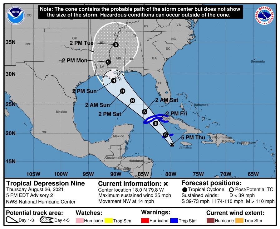
Just days after Hurricane Henri swept through the Northeast, the tropics pose another, even more dangerous threat. The National Hurricane Center is monitoring a system in the Caribbean that was upgraded Thursday afternoon to a tropical storm named Ida. In just a few days, it is expected to make landfall as a powerful hurricane on the Gulf Coast.
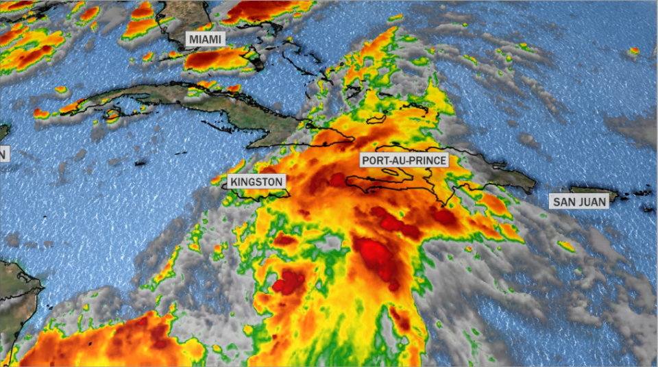
Ida is located west-southwest of Jamaica, with sustained winds of about 40 mph, and is moving briskly towards the northwest. Forecasters are predicting rapid organization and strengthening as it approaches the Gulf Coast, likely threatening Louisiana at or near major hurricane strength on Sunday.
Since the Gulf of Mexico has not seen a storm recently, the water has not been worked over, and sea surface temperatures are very warm, ranging from 86 degrees in the deeper water to 90 degrees near the coast of Louisiana. Combine that with the fast approach of peak hurricane season, and there is good reason for concern.
Forecasters have been monitoring the system's development for several days. Before computer models could get a handle on the track, they need to know where the center of the storm will form. Once that is apparent, the models will have an easier time.
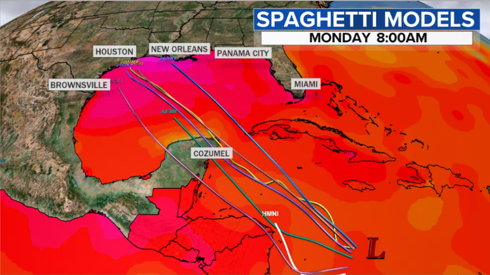
There is a general consensus now that this system is likely headed for the Louisiana coast. When exactly it arrives will depend on where it makes landfall — the further west, the longer it will take. The window now appears to be narrowing in on Sunday through Monday. That doesn't leave much time to prepare.
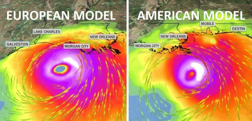
Pictured below are two of the most reliable medium-range models, the European and American models. On Wednesday, runs of both models showed a strong hurricane making landfall somewhere along the Louisiana coast, but some other models predicted landfall further west along the Texas coast.
Several models showed landfall centered near western Louisiana. If this were to occur, it would be exceptionally bad luck, as both Hurricane Laura and Hurricane Delta made landfall in that area during last year's record-breaking hurricane season.
A lot can and will change — including the eventual track and intensity. It is recommended that residents in the area continue to pay close attention and be sure their hurricane safety kits are up to date.
Judge to rule on lawsuit against Florida Gov. Ron Desantis' mask mandate ban

