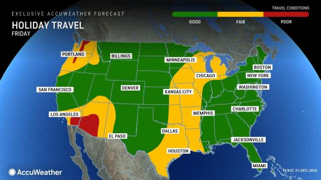
Gushing rainstorm to trigger flash flooding from Southern California to Arizona


A big storm swinging in from the Pacific Ocean has already brought a month's worth of rain and may continue to bring major travel problems, flooding and debris flows to areas from California to portions of Arizona through Friday night.
The same storm drenched areas in Northern and Central California into midweek while remaining largely offshore over the Pacific. However, the storm has since turned inland over Southern California, producing drenching and problematic results.
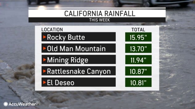
As of Friday morning, rainfall totals began to climb over 10 inches in some of the highest elevations across parts of Central and Southern California. Meanwhile, Los Angeles International Airport had received over 2.75" of rain, and Oxnard reported over 5" of rain since Wednesday afternoon.
 |
As AccuWeather accurately predicted, the rain recorded in Los Angeles and other parts of Southern California was more than the historical average for the entire month of December.
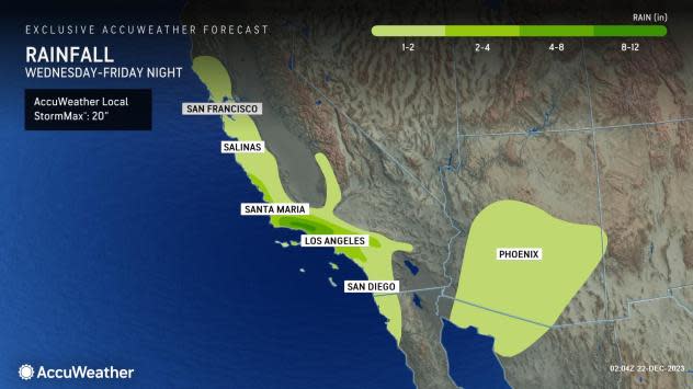
Throughout the day on Friday, showers will persist across the southern third of California, but the zone from San Diego to Palm Springs, California, is likely to be blasted by the heaviest rain into the afternoon.
The AccuWeather Local StormMax™ Rainfall for this storm is 20 inches and is most likely to occur in the mountains of Santa Barbara and Ventura counties.
 |
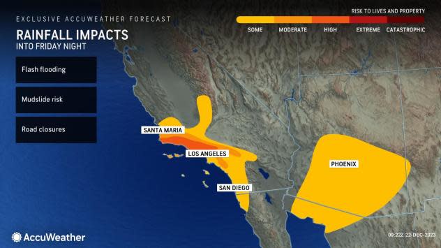
As the rain pours down, travel delays are expected to continue. Water will collect in low spots on area streets and highways, leading to ponding. Any debris blocking storm drains can result in more serious urban flooding. Dangerous to life-threatening conditions could unfold along the south- and southwest-facing mountainsides.
"With all the rain and the problems it will create, commutes will be difficult, and motorists will need to seek alternate routes as traffic will be snarled from through Friday," said retired AccuWeather Western Weather Expert, and California native, Ken Clark.
 |
Streams and rivers will surge in the area as many lakes and reservoirs are near full capacity and may not be able to absorb the runoff as well as they did last year during widespread drought.
Dry streambeds, called arroyos, will quickly fill with water and may become raging torrents. As such, AccuWeather forecasters urge people to stay alert for rapidly changing weather conditions that may prompt quick action and possible evacuations.
 |
Roads in hilly locations and outlying areas may become blocked. The pouring rain can lead to road washouts, landslides and mudslides. Where there have been recent wildfires, debris flows are possible.
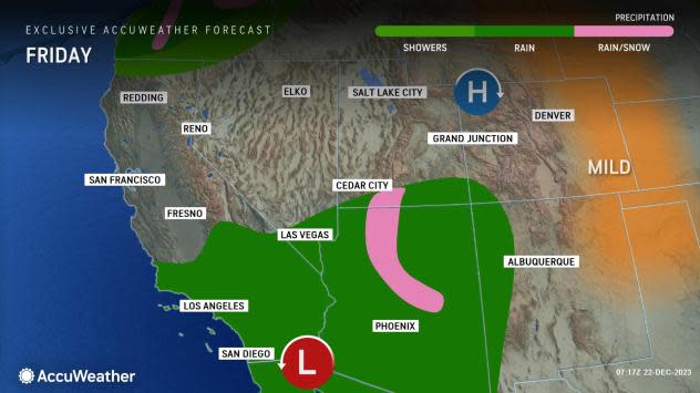
Since this will be a warm storm, freezing levels will be quite high, and no snow will fall over the passes in Southern California. Snow will be limited to the ridges and peaks in the Sierra Nevada, much to the disappointment of skiing enthusiasts. However, due to a strong El Niño, more opportunities for heavy snow will come throughout the winter.
Fog and windy conditions are likely, with drenching rain over the higher elevations, which can make for dangerous travel.
A brief period of snow will occur at the tail end of the storm in the Arizona and New Mexico mountains. The same storm may end up being a profuse snow-producer from portions of the Colorado and Wyoming Rockies to the northern High Plains.
Thunderstorms may accompany the rain in some areas. A couple of incidents of hail cannot be ruled out, and neither can a waterspout near the Southern California coast.
 |
The storm will drench areas farther to the east, including Arizona and western New Mexico, into Saturday. These two interior Southwest states, in particular, have been struggling with serious drought and have experienced several wildfires this past summer. Much of Hilary's rain avoided the area, so the upcoming downpours can lead to significant debris flows in burn scar locations.
In Phoenix, this storm has the potential to eclipse that of individual storms from the entire year, should 1-2 inches of rain pour down.
Hilary delivered 2.99 inches of rain to downtown Los Angeles in August, with 1.84 inches of rain drenching San Diego.
Palm Springs received a whopping 3.23 inches of rain from Hilary on Aug. 19-21. This storm may fall well short of that in Palm Springs and other California deserts and Inland Empire locations, but this will likely be the biggest storm since then.
Want next-level safety, ad-free? Unlock advanced, hyperlocal severe weather alerts when you subscribe to Premium+ on the AccuWeather app. AccuWeather Alerts™ are prompted by our expert meteorologists who monitor and analyze dangerous weather risks 24/7 to keep you and your family safer.
