Ferry cancellations and power outages likely with weekend storm in B.C.
A duo of storms will bring widespread disruptions to parts of British Columbia through the weekend as the West Coast contends with blustery winds, heavy rainfall, and deep alpine snows.
Power outages are possible from the gusty winds, which may also bring travel delays and ferry cancellations throughout the region.
MUST SEE: Canada's November outlook: A smooth transition or a free fall into winter?
We’ll see our first bout of rough weather arrive on northern and central Vancouver Island by Friday afternoon, quickly picking up intensity through the evening hours. Intense precipitation rates are possible, and drivers are urged to plan ahead for rapidly changing conditions.
Friday afternoon through Saturday
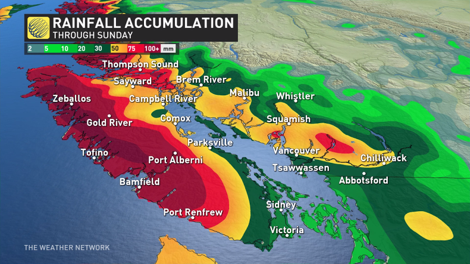
Heavy rain will sweep over Vancouver Island, with rainfall rates approaching 10 mm per hour across the west. Conditions will begin to ease here by early Saturday as the front moves onto the Lower Mainland.
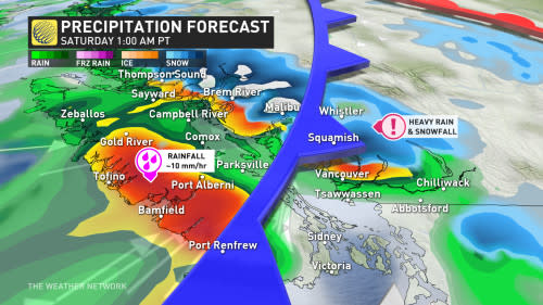
Freezing levels will drop below 1200 metres as cooler air dips into the region from the north, bringing the opportunity for significant snowfall along the coastal mountains.
More than 50 cm of snow is possible along the coastal alpine regions late Friday into Saturday, a fantastic turn of events for ski resorts and winter sport enthusiasts. However, this could make for difficult travel along the highway passes.
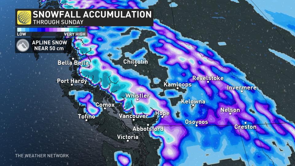
Elevations near 1000 metres may experience periods of mixing between rain and snow as heavy precipitation rates pull down cooler air from above.
Folks below 1000 metres will see heavy rain and gusty winds for the duration of this event.
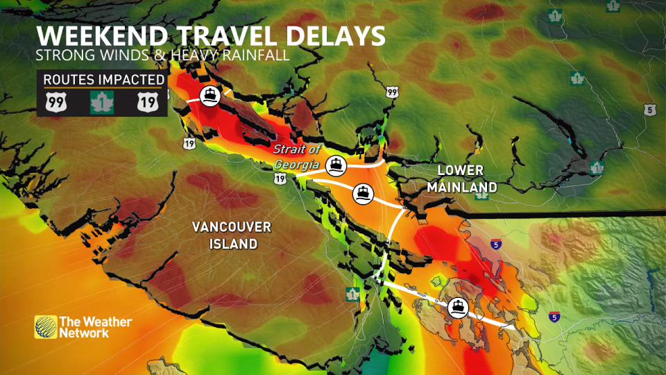
Wind gusts of 60-70+ km/h, with even higher gusts over the Straits, will lead to the risk for power outages, travel delays, and ferry cancellations. Winds will spread Friday evening from Campbell River southeast near the San Juan Islands by Saturday morning.
Forecasters expect more than 100 mm of rain for Tofino, with 40-60 mm expected across the Lower Mainland during this event.
The intensity of the system will diminish through Saturday, but another storm arriving soon after on Sunday will mark the return of active weather.
Unsettled weather will continue into the middle of next week, but the storm track will eventually start to shift south later in the week, taking the most active weather into California and Oregon. A somewhat drier pattern is expected during the second half of November.
Header image courtesy of Getty.
Stay tuned to The Weather Network for the latest on conditions across B.C.

