Hang on to your hat! Windy Tuesday to usher in storms, stronger winds to Treasure Coast
Strong winds with possible gusts up to 65 mph in some areas plus an increased risk of tornadoes were expected to be the potential impacts of storms on the Treasure Coast from a cold front forecast to sweep across the region late Tuesday.
A wind advisory from 10 a.m. through 7 p.m. is in effect for conditions expected ahead of the storms. Storms are expected to reach the Treasure Coast Tuesday night, according to National Weather Service Forecast Office meteorologists in Melbourne.
“This line will be very fast-moving,” said Derrick Weitlich, a lead meteorologist with the agency. "It will push through the area pretty quickly.”
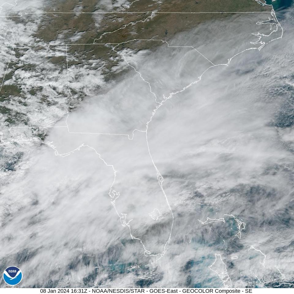
Weather projections showed the system reaching the Treasure Coast between 7 p.m. and 11 p.m. and then moving offshore by midnight.
More: Florida Gov. DeSantis activates State Guard as 'severe weather' threatens state
Sustained 20- to-30 mph winds with 40- to-45 mph gusts were forecast to begin early Tuesday.
As the front passes he said damaging winds up to 65 mph with isolated gusts up to 70 mph were possible, but the higher wind speeds were expected more in the central regions near Okeechobee County, Weitlich said.
“I can’t rule out the threat of a tornado or two," he said.
Live updates: Check for any weather watches, radar, warnings issued for Treasure Coast
The heaviest impacts were expected for the Interstate 4 corridor in the central part of the state, north of Orlando with the Sanford area likely seeing the highest potential of damaging winds and tornadoes.
The same hazards affiliated with the cold front though, he said were expected across all of East Central Florida.
“It’s important people pay attention to the weather and be aware of any watches or warnings issued with this storm,"
He said it's especially important on the Treasure Coast because of the front's anticipated arrival after dark.
The speed of the storms' sweep across the region meant little rain was expected with the system, he said.
The agency only projected roughly ½ to 1 inch of rain at any point across Indian River, St. Lucie and Martin counties.
“Behind it, conditions will pretty quickly improve,” he said.
Wind speeds are predicted to lower to 5- to-10 mph by Wednesday accompanied with a drop in temperatures to what he said were “more normal values,” with lows in the mid to upper 50s and highs in the low 70s.
More: DEP issues final order to punish Port St. Lucie resort for destroying mangrove forest
More: Costco plans to move distribution center to Port St. Lucie from West Palm Beach
Corey Arwood is a breaking news reporter for TCPalm. Follow @coreyarwood, or call 772-978-2246.
This article originally appeared on Treasure Coast Newspapers: Front forecast to bring storms, strong winds to Treasure Coast

