New Hanover planning board rejects new zoning district needed for west bank development
A development across the river from downtown Wilmington is headed back to the drawing board following the denial of a zoning change needed to accommodate the project.
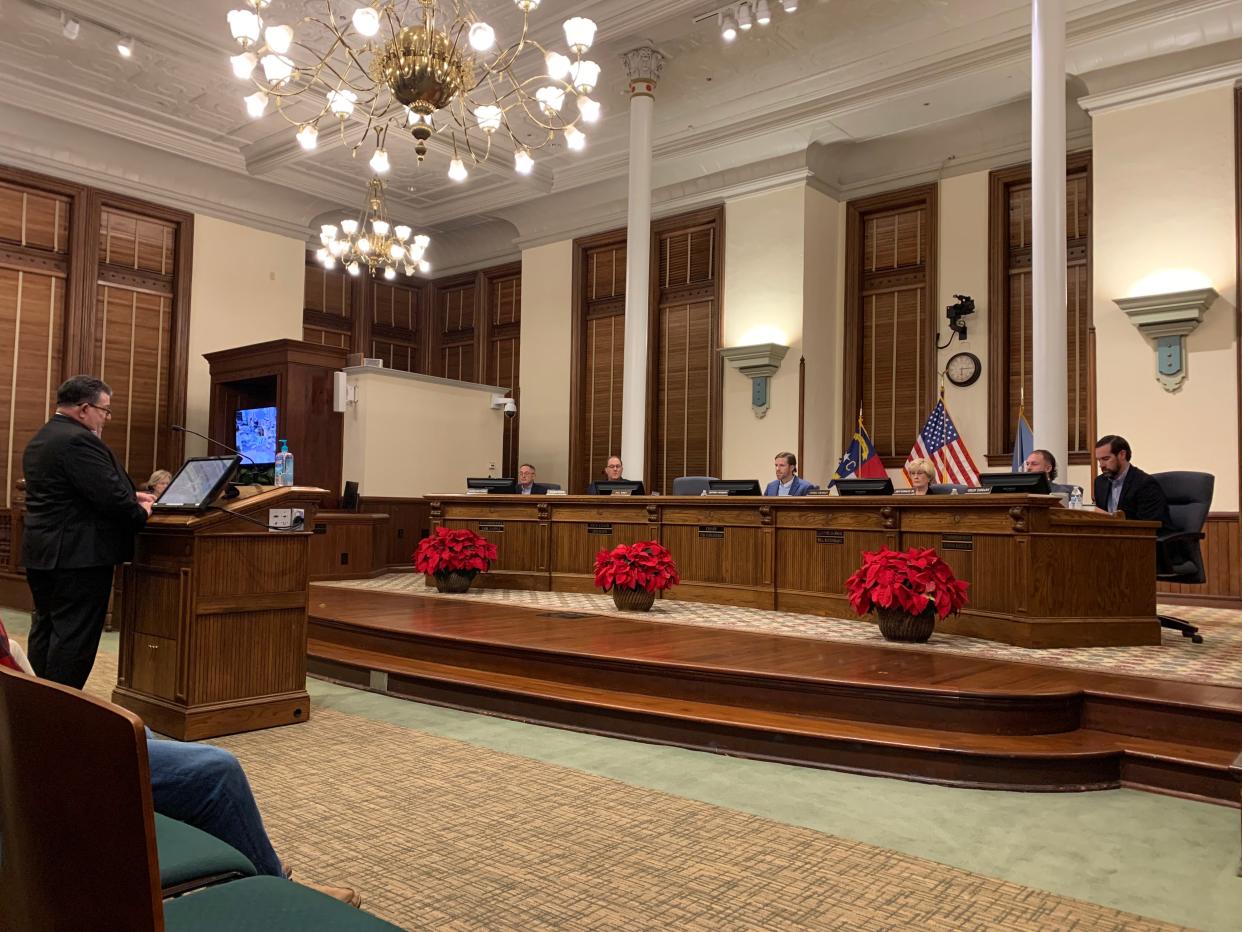
The New Hanover County Planning Board voted 5-1 to block the creation of a new zoning district that was needed to move forward with the Villages at Battleship Point.
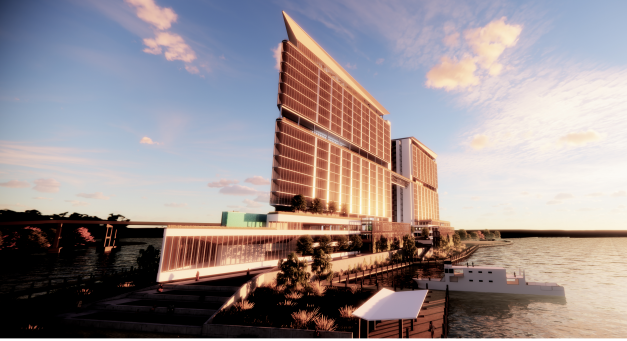
The project, proposed by KFJ Development Group, was planned for a more than 8-acre piece of land located at 1100 Point Harbor Road — directly across the river from the northern end of downtown and establishments like Marina Grill and Pier 33.
Plans for the project included 550 condos, 300 apartments and 100,000 total square feet of retail and restaurant space, according to project details presented at a community meeting in late September. The residential and commercial space will be spread across three high-rise buildings linked by pedestrian walk ways.
The developer had asked New Hanover County to establish a new zoning district to fit their plans by amending New Hanover County's Unified Development Ordinance.

More: Cape Fear's west bank project has an obstacle to overcome before approval
More: Project could bring skyscrapers, condos, and Riverwalk to Cape Fear's western bank
More: Developers want to build on western bank of the Cape Fear River. It's not the first time.
The planning board considered the request for the new district, called the Riverfront Urban Mixed-Use Zoning district, at their November meeting but chose to postpone action until December.
While county staff recommended approval, board members said they wanted more details about the project before approving the new district, especially given the development's scope and potential impact on the area.
The proposed zone would have combined concepts from three existing districts. It would have applied to sites with areas between five and 10 acres and accommodated a maximum density of 100 units per acre.
The district underwent a few changes between the November and December meetings.
New language clarified the new district would only apply to a strip of land on the west bank of the Cape Fear River just south of the Isabel Holmes Bridge. The language was also adjusted to clarify that the 240 foot height will be measured from the first finished residential floor, not the ground.
Even before Thursday's meeting, New Hanover residents expressed concerns about rezoning and developing the land. New Hanover County Planning Director Rebekah Roth said her department received 38 comments in opposition to the project, four in support and one neutral comment before the meeting.

The New Hanover and Brunswick County branches of the NAACP wrote a joint letter to New Hanover County Planning Director Rebekah Roth outlining their opposition to the creation of the new district and the land rezoning.
In the letter, the group highlights concerns that the project could threaten local wetlands and increase localized flooding in the area. It also raises concerns about the location of the proposed project within a FEMA designated floodplain.
"Because of this, it will be vulnerable to floods, storm surge and sea level rise, not only at the time of initial construction, but throughout its entire lifecycle," the letter states.
During Thursday's meeting, residents expressed similar concerns about flooding and the developer's ability to account for rising sea levels in the future.
“This district goes against all of those flood resiliency recommendations,” said New Hanover County resident Robert Parr. “We are creating a zone that would create a disaster in this area.”
Parr had also presented flooding and sea level rise data at the November meeting in opposition to the district.
Other residents spoke about their concerns that the project would bring traffic congestion to U.S. 421 and would impact Battleship North Carolina, which is classified as a historic site.
Leland resident Brayton Willis raised concerns about the project's planned "living shoreline," which he said would put the river in a "straightjacket," making water flow unpredictable in the area.
“We need to figure out how we can work with floodplains and not on them,” he said.
Frank Pasquale, the project's technical director, said the development team is aware of the flooding risks in the area and had plans to build spillways that would allow water to flow through open parking decks that would comprise the first few levels of the development.
“We know this area is going to flood,” he said. “Anyone who says this area is not going to flood is a fool.”
An architect for the project presented more detailed plans about how designs for the project would take into account the wetlands surrounding the area.
Ultimately, members of the planning board said they felt "uncomfortable" with the project. Member Colin Tarrant said the proposed district didn't site well with him and that approving the district would be like "engineering a problem" for future county residents.
“I think we should tread lightly before we approve something like this,” he said.
Planning board chairman Jeffrey Petroff said he was worried about the size of what could be allowed in the new district, especially measuring building height starting at the first residential floor.
“The intent is good, but the scale just seems excessive to me,” he said about the project.
Board vice-chairwoman Donna Girardot agreed.
“If we start measuring from the parking lots up, I’m concerned about that,” she said.
Pasquale said the development team was ready to adjust the height of the building but wanted more direction from the planning board.
The board opted to deny the new district on a 5-1 vote with member Allen Pope voting in favor of establishing the district. Paul Boney had recused himself from the vote because he arrived late to the meeting.
If the district had been approved, the planning board was set to consider rezoning the site of the proposed development from its current I-2 heavy industrial district zoning to the newly established district.
Members of KFJ Development Group asked the rezoning item be continued to an unspecified later date.
Reporter Emma Dill can be reached at 910-343-2096 or edill@gannett.com.
This article originally appeared on Wilmington StarNews: Proposed west bank development hits a roadblock with zoning denial

