Phoenix finally sees rain after Hilary makes landfall. Here's a timeline of the tropical storm and its impact to Arizona
This weekend you may have heard of Hilary, a tropical storm that developed into a category 4 hurricane on Friday, promising to bring heavy rainfall, severe thunderstorms, catastrophic flooding, and even tornadoes into the state. Yet, the weather effects did not live up to the expectations.
As then-Hurricane Hilary advanced toward California and Arizona, meteorologists forecast "significant excessive" rainfall to potentially hit the state. Up until Monday in the early morning, nothing but a few raindrops had hit the Phoenix area, and the areas mostly impacted were limited to the western parts of Arizona.
On Sunday, Hilary again lowered its category into a tropical storm after losing strength once it hit land over the northern Baja California Peninsula of Mexico.
As the storm fades away, here's what to know about how now Tropical Storm Hilary impacted Arizona, and what you should expect for this week.
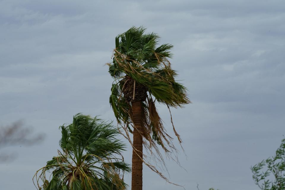
Hilary updates: Strong winds buffet southern Arizona
What happened to the rain?
Gabriel Lojero, meteorologist with the weather service in Phoenix, said the state generally recorded less than inch of rain since Hilary became a hurricane, through Sunday afternoon. Locally higher amounts were seen, he said, but on average, Arizona saw only about three-quarters of an inch of rain.
According to Lojero, rain chances initially anticipated to wash away the Valley, significantly reduced as Hilary moved mostly straight northward, instead of following the north-eastward trajectory that the storm showed on Saturday, but only for a little bit.
"The storm was just too far west," Lojero said. "If the track would have been sort of to the northeast from the Baja Peninsula, we would have had a better shot at rain here in the Phoenix area, but it just was too far west."
Lojero added the hurricane most likely moved north because of its steering pattern.
He explained the prevailing winds surrounding a hurricane are what guide it along its path. In the case of the Hilary, there was a strong high-pressure system situated across the central U.S. and a low pressure system just off the West Coast, Lojero said.
"The configuration of those two features caused northerly track," Lojero said.
How did Hilary impact Arizona? A timeline:
The main impact on the Grand Canyon state were the strong winds and low temperatures, Lojero said. Here is a timeline of how Hilary impacted Arizona over the past few days.
Aug. 17: The storm's effects were already being felt in Arizona, with promising rain chances escalating and with the National Weather Service forecasting strong to severe thunderstorms with concerns of local damaging winds and flooding starting Friday. Increased moisture levels spurred showers around parts of the state on Thursday.
Aug. 18: Hilary developed into a category 4 hurricane. Located about 240 miles west-southwest of the southern tip of Baja California on Saturday morning, Hilary was considered "large and powerful" by the National Hurricane Center with maximum sustained winds of 130 mph. The National Weather Service office in Phoenix estimated rainfall amounts for southwestern Arizona as Hurricane Hilary moved closer. Flood watches were already in effect for southwestern Arizona and southeastern California from Saturday morning through Monday morning, the weather service tweeted Friday afternoon.
Aug. 19: On the morning of Aug. 19, Hurricane Hilary was about 235 miles southwest of the Baja California peninsula, moving north northwest and producing powerful winds of up to 125 mph. Throughout the day, Hilary weakened from a Category 4 to Category 3 and later into Category 2 storm as it headed toward the West Coast, according to The National Hurricane Center.
The National Hurricane Center expected Hilary’s impact would produce “catastrophic and life-threatening flooding likely over Baja California and the southwestern U.S. through Monday.” But Arizona saw little of that, with only strong winds seen in the area.
In the afternoon, for the first time in more than two months, the Valley failed to reach triple-digit temperatures, with the high temperature recorded on Saturday at Phoenix Sky Harbor only reaching 95 degrees, according to the National Weather Service.
The National Weather Service in Phoenix described conditions expected for Saturday and Sunday as "deteriorating" for areas such as Yuma and La Paz counties, which the weather service forecast to see most of Hilary's impact for southwestern Arizona. Yuma County did see strong storm activity early as 6 a.m. on Saturday, according to the weather service.
Aug. 20: As Hilary weakened into Tropical Storm category, Sunday came with highly breezy conditions. Showers and more wind gusts were seen in metro Phoenix late into the evening.
Sunday morning saw a low temperature of 83 degrees in the Valley, and a high temperature of 102 in the afternoon. Gusts up to 35 mph in metro Phoenix and up to 60 mph in Yuma were seen early Sunday evening. “New rainfall amounts of less than a tenth of an inch” were called for the Valley. By Sunday night, the low was expected to drop to 79 with winds of up to 20 mph before midnight.
In Yuma, the Arizona county most heavily affected by Hilary weather effects according to Lojero, more than 7,700 people were without power, as reported by Arizona Public Service. Outages had significantly reduced as of 8 p.m. Sunday.
What to expect for the rest of the week
Meteorologist Matt Salerno with NWS Phoenix said there is going to be some moisture left over from Hilary that will stick around for the first half of the week, bringing more low temperatures and more typical monsoon shower and thunderstorm chances, mainly across southern and central Arizona.
High rain amounts, severe storms and strong winds developed overnight Sunday and were expected to remain through Monday night, with the highest impacts forecast for the northwestern parts of the state.
Flash flooding chances were also heightened with storms forming in Northern Arizona. Additional flood watches were issued across the higher terrains of eastern Maricopa, and central to southern Gila counties.
After Monday, the effects of the hurricane are expected to fade significantly, and the state will again come back to a gradual warming trend, with temperatures potentially reaching 110 degrees again by this weekend, Salerno said.
This article originally appeared on Arizona Republic: Here's how Hilary has impacted Arizona

