Heading to the Florida Keys for Memorial Day weekend? You may hit issues on the road
If you’re looking to escape to the Florida Keys this Memorial Day weekend, paradise will come with a cost: possible delays on the Overseas Highway.
Here’s what to know:
Delays and increased enforcement on Keys road
Law enforcement staffing: In addition to the extra traffic on U.S. 1, the Monroe County Sheriff’s Office says deputies “will be out in force” through the three-day weekend “to make sure people are driving safely.”
“All Sheriff’s Office Traffic Enforcement Officers will be assigned to work the entire holiday weekend and will work county-wide to help supplement road patrol, particularly on U.S. 1,” the agency said in a statement.
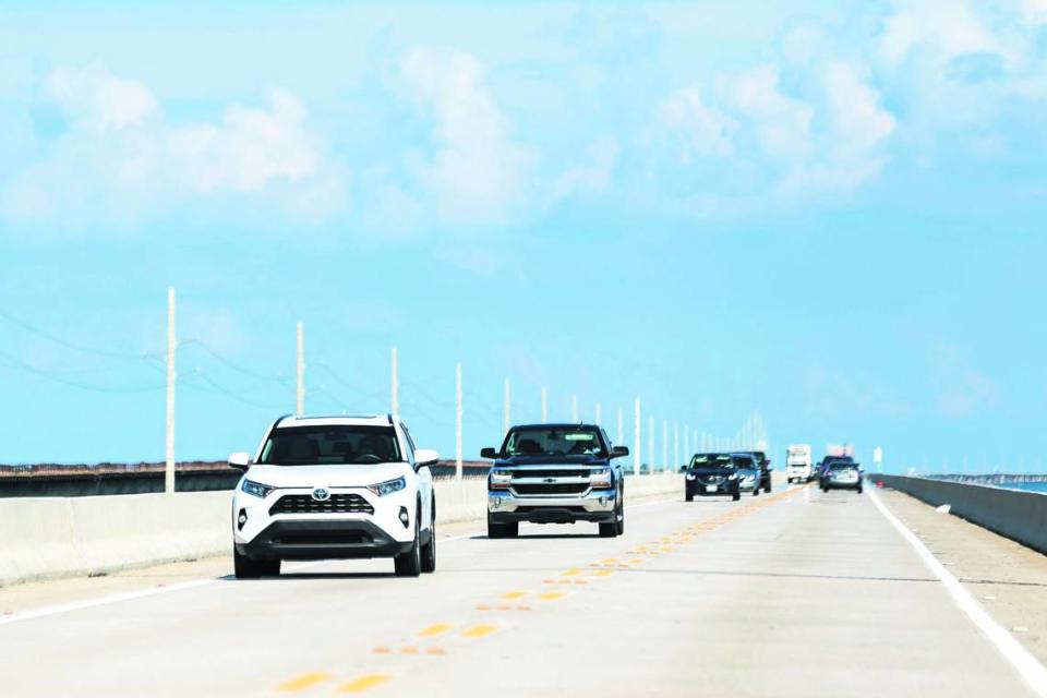
Traffic flow: Delays on the Overseas Highway are expected as soon as Friday as travelers make their way down through the Keys. And expect heavy traffic flowing north on Monday as the holiday winds up.
“Anyone planning to be on the road over the weekend should plan extra time accordingly,” the sheriff’s office says.
Drivers should also be ready for extra scrutiny by Keys deputies and Florida Highway Patrol troopers.
What police will be looking for:
▪ Passing in no-passing zones
▪ Passing illegally in turn lanes
▪ Traveling at unsafe speeds
▪ Drinking and driving
What to know about the the Overseas Highway

No tolls: Traveling on the Overseas Highway is toll-free.
Length: The highway runs 113 miles through the Keys over the Atlantic Ocean, Florida Bay and the Gulf of Mexico.
Mile markers: Green mile marker signs are on the side of the road and are used for addresses and directions. The road begins and ends in Key West, where the mile marker zero signs are at Whitehead and Fleming streets.
Bridges: The longest span is the Seven Mile Bridge, which is actually 6.79 miles long. The second longest is the Long Key Bridge, at 2.3 miles.
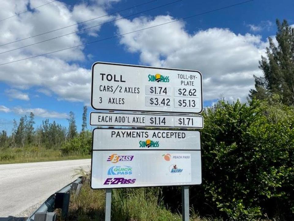
Alternate route: Card Sound Road, considered an alternate road to the Keys, has a $1.74 toll, taken electronically through SunPass, at the northern end of the bridge, a 65-foot high, 2,800-foot long span that crosses Card Sound.. The cost for toll-by-plate is $2.62. Getting into the Keys using Card Sound Road, or County Road 905A, drivers take the highway southeast, over the bridge to a three-way stop sign. If you make a left, you’ll head to the ultra-exclusive gated community of Ocean Reef. Turn right on County Road 905 (without the “A”) and you’re on your way to Key Largo.
Speed limits: The speed limit on most of Card Sound Road is 55 mph. The speed limit changes on U.S. 1, and you’ll only be able to hit 55 mph in certain places. Until you hit downtown Key West, expect 50 mph for most of the road. But you’ll need to go slower when you start to see clusters of businesses and homes because the Overseas Highway runs through small communities. Most of the highway is patrolled by the Monroe County Sheriff’s Office and the Florida Highway Patrol.
Traffic apps: Two free apps can help you navigate the Overseas Highway. One is for traffic and the other is a guide to the Keys.
▪ The Monroe County Sheriff’s Office has a namesake app that is a must-have for people who must take the road regularly. The app has a “live calls and traffic info” tab that gives the location and times of crashes or other traffic disruptions, such as when a medical helicopter is landing on the highway. You can also sign up for notifications, which will tell you when lanes are reopened. The sheriff’s office also posts about crashes in real time on its Facebook and Twitter feeds, which you can access through the app.
▪ A travel app from the Monroe County Tourist Development Council —The Florida Keys and Key West — features just about everything you want to know about exploring the islands. The app includes narrated driving tours — one for each direction of the highway — along with lists of hotels, restaurants, art galleries, watersports rentals and fishing guides. Information is categorized by location: Key West, the Lower Keys, Marathon, Islamorada and Key West. The app also has videos of the Keys, a map and weather forecasts.
Both apps are available through the Apple Store and Google Play.
Enforcement on Florida Keys waters
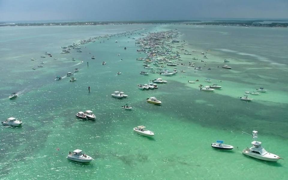
On the lookout: Keys visitors should also expect stepped-up law enforcement on the water by the sheriff’s office and officers with the Florida Fish and Wildlife Conservation Commission.
The No. 1 thing those officers will be looking for is drunk boating, said Sheriff Rick Ramsay.
“Many people head offshore to have a good time, but boaters should make sure to designate someone sober to bring the vessel and its passengers back to shore safely,” he said.

