Heading to the Sawtooths? These are the best hiking trails in the Central Idaho wilderness
The Sawtooth National Recreation Area is known for its scenic views and numerous outdoor opportunities. Whether you’re heading up to the area to enjoy the sights with your family or you’re just seeking solitude in the expansive wilderness, there’s a trail for you.
Susan James, recreation manager for the SNRA, said the area offers more than 900 miles of trails that traverse the Sawtooth, Boulder and White Cloud mountain ranges. Many of them include breathtaking views, alpine lakes and opportunities to spot wildlife. Some trails are challenging multi-day treks, while others are a great fit for a family trip.
Forest Service officials and outdoor groups have encouraged hikers to look for less-traveled paths to alleviate some of the strain on heavily used trails. On any trail, be sure to follow Leave No Trace principles — guidelines that reduce the impact on the environment and keep wilderness areas free from trash and potential safety hazards. Leave No Trace emphasizes packing out any items you pack in and treating wildlife and other recreators with respect. Find more trail etiquette guidelines here.
Here are some trail recommendations from Statesman staff and Forest Service experts:
Quintessential SNRA
The Sawtooth National Recreation Area conjures images of jagged mountain peaks and pristine high-altitude lakes. These trails are perfect for a quintessential SNRA experience.
How much do you want to take on? How much incredible scenery do you want to see?
It’s your choice.
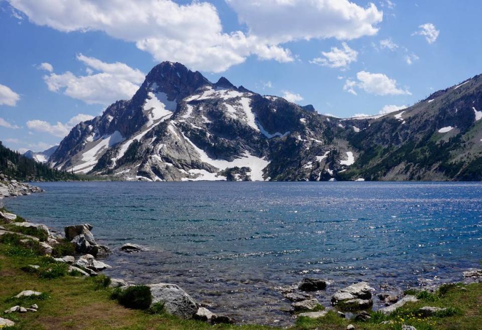
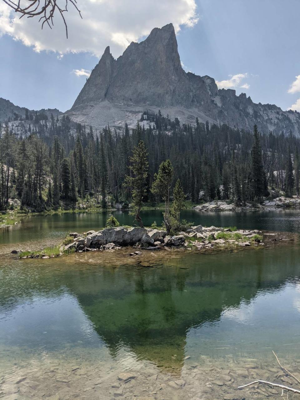
The round trip to Sawtooth Lake is roughly 10 miles with 1,650 feet of elevation gain. The round trip to Alpine Lake is about 8 miles with 1,100 feet of elevation gain, so it’s common for hikers to choose the short side trip to Alpine Lake and call it a day.
But it’s worth the extra fight to get to Sawtooth Lake. Plus, you get some awesome views looking down at Alpine Lake.
At Sawtooth Lake, a short walk along the shore to your left opens the view to Mt. Regan, which seems to sprout right out of the water. It’s windier and cooler than Alpine, which seems like a better hangout. But the striking visuals and feeling of being on a plateau more than 8,400 feet up into the Sawtooths are unforgettable.
The Sawtooth Lake hike begins at the Iron Creek Trailhead. A few miles northwest of Stanley on Idaho 21, turn onto Forest Service Road No. 619 toward Iron Creek. The dirt road takes you to the trailhead.
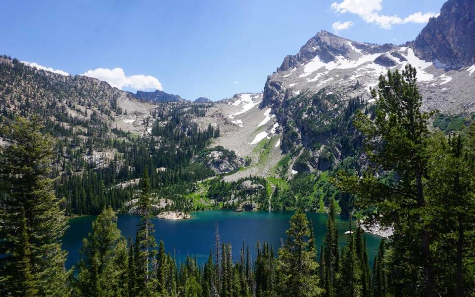
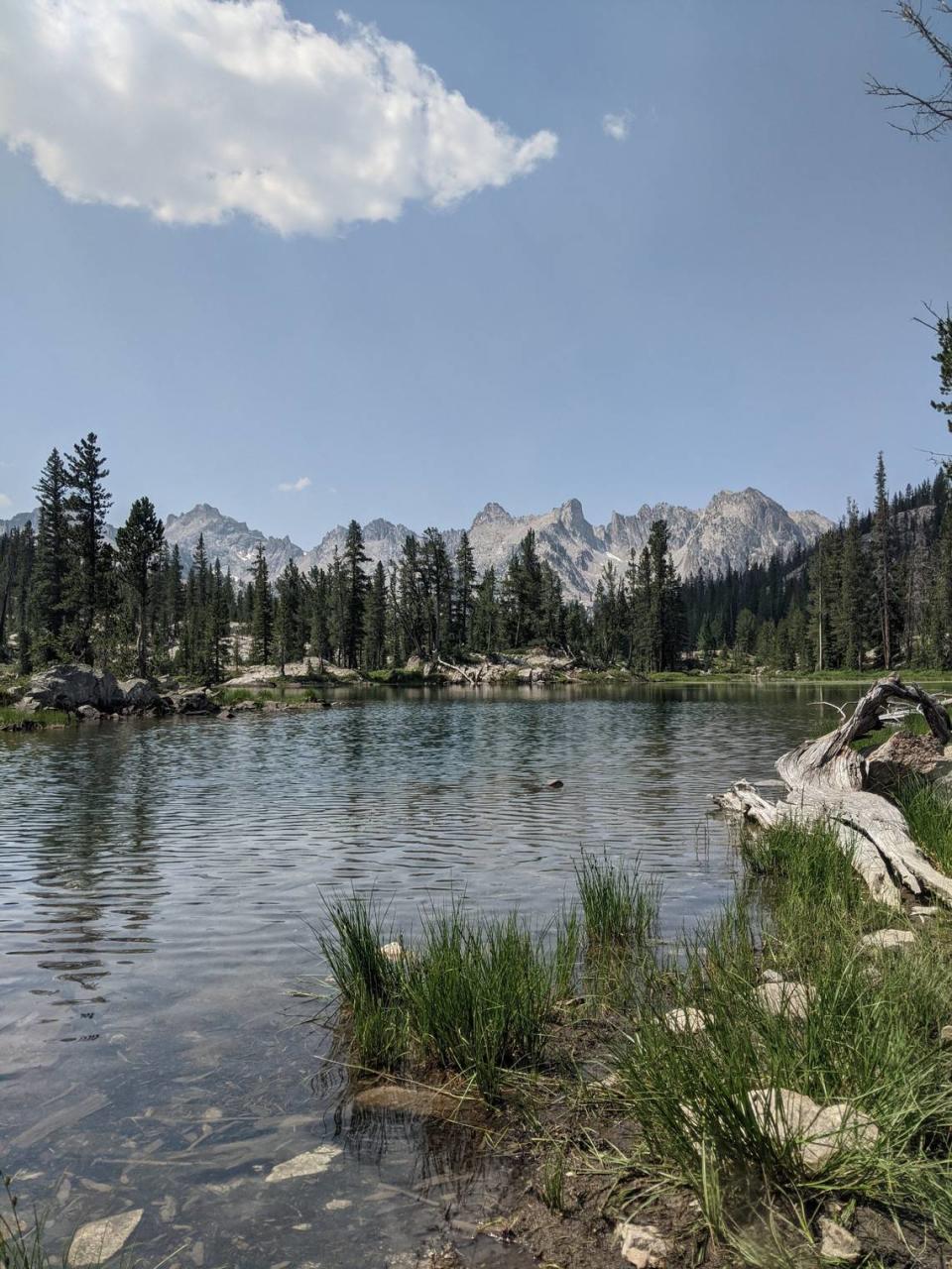
Hell Roaring Lake
A popular destination for rock climbers and campers, this lake is a 5.3-mile hike into the Sawtooths from Idaho 75 between Redfish and Pettit Lakes. Round trip, you’ll trek 10.7 miles with a little over 700 feet of elevation gain.
“Hell Roaring Lake has unique glacial-formed mountains with one called the Finger of Fate,” Sarin Lomascolo, visitor services information assistant with the SNRA, told the Statesman in an email. “This is a 10-mile hike but it is a relatively flat hike and easier first-time backpacking lake.”
The Finger of Fate was damaged slightly in 2020 by earthquakes, but it’s still known as an excellent climbing area with unique granite formations.
Family-friendly hikes
These trails are less strenuous so kids and adults of nearly all ages and abilities can join in.
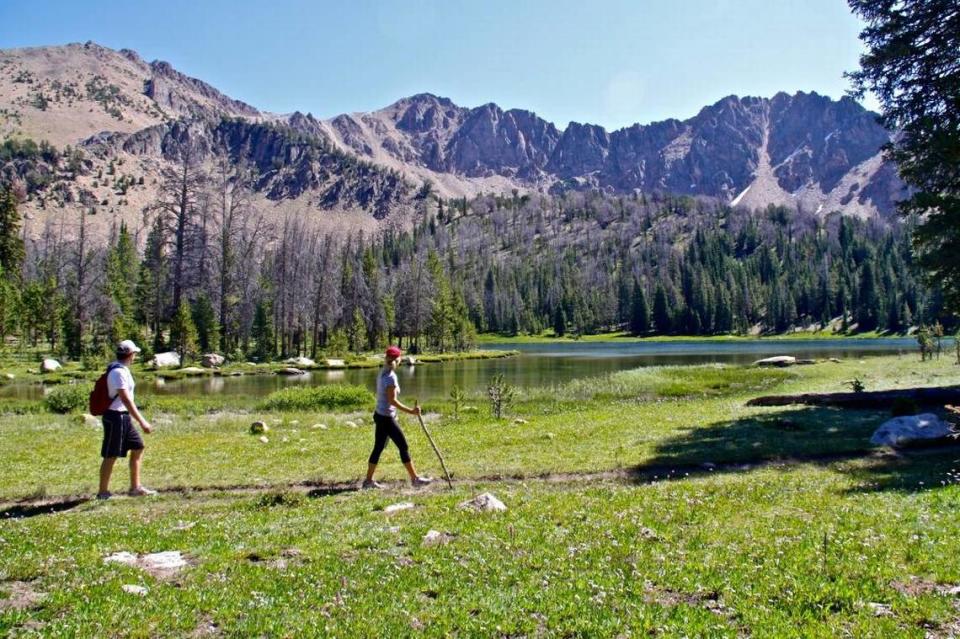
Fishhook Creek Trail
This 4.5-mile trail starts just north of Redfish Lake. With little elevation gain, it’s an easy route for kids or less experienced hikers.
The jagged peaks of the Sawtooths peek through the trees, offering gorgeous views. Lomascolo suggests visiting the Redfish Lake Visitor Center while you’re in the area to pick up a junior ranger activity book.
The Sawtooth Interpretive and Historical Association, which runs the visitor center, offers guided walks and junior ranger programs daily, as well as special evening programs throughout the summer. Visit discoversawtooth.org to learn more.
Fourth of July Lake is an easily accessible destination just outside the White Clouds Wilderness. It’s a terrific hike for kids — challenging enough to feel like a workout and short enough to avoid “are we there yet?” syndrome.
The reward is a great view of the western edge of the White Clouds. The turnoff for Fourth of July Creek Road on the east side of Highway 75 is about 10 miles south of the turn for Redfish Lake.
You’ll have to endure 10.4 miles of rough, one-lane gravel road to reach the trailhead, which has a large parking area (and needs it). The trail to the lake is 1.8 miles with 615 feet of elevation gain. It’s in great shape, but a couple of water crossings require stepping on rocks or balancing on a log — a fun twist for the kids.
The lake is a terrific spot for a picnic lunch and a family photo.
Washington Lake
Once you get to Fourth of July Lake, keep on going south to Washington Lake, just a little over another mile down the trail.
This is a great fall trip, in September or even early to mid-October. But check the weather, as it can be hit-or-miss this time of year.
The sign at the trailhead says Washington Lake is 2 miles away, but it’s a little more than 3 miles. It’s a relatively easy 3 miles. Washington Lake is at 9,367 feet, but the 1,080-foot elevation gain is gradual and spread out throughout the hike.
Once you get to Washington Lake, there are a couple of established campsites on the south shore of the lake and plenty of other durable surfaces around the lake to pitch a tent.
The established campsites definitely have the nicest views and mix of wooded and open areas, but the wind tends to funnel across the lake and right into camp.
Challenging trails
These trails offer a challenge and are better for more experienced hikers or backpackers. Many of them feature steep elevation gains, technical terrain or double-digit mileage.
Born Lakes
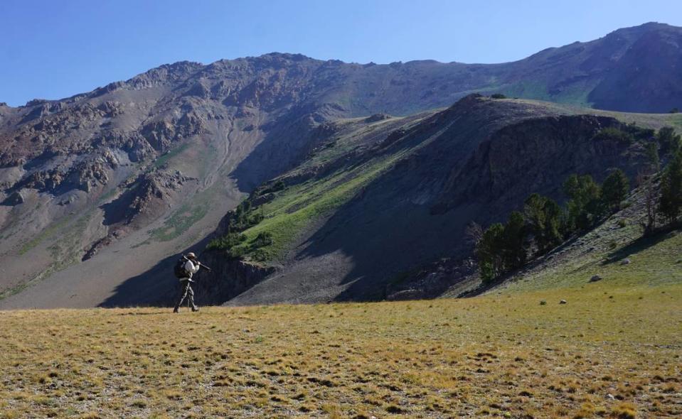
Another, more challenging option once you hit Fourth of July Lake is to head east and north toward Born Lakes. It’s a pleasant, gradual but constant incline to the top of the ridge, elevation 9,900 feet, overlooking the gorgeous Antz Basin.
Descend through a series of switchbacks into Antz Basin, which is a stunning valley that has a European feel to it. From there, it’s a short flat hike to Born Lakes, a series of small lakes that is a popular day hike destination on the weekends but also offers plenty of spots to pitch a tent for a nice overnighter. It’s about 4 miles from the trailhead to Born Lakes with about 1,300 feet in elevation gain. While the descent into Antz Basin is nice, it’s a bit of a slog coming back out of it.
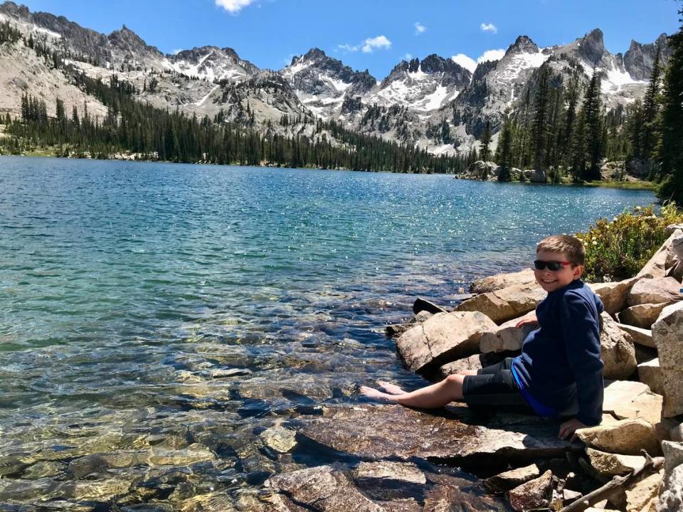
Alice Lake
Alice Lake is part of the famed Alice-Toxaway Loop, which is more of a backpacking route (though some do it as a long day hike).
Just a day hike to Alice Lake is long, too. It’s about 12.5 miles round trip with about 1,600 feet of elevation gain and several water crossings, which can be a problem before midsummer.
The hike begins at the Tin Cup Trailhead at Pettit Lake and the first part of the journey is a walk around the lake. You’ll climb through a rocky canyon with sweeping views, cross a raging creek and see Idaho’s version of El Capitan before arriving at Alice Lake, which is surrounded on three sides by mountain peaks.
The Tin Cup Trailhead is west of Idaho 75. Turn west on Forest Service Road No. 208 about 18 miles south of Stanley.
This strenuous hike begins outside of Ketchum and ends with huge views of the Central Idaho mountains. It’s about a 9.5-mile round trip with more than 3,100 feet of elevation gain.
The hike begins along the North Fork of the Big Wood River, follows a gorgeous creek through an idyllic alpine setting and — after some hiking through loose rock — reaches West Pass, which sits below Ryan Peak, the Boulders’ highest.
The North Fork Wood River Trailhead is at the end of North Fork Canyon Road, about 8 miles north of Ketchum. The road begins at the SNRA headquarters. A sign at the trailhead reads “West Fork of the North Fork.”
Accessible (ADA) trails
Two trails in the Sawtooth National Recreation Area are compliant with the Americans with Disabilities Act.
Phyllis Lake
The Phyllis Lake trailhead is just past the Fourth of July Trailhead, about 11.5 miles down a gravel road. High clearance vehicles are recommended, as the road is rocky and sometimes covered by a creek. Take Forest Service Road No. 209 to the Fourth of July Trailhead and continue southeast on Forest Service Road No. 53.
The trail, which is wheelchair accessible, takes you to the shore of the lake. The Forest Service recommends fishing, and visitors have reported seeing mountain goats in the area.
Murdock Creek
The Murdock Creek trailhead is much easier to reach, but the trail is only wheelchair accessible part of the way before becoming much steeper.
From Idaho 75, take North Fork Canyon Road (near the SNRA headquarters) for 1.2 miles before turning right onto Murdock Creek Road. The trailhead is about another half mile.
Other options: Views from the road
You can still see plenty of views from the road if you’re not able to make it to a trail, Lomascolo said.
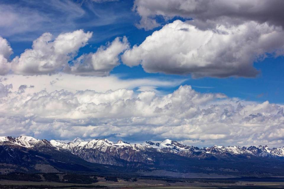
“The mountains in the Sawtooth National Recreation Area are what make them so special,” she said. “Driving along 75 going north from Ketchum, you can view the Boulder mountains, which are part of the Hemingway-Boulders Wilderness. The Bethine and Frank Church Overlook is a great first view of the Sawtooth Valley and Sawtooth mountains.”
A version of this story first published in August 2022.
Coyotes and their pups call the Boise Foothills home. Here’s how you can stay safe on trails

