Heat indexes near 110 degrees this week as temperatures soar across Middle Georgia
A swampy blanket of air that has smothered much of the nation’s heartland is, in coming days, expected to send heat indexes in Georgia soaring well into the troubling triple digits.
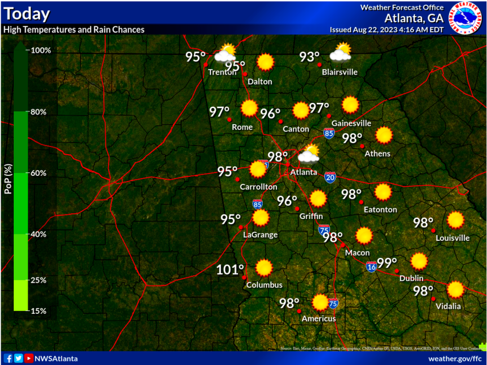
Actual high temperatures from the mid-August blast furnace searing the region at midweek are forecast for the mid-to-upper-90s.
However, highs in the Macon and Warner Robins areas will likely approach or hit 100 degrees by Saturday when, depending on humidity levels, it could feel as hot as 109.
“This is definitely one of those things that we worry about when we see it,” said forecaster Sid King at the National Weather Service’s Peachtree City post. “Sometimes people think dangerous weather is significant storms or tornadoes or hurricanes. But heat is the number-one (weather-related) killer.”
On Tuesday, the Georgia Department of Public Health warned people to stay hydrated and “avoid prolonged exposure to the heat and sun, and to limit strenuous outdoor activity.”
The culprit for the late-summer swelter, King explained, is a dome of high pressure centered over Arkansas and Missouri. The mass was pretty much hovering, temporarily blocking weather systems that night supply rainy relief.
There is, King said, “a lot of hot air that’s trapped under it.”
The entrenched high pressure was allowing in just enough moisture off the Atlantic Ocean to make for dangerous humidity levels.
Tuesday high temps in Middle Georgia were forecast for 98 or 99, with heat indexes up to 108.
Highs on Wednesday and Thursday are expected to “cool” to 95 or so, but by Friday and Saturday actual highs could climb toward or reach the century mark.
Some cooling was expected by Monday if a looming, cloud-hauling weather front doesn’t stall. The forecast high for Sunday is 90. Monday’s expected high is 88.