Heat wave has Florida split with drought on the west coast and bountiful rain on the east coast
A dogged weather pattern this summer has soaked southeast Florida with rainfall 7 inches above normal in West Palm Beach, while parts of the west coast of the state suffer an unusual wet season drought.
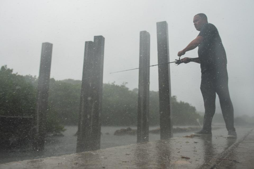
The robust afternoon thunderstorms along Palm Beach County’s coast, which included a 67-mph wind gust at Palm Beach International Airport last week, have dumped 18.75 inches of rain since June 1, making the period through Tuesday the 6th wettest in National Weather Service records.
They have also brought roiling cloud cover and nominal relief from the oppressive heat, but temperatures along the east coast still rank in the top 10 hottest from Miami to Daytona Beach, according to the Southeast Regional Climate Center.
It's even hotter along the Interstate 75 corridor.
2023 hurricane season: Fear rain as much as storm surge as climate change increases threat
The west coast areas from Tampa to Key West are experiencing a top-5 warmest period on record beginning June 1. At Naples Municipal Airport, the mean temperature since early June is 3 degrees warmer than normal and ranks warmest on record. Naples is also 5 inches short on rainfall.
At Bradenton and Fort Myers, mean temperatures are 2 degrees above normal, ranking them both second warmest on record. There are also rain deficits of 6 inches at Bradenton and 7.7 inches in Fort Myers.
“We’re pretty bad off with drought right now,” said Jennifer Hubbard, a meteorologist with the National Weather Service in Tampa. “Even if we come into the rainy season with a rain deficit, we’ve usually made up ground by now.”
It's rainy season, but its been an odd one! If you live on Florida's West Coast you know its been dry. Persistent westerly flow means super steamy humidity BUT by the time the storms develop they are well east. Result: Last 30 day rainfall is several inches below normal. @WFLA pic.twitter.com/AQT6RGm1EY
— Jeff Berardelli (@WeatherProf) July 6, 2023
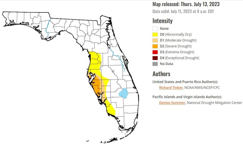
The U.S. Drought Monitor has areas from St. Petersburg to Fort Myers in a severe drought as of July 13, which is the second tier in a 4-level intensity scale. Areas deeper inland along the west coast are considered abnormally dry to being in moderate drought.
"It's rainy season but it's been an odd one!" said Tampa-area meteorologist and climate scientist Jeff Berardelli in a social media post. "Persistent westerly flow means super steamy humidity BUT by the time the storms develop they are well east."
Like the South Florida Water Management District, the Southwest Florida Water Management District has year-round water conservation measures that generally recommend limiting landscape watering to two days per week. Cities and counties may also have their own year-round restrictions that limit watering to once per week.
Wet days ahead: Climate change has scientists trying to solve South Florida’s rainfall mystery
Dry west/west east partly explained by stagnant pattern in atmosphere
The tale of a Peninsula split by wealth or dearth of rain is tied in part to the overall stagnant pattern in the atmosphere where low pressure in the northeast has caused deadly flooding and high pressure in the south has caused menacingly high temperatures, including 16 consecutive days with a heat advisory in South Florida.
Bryan Norcross, hurricane specialist for Fox Weather and longtime Miami-area meteorologist, said the situation is “potentially a monstrous thing.”
“The fact that the weather pattern has been so stationary, and to what degree the semipermanence over the east coast is unusual is an open question and could be a serious question,” Norcross said. “There is research that says the artifact of a warmer Arctic is stagnant-moving weather.”
For South Florida, the low pressure in the northeast and high pressure over Texas and the Gulf of Mexico has weakened the Bermuda High and pushed it east. The semi-permanent clockwise swirl of high pressure in the Atlantic typically shrivels and shifts in winter closer to the Azores. In summer, it shimmies back nearer to Bermuda.
The Bermuda High typically sends easterly breezes blowing deeper into the Peninsula. In its current feeble state, the west coast sea breezes have infiltrated across sawgrass and farmland and suburbs to pin showers and towering thunderstorms along the east coast.
What's an omega sunrise?: A Post photographer nailed it during South Florida's heat wave
At the same time, the puny easterly winds mean warmer ocean temperatures so that when there is a breeze it’s blowing over warm water and carrying more moisture, upping the heat index or “feels like” temperatures.
“The Bermuda High is out there, but it’s just weak and kind of meandering around,” said AccuWeather meteorologist Jake Sojda.
Heat index hell: 126 days with temps that feel like 105 degrees? Florida's heading that way
After short respite, east coast to go back to higher-than-average temperatures
Dryer weather for the east coast is in the forecast with a shift in the Bermuda High that will result in stronger onshore winds that will push storms into the center of the state or keep them confined along the west coast. A slug of Saharan dust is also expected, which could help dry up showers before they start.
The wind shift will be short-lived, with southerly and southwesterly winds returning early in the weekend. And peak temperatures will remain above normal at least through Monday with highs in the mid-90s and heat index temperatures near 100. The normal daytime high in West Palm Beach this time of year is 90 degrees.
“When you look at the records and data, there is a general warming trend and every year just wants to be hot,” said meteorologist Michael Lowry, a hurricane and storm surge expert with Miami’s ABC affiliate Channel 10. “In Florida, it feels like we just don’t get a break anymore.”
Kimberly Miller is a veteran journalist for The Palm Beach Post, part of the USA Today Network of Florida. She covers real estate and how growth affects South Florida's environment. Subscribe to The Dirt for a weekly real estate roundup. If you have news tips, please send them to kmiller@pbpost.com. Help support our local journalism, subscribe today.
This article originally appeared on Palm Beach Post: High temperatures and unusual weather pattern create drought and bounty of rain in Florida

