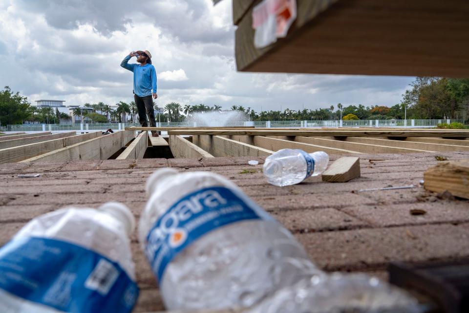
Heat wave in South Florida will last through the week with 'feels like' temperatures topping 100
South Florida is stumbling into its eighth consecutive day of perilous heat as Saharan dust chokes moisture from anemic cloud tops and a maudlin warmth at the surface is so wet it’s like walking through water.
It’s the longest stint of back-to-back heat advisories issued for Palm Beach County since at least 2005, and by the time it expires — if it expires — Wednesday at 8 p.m., it will be a notable streak of scorching “feels like” temperatures that in Miami topped 100 degrees 30 days in a row as of Monday.
“I’d say this is unbelievable, but that word has lost its meaning lately,” said University of Miami hurricane and climate researcher Brian McNoldy in a social media post Monday. “Miami just hit a 109.9 degree heat index at 1 p.m.”
Heat index in West Palm Beach - how hot is it?
West Palm Beach reached a heat index of 105 at 2:30 p.m. Monday.
The National Weather Service does not keep records of heat index temperatures, which are a measure of what the air feels like when the human cooling mechanism of sweating falters in high humidity. But McNoldy has been tracking them for Miami, which, in addition to 30 days of 100-plus heat index temperatures, recorded its fifth consecutive day of a 105-degree heat index or higher on Monday.
Hot enough for you?: 17 best indoors activities to beat the heat in Palm Beach county
A heat advisory is issued for most areas when the heat index or "feels-like" temperature is expected to reach 108 degrees or higher for two hours or more. In Miami-Dade County, the weather service issues a heat advisory if the heat index is expected to be 105 or higher for two hours or longer.
“We’re humid, but we’re not humid in the upper levels, so we don’t get the reliable thunderstorm activity that gives us a respite from high temperatures,” said meteorologist Cameron Pine, who works at the NWS office in Miami. “It’s a pretty nasty combination.”
The heat is a shared misery this summer from Arizona’s torrid Sonoran Desert through the boiling Southern Plains and into sub-tropical Florida.

It was a different problem in the northeast Monday after torrential rains from a slow-moving storm hit New York and Connecticut on Sunday before reaching New England. Some towns in Vermont were inaccessible after roads were washed out. The Associated Press reported the storm caused hundreds of flight cancellations at Kennedy, LaGuardia and Newark airports. About 200 flights were canceled at Boston’s Logan Airport.
The NWS was predicting more rain and flash flooding across Vermont on Monday as an area of low pressure hugging the coast pushes moisture into the state, as well as New Hampshire and Maine.
For the southern U.S., it’s a stubborn area of high pressure that is causing the abnormally warm temperatures after digging its heels into the Gulf of Mexico last month. With no equal in the atmosphere to bully it loose, it spins clockwise, compressing and heating air as it sinks in a pattern of relentless heat.
Cool off with these fun activities: Water sports to beat the summer heat
At the same time, a weak Bermuda High means fewer cooling sea breezes in the afternoon for southeast Florida.
And a tardy plume of Saharan air that left the coast of Africa nearly two weeks ago reached the tip of the peninsula and the Gulf of Mexico over the weekend. That’s left the atmosphere 5,000 feet above the Earth “bone dry,” said Jason Dunion, a University of Miami meteorologist working with NOAA and the Atlantic Oceanographic and Meteorological Laboratory to measure and track the Saharan dust.

“It ramped up in June, but it’s behind schedule and not as much as we usually see,” Dunion said.
While there is a break in the dust possibly on Wednesday, a larger plume that left Africa on July 3 is moving west and could reach Florida on Thursday, followed by a third plume that was just moving off the coast Monday.
That means high temperatures in Palm Beach County are forecast to reach the mid-90s through at least Sunday. The normal high temperature at Palm Beach International Airport for this time of year is 90 degrees. It reached 97 degrees last Thursday, which broke the previous record high of 95 degrees set in 1992. It reached 94 degrees on Monday, 2 degrees shy of the record of 96 set in 1981.
“Unfortunately, there’s nothing to change it on the horizon,” said Weather Prediction Center meteorologist Andrew Orrison about the lack of a respite to the heat in the near future.
Looking for some cool treats?: Best ice cream, gelato, ice pops in Palm Beach County
Instead, Orrison said the Weather Prediction Center, which is part of the National Oceanic and Atmospheric Administration, is expecting temperatures to get hotter, expand in coverage and increase in magnitude.
“If anything, the heat really kind of builds for Florida,” he said.
Orrison noted that sea-surface temperatures in the Gulf of Mexico, the Florida Straits and along Florida’s east coast are unusually high for this year — a change that he said occurred over the past month. Along the southwest coast of Florida, the water is up to 5 degrees warmer than normal in some places, reaching nearly 90 degrees. Off Palm Beach County, it’s about 3 degrees warmer than normal at nearly 88 degrees.
“Even if we get a sea breeze, it’s going over extremely warm water,” Pine said. “You can definitely label this a heat wave.”
While scientists are wary of tying specific events to climate change, McNoldy said a warming globe makes periods like the current spat of prolonged warmth "a little more likely."
Kimberly Miller is a veteran journalist for The Palm Beach Post, part of the USA Today Network of Florida. She covers real estate and how growth affects South Florida's environment. Subscribe to The Dirt for a weekly real estate roundup. If you have news tips, please send them to kmiller@pbpost.com. Help support our local journalism, subscribe today.
This article originally appeared on Palm Beach Post: Palm Beach County hot weather, heat index undercurrent climate change

