Weather Service warns of ‘life-threatening’ potential of next California storm
While Southern California dries out from Thursday’s heavy rain, forecasters are already sounding alarms about a second, stronger storm arriving this weekend.
Dry weather is expected for most of the Southland Friday and Saturday, with overnight lows in the 30s to 40s in coastal and valley regions.
The brief pause in rainfall may give residents and crews time to clean up damage caused by the first storm.
Heavy rainfall early Thursday, along with clogged storm drains caused flooding on a section of the 710 Freeway in Long Beach. Flooding also closed part of the Pacific Coast Highway through Bolsa Chica Ecological Reserve near Huntington Beach.
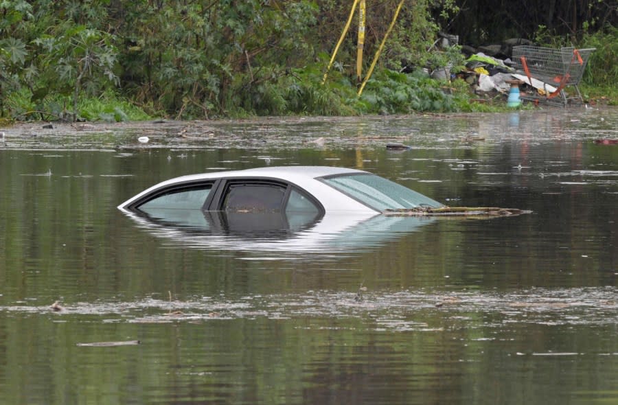
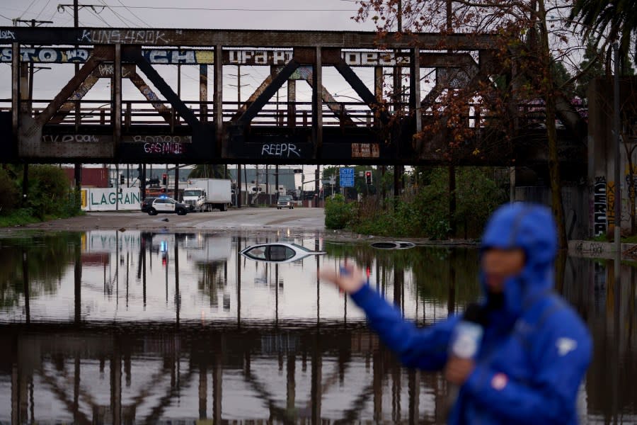
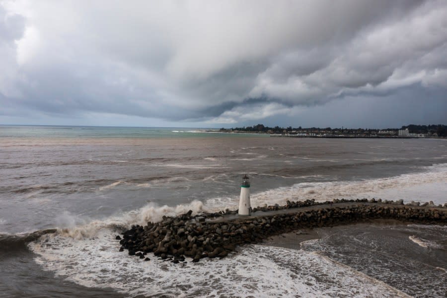
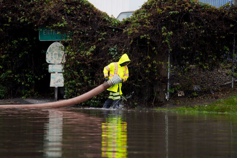
A car is nearly completely submerged under flood waters in Long Beach, Calif., Thursday, Feb. 1, 2024. Heavy rain flooded roadways and much-needed snow piled up in the mountains on Thursday as the first of back-to-back atmospheric rivers pummeled California. (Brittany Murray/The Orange County Register via AP) A television reporter does a broadcast as cars are seen submerged on a flooded street under a railroad bridge Thursday, Feb. 1, 2024 in Long Beach, Calif. (AP Photo/Eric Thayer) Storm clouds hang over Walton Lighthouse, Thursday, Feb. 1, 2024, in Santa Cruz, Calif. The first of two back-to-back atmospheric rivers drenched California on Thursday, flooding roads and toppling trees while triggering statewide storm preparations and calls for people to get ready for powerful downpours, heavy snow and damaging winds. (AP Photo/Nic Coury) A worker carries a hose on a flooded street Thursday, Feb. 1, 2024 in Long Beach, Calif. (AP Photo/Eric Thayer)
A mudslide in Rancho Palos Verdes left dirt, water and debris on Palos Verdes Drive and created a hazard for motorists.
In the Hollywood Hills, heavy rains toppled a tree that struck a moving vehicle.
“With the ground already saturated from today’s rains, [the] onset of dangerous flash flooding will be much quicker with this next event and everyone, especially those near or in south facing mountain [communities], needs to start preparing now for possible evacuations during or even before the storm hits,” the National Weather Service warned on Thursday.
KTLA Interactive Weather Radar Map
The warning comes as forecast models call for an increased chance of extended heavy rainfall beginning as early as Saturday night and continuing through Tuesday.
Rainfall rates, according to NWS, could easily reach a half inch per hour in some areas during that time.
Coastal and valley regions are expected to get 3-6 inches of rainfall, while 6-12 inches of rain is likely in the mountains.

However, forecasters said there’s an outside chance through Monday evening of significantly higher rainfall amounts where south-facing mountains could see up to 15 inches of rain, with some coastal and valley regions seeing a potential for 6-10 inches.
“One of the weather systems associated with the atmospheric river could be moving very slowly and because of that heavy downpours are very possible,” KTLA weather anchor Kirk Hawkins said. “These are very serious and dangerous flooding concerns that all parts of Southern California could impacted by.”
Moving forward, SoCal is likely to see scattered showers through Tuesday and Wednesday, possibly Thursday, but NWS said there is “low confidence” about the timing and amount of rainfall.
Snow levels are forecast to drop to 4,500 feet tonight, with a 10% chance of snow falling through the Grapevine at pass level.
Taggers graffiti 27 stories of skyscraper in downtown Los Angeles
During the heaviest part of the incoming storm, snow levels are expected at around 7,000 feet with elevations above that getting between 2-4 feet of snow.
By Tuesday and Wednesday, lower elevations between 4,500-5,000 will likely get snowfall with the potential for elevations at 3,500-4,000 feet seeing snow by Thursday.

Officials at the weather service said this second atmospheric river storm is “shaping out to be a life-threatening flooding situation” during the stretch between Sunday and Monday and were urging those in flood-prone areas to prepare ahead of time.
Commuters should change travel plans during the peak of the storm and avoid driving or parking in low-lying flood-prone areas.
As always, motorists are urged to avoid mountain travel during the storm if possible. Otherwise, drivers should be well stocked with emergency winter supplies in case of road closures or delays.
For the latest news, weather, sports, and streaming video, head to KTLA.

