Threat of damaging winds in the Triangle on Tuesday. When to expect strongest gusts
The National Weather Service Raleigh issued a hazardous weather outlook for the Triangle and other parts of central North Carolina for early this week, with strong wind gusts expected in the Triangle and other areas of the state on Tuesday.
Here’s what to know:
How windy will it be in Raleigh/Durham this week?
Strong wind gusts are expected from a new storm system passing through North Carolina on Tuesday. The system brings the threat of damaging winds, with a wind advisory in effect until noon Tuesday.
The strongest gusts are expected until 11 a.m., ABC11 reported Tuesday morning, and the gusts could top 40 mph.
“The wind is the big story here,” Locklear told The News & Observer on Monday.
Is it safe to drive in NC’s wind this week?
The wind will make driving difficult for many, NWS Raleigh warns. High-profile vehicles — like ambulances, school buses and tractor trailers — will probably have difficulty driving.
“When we get wind gusts like this, we can have trees down, which can make driving more difficult, and that can bring sporadic power outages too,” Locklear said.
Even those driving small commuter cars will feel the wind pushing their car around, he said.
Any small, unsecured objects will be blowing around, too.
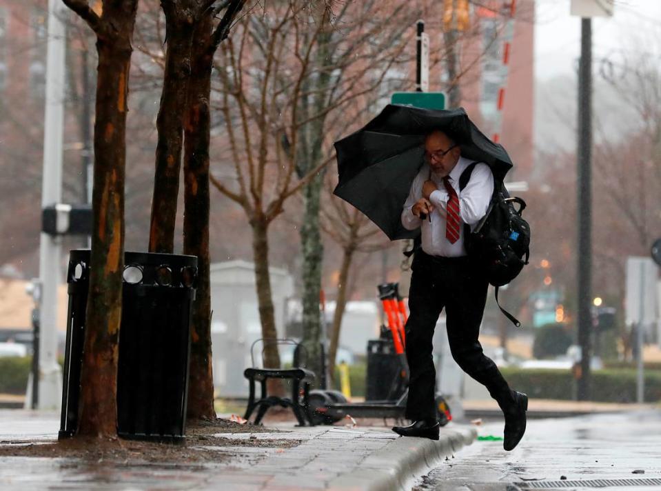
Monday brought rain to Raleigh/Durham
Monday’s forecast called for between an inch and an inch and a half total, between Monday daytime and Monday overnight, said NWS Raleigh lead meteorologist Brandon Locklear.
“It’ll be a nasty day around here. Just pretty wet. What you see right now is what you’re going to get for most of the daytime,” Locklear said at 8 a.m.
“It’ll be steady rain throughout the day with the occasional drizzle, but as we get into the evening we can see an increase in rain intensity.”
The Raleigh/Durham area is under a severe thunderstorm outlook from late Monday to early Tuesday. The main hazard is wind, but isolated flash flooding is possible.
In the southeastern portion of the state, about two inches of rainfall is expected.
A Marginal risk of both severe thunderstorms and flash flooding will accompany strengthening low pressure across NC late Mon-Mon night. Wind gusts of 35-45 mph will then result behind the associated cold front Tue morning through mid-afternoon. pic.twitter.com/hSFueJ4ElJ
— NWS Raleigh (@NWSRaleigh) February 12, 2024
Raleigh’s weather forecast for the rest of the week
Here’s NWS Raleigh’s weather forecast (as of Monday 9 a.m.) for the rest of the week:
Monday: Showers and patchy fog before 11 a.m. High near 62 with a 90% chance of precipitation. Showers and thunderstorms in the evening, mainly before 2 a.m. Low around 48. Winds can gust around 40 mph.
Tuesday: Partly sunny with a high near 58. Breezy with high wind gusts. Low around 35 overnight.
Wednesday: Sunny with a high near 56. Low around 34 overnight.
Thursday: Sunny with a high near 63. Low around 42 overnight.
Friday: Mostly sunny with a high near 60. Mostly cloudy overnight with a low around 41.
For more information, visit forecast.weather.gov.
Should we add a Category 6 to the hurricane scale? Why scientists say we need it
This Raleigh restaurant is one of the best Valentine’s Day spots in the US, Yelp says
Raleigh is getting a new Trader Joe’s. What we know + why you might want to work there

