Heavy rainfall and flash flooding threat this week

Overview
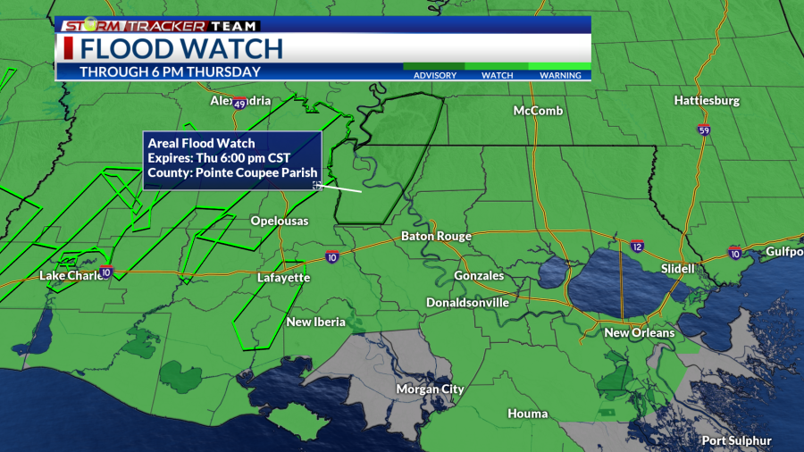
An active pattern is setting up to bring widespread showers and storms over the Lower Mississippi Valley. Some rain will be persistent and heavy at times to bring a flash flooding threat across the region including the Greater Baton Rouge area. Flood watches have already been posted for much of the surrounding areas.

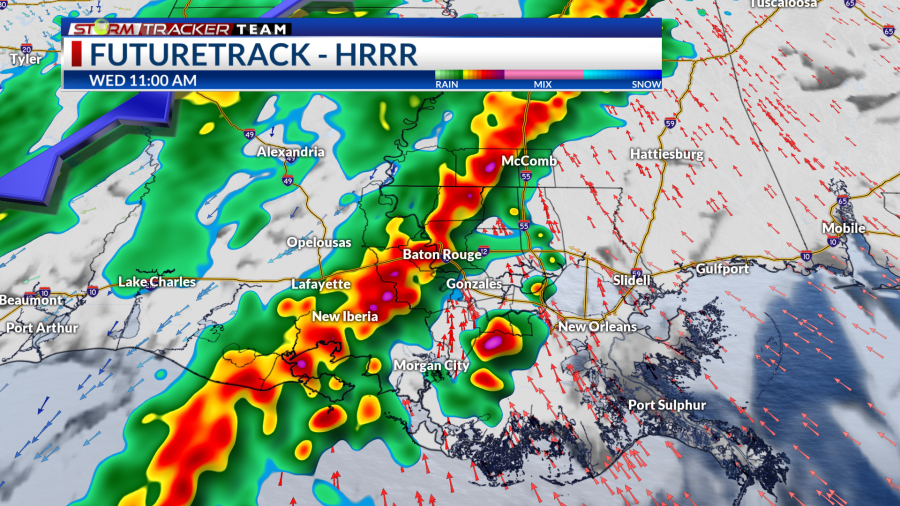
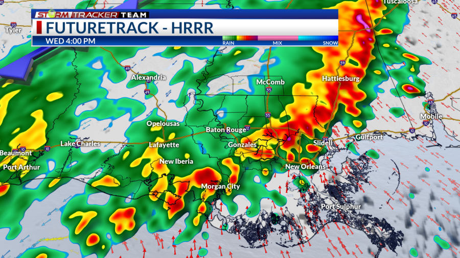
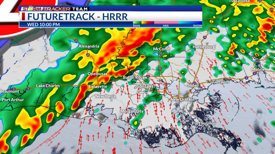
Wednesday
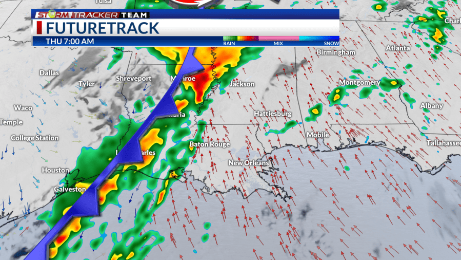
A frontal boundary will be approaching from the west which will help spark widespread showers and storms over the state. The atmosphere will be very saturated with plenty of moisture to work with which will help rainfall be heavy at times. The front will likely stall near or just west of the area, which will increase the threat for training rain.
Wednesday Morning Wednesday Afternoon Wednesday Night
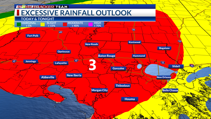
Flash flood concerns will be elevated for the day where the Weather Prediction Center (WPC) has placed a Moderate Risk (3/4) for excessive rainfall over the northwestern portion of the area with a Slight Risk (2/4) elsewhere. A Flood Watch is in effect until 6 pm Thursday across our area. During that time frame, we could see on average 2-5″ of rain with locally higher amounts possible.
As we warm up into the late morning and afternoon hours, the atmosphere will have a touch more instability to work with; therefore, there will a limited chance for a few strong to severe storms. The threat remains low, but non-zero where a Slight Risk (2/5) for severe storms is outlined by the Storm Prediction Center (SPC) over the area. The main threats would be damaging wind gusts and maybe a quick, spin-up tornado.

Thursday
The rain will continue into the day Thursday after a possible break in the pre-dawn hours. The frontal boundary will still be lingering just to the west which will help spark another round of showers storms beginning in the morning. The front will be slow to make eastward progress, so rain will will last for much of the afternoon.
Thursday Morning Thursday Afternoon Thursday Night
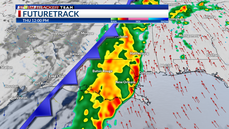
Due to the slow nature of the front, rain will again be persistent and possibly train over the area to raise another flash flood concern again. The WPC has placed a Slight Risk (2/4) for flash flooding is over the area.

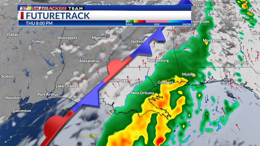
As the front begins to move to the east, rain will begin to clear out from west to east during the late afternoon to evening hours. Most rain will clear by the the nighttime hours.
Up Next
More rain will be in the forecast beyond Thursday with scattered showers and storms possible Friday morning and afternoon. Another frontal system will take shape and will swing a cold front through the area Friday night into Saturday morning. This will bring the final round of showers and storms before rain clears out to finish the weekend and temperatures fall back near average.

How to Prepare
Be sure to multiple ways to receive weather alerts and stay tuned to updated forecasts during the day. Make sure your phone is unmuted, charged, and turned on for WEA notifications. Turn off your do not disturb and take your phone off of silent mode so those WEA alerts can push through to you.
Have a plan and a safe place to go to if a warning is issued for your location. Find a lower-level, interior room away from windows.
You can always check out the Interactive Radar here.
For the latest forecast information, check out our weather page!
Remember that you can download our weather app. It’s available to download now in the App Store and Google Play. Just search for “BR Proud Weather”.

Follow and keep up to date with the Storm Tracker Team:
Meteorologist Brandon Lashbrook – Twitter | Facebook | Email
Meteorologist Ashley Renee – Twitter | Facebook | Email
For the latest news, weather, sports, and streaming video, head to BRProud.com.

