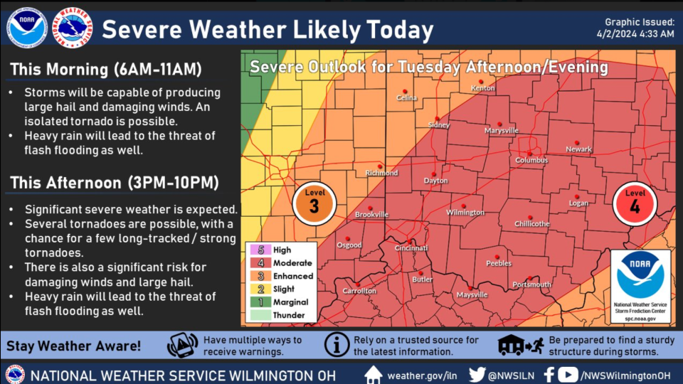
Storm expected between 5 and 8 p.m. Tuesday could bring golf-ball-sized hail, 80 mph winds
NEW PHILADELPHIA ‒ Heavy rain over the past 24 hours has resulted in some road closures in Tuscarawas County, and Conotton Valley Union Local Schools closed early Tuesday because of flooding.
And potentially bad weather could be coming later in the day.
Jennifer James, director of the Tuscarawas County Homeland Security and Emergency Management Agency, attended a briefing Tuesday morning with the National Weather Service.
The potential for severe weather in Tuscarawas County exists from 5 to 8 p.m. Tuesday. Storms could bring golf ball size hail, 80 mph winds and the possibility of tornadoes.
She said people should be prepared.
"Make sure they have a plan in place for tonight, and flashlights, batteries, a way to receive emergency notifications, and charge their devices," she said.
Several county roads are closed because of high water, including Dueber Road NE (County Road 105), Somerdale Road (County Road 109), Rush Church Road (County Road 32) between Blizzard Ridge Road and Rock, Tedrow Road (County Road 33) at Ohio 258, Blizzard Ridge Road (County Road 30), between Rush Church Road and Fallen Timber Road, Winklepleck Road (County Road 73) between Simons Drive and Golf Course Road, Blizzard Ridge Road between Dutch Valley Road and Newport Road, Edie Hill road (County Road 34) at Barkley Road, Crooked Creek Road (County Road 28 at Rush Church Road, New Cumberland Road (County Road 90) at Echo Lake Road, and Sandy Ridge Road (County Road 13) at Laurel Creek Road.
State highways closed include Ohio 258 near Stillwater in southern Tuscarawas County and Ohio 151 in Harrison County.
"We do anticipate that with the continued rain that there is a high possibility of additional routes," said Lauren Borell, public information officer for Ohio Department of Transportation District 11 in New Philadelphia.
According to the National Weather Service forecast, Tuscarawas County remains under a flood warning until 10:45 a.m. Tuesday. "Flooding of rivers, creeks, streams, and other low-lying and flood-prone locations is imminent or occurring," according to the NWS website. "Streams continue to rise due to excess runoff from earlier rainfall. Low-water crossings are inundated with water and may not be passable."
The weather service also is reporting a severe weather risk will increase this afternoon through late Tuesday. Tornadoes, large hail, and damaging wind gusts are expected.
Due to heavy flooding, the Conotton Valley Union Local Schools dismissed students at 10:30 a.m. Tuesday, the district reported on its Facebook page. Bus departures and student pick-up were scheduled for that time.
Due to the threat of severe weather, New Philadelphia City Schools canceled all athletic contests for Tuesday, including the junior varsity/varsity baseball game against Mansfield, varsity tennis against Mansfield, varsity track versus Wooster and junior high track versus Louisville.
The National Weather Service in Pittsburgh reports that the New Philadelphia area has received between 1 inch and 1.5 inches of rain over the past 24 hours.
Totals include:
Harry Clever Field, New Philadelphia ‒ 1.33 inches.
Port Washington ‒ 1.12 inches.
Zoar ‒ 1.17 inches.
Uhrichsville ‒ 0.71 inches.
So far, there are no reports of flooding in the area.
"Not at this time but we will be monitoring the park pond and the lagoon throughout this storm event," said New Philadelphia Service Director Ron McAbier.
This article originally appeared on The Times-Reporter: Tuscarawas County braces for storm expected to hit early this evening

