Heavy snow blasts western Newfoundland, with messy weather stretching into Friday

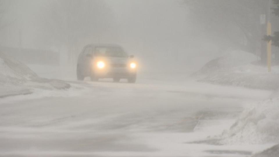
Most of Newfoundland is under snow and rain warnings that could stretch into Friday. (Gary Locke/CBC)
Wind, rainfall and winter storm warnings have a grip on most of Newfoundland on Thursday — and could continue into Friday, according to Environment Canada.
The west coast of the island was dealing Thursday with significant snowfall. About 20 to 45 cm was anticipated to fall, with more possibly falling over inland and higher terrain.
Wind gusts are expected to reach 80 km/h.
The winter storm warning stretches from Channel-Port aux Basques to Gros Morne. Schools in the area closed.
Environment Canada said the weather will continue until Friday evening.
"After a mild and wet start to the week, an abrupt transition to winter weather is expected today as snow, at times heavy, combines with strong winds to cause poor visibilities in snow and blowing snow," reads the Environment Canada bulletin.
"A period of freezing rain may also occur during the changeover along with rapidly falling temperatures. Consider postponing non-essential travel until conditions improve. Prepare for quickly changing and deteriorating travel conditions."
The Northern Peninsula can expect between 25 and 40 cm Thursday into Friday night.
Further east, Deer Lake, Green Bay-White Bay and the Buchans interior area could see higher snowfall totals in the 30 to 60 cm range. That's also expected to continue into Friday evening.
Heavy rainfall is expected for other areas of the island.
The Connaigre and Burin Peninsulas could see between 60 to 90 millimetres of rain between Thursday and Friday morning.
Environment Canada said similar storms in the past have caused rivers to overflow, flooding of basements and road washouts.
"Heavy downpours can cause flash floods and water pooling on roads. Localized flooding in low-lying areas is possible," Environment Canada said.
Download our free CBC News app to sign up for push alerts for CBC Newfoundland and Labrador. Click here to visit our landing page.

