As heavy, wet snow melts, upper Mississippi River floods to near record levels
Intense spring floods along the upper Mississippi River are nearly setting records in some communities, the result of unusually wet snow through the winter that is now rapidly melting.
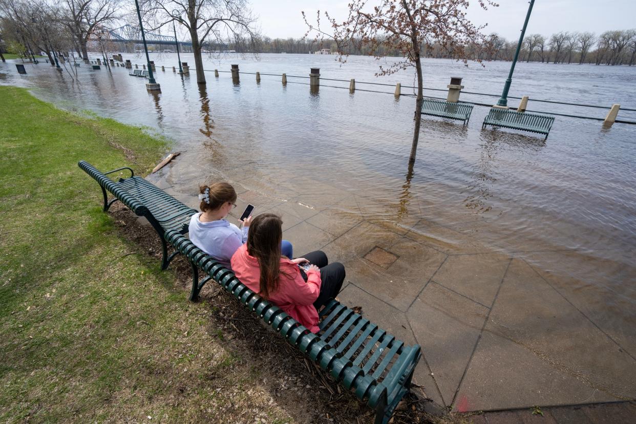
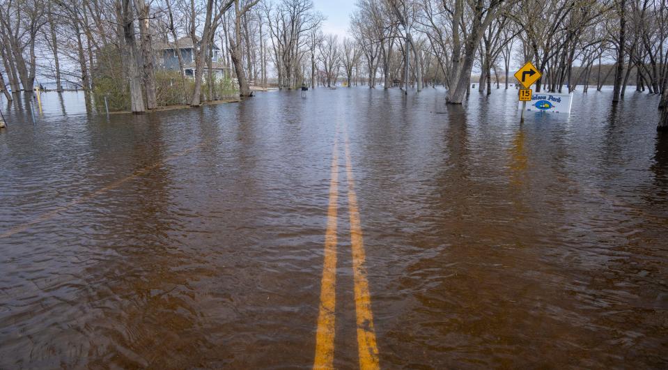
The swollen river is spilling over some upriver locks, flooding roads and soaking fields, parks and businesses. The water is expected to crest and start receding in most places by next week, but by then the impact is expected to be widespread and long-lasting.
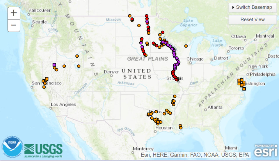
As of Thursday morning, the National Weather Service had issued 58 flood warnings in Wisconsin, Minnesota, Iowa, Illinois and Missouri.
Each spring, the river expands when snow melts across the upper basin. This season, the snow was often heavy and wet, and a string of unseasonably warm days at the beginning of April kicked off a massive melt.
The flooding appears to be the third-worst ever. The upper river flooded to its highest levels ever in 1965, and its second-highest in 2001.
More: Heavy, wet snow in upper Wisconsin, Minnesota raises risk of serious Mississippi River flooding
In Camanche, Iowa, 84-year-old Jack Murphy helped stack sandbags in his backyard to protect his home, once again, from a flooding Mississippi River. It’s a routine he and his wife, Willa, 81, have been through numerous times.
“You don’t sleep at night,” Murphy said about living so close to the rising river. Every morning like clockwork, he wakes around 4 a.m., and checks the water levels. Local students and volunteers are helping him build his sandbag barrier.
The Mississippi River at Camanche is projected to crest at around 23 feet by Monday — ranking in the top three highest peaks in the town’s history. Many tributaries are also flooding.
Willa Murphy called it “scary.”
“You think it’s not going to happen, and then all of a sudden everything lets loose, and you’ve got to hurry up and do something,” she said.
There are no Mississippi River flood warnings in the lower basin yet. Forecasters say the likelihood of downstream flooding is low, because the Missouri and Ohio rivers are not flooding. If they were, the Mississippi would be overwhelmed all the way south.
Dry fall prevented spring floods from being even worse
After the early April warmth melted nearly 80% of the basin’s snowpack in just three days, forecasters feared river flooding would surpass 2001 levels and even creep close to 1965, said Jordan Wendt, service hydrologist for the National Weather Service in La Crosse, Wisconsin.
But last year’s drought across the Midwest left the ground drier and ready to suck up some of that water. It took three days of melting for soil to become saturated, Wendt said.
Still, some areas were hit hard – including where the Wisconsin River feeds into the Mississippi near where Wisconsin and Illinois border with Iowa. So much water was rushing in from the smaller river that it was essentially forming a small lake where the water waited until it could flow down the Mississippi, Wendt said.
The U.S. Army Corps of Engineers sent a team of engineers down to nearby McGregor and Marquette, in Iowa, to help them manage the flood response, said Patrick Moes, deputy public affairs chief for the Corps’ St. Paul District. The river is expected to crest there at about 23 feet.
Wendt said most locations should fall back under flood stage at the end of the first week of May, and the river should be back near its banks by the middle of the month.
Until then, though, residents will have to deal with high water.
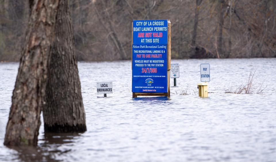
On low-lying French Island, which sits between the Black and Mississippi Rivers in La Crosse County, rising waters led a few people to voluntarily evacuate their homes, Town of Campbell fire chief Nate Melby said Wednesday.
The town received large pumps from the Army Corps to drive water out of neighborhoods, a strategy that has been working, Melby said. During the 2001 flood, 70 homes on the southern part of the island were flooded with three to four feet of water. This time around, they’ve been able to keep the water down, he said.
The river crested in La Crosse on Wednesday evening at just less than 16 feet. Even when the floodwaters recede, the community will have a tough job ahead cleaning up mud and debris the river left behind. But Melby said he’s encouraged.
“You see the best in people in those times,” he said.
Flooding curbs barge and road transportation
The Army Corps has closed 18 locks and dams from the Twin Cities to Illinois because of high water levels, halting barge traffic during the river’s busy spring shipping season.
Some of them, like Lock and Dam 4 in Alma, closed because the water has overtopped the lock chamber where boats typically pass through, Moes said. Others closed because the rushing current was pushing barges too close to the dam.
“I’ve been here 13 years and I’ve never experienced the amount of closures we’re dealing with this year,” Moes said. “It’s truly a historic flood.”
A few may open again April 29, but that will ultimately depend on the flood conditions, he said.
Since there’s no detour for barges that use the river, they’ll have to wait to get goods moving again.
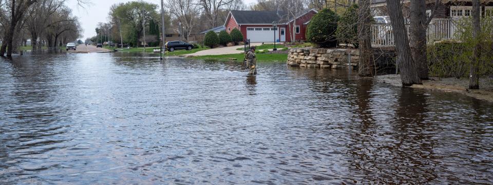
The river is flooding roads, too.
On Monday, floodwaters spilled onto Wisconsin Hwy. 35 and into downtown Fountain City, about 45 minutes upriver from La Crosse on the scenic Great River Road.
The city declared a state of emergency after a flood barrier on the highway broke loose.
Buffalo County Sheriff Mike Osmond said the main impact to the community will be a financial one, particularly the restaurants and taverns that line the river road. Local law enforcement was still diverting traffic from the area, though Osmond said the river crested Tuesday night and should begin to recede.
The road hasn’t flooded since 2001, he said.
Fountain City Mayor Gwen Katula said she was uneasy in the days prior as flooding projections waffled.
“You don’t want to stir up your community in alarm, but you need to make them aware of what’s going on,” she said. “As predictions went up, it was somewhat dreadful.”
The historic Black Hawk Bridge that joins Lansing, Iowa, to Wisconsin closed Tuesday so local officials could inspect the integrity of the dike connected to it. In 2017, a Lansing resident was killed because of a washout on the same stretch of road.
“They’re trying to make sure nothing like that ever happens again,” said Mayor Melissa Hammell.
The bridge is the only place to cross the Mississippi between La Crosse and Prairie du Chien, which are almost 60 miles apart. With it closed, some people who live and work on different sides of the river are facing a much longer commute.
A city park and baseball diamond were flooded, and the local food pantry had to evacuate its building in a low-lying area. High school students helped pantry staff distribute items once it relocated to safer ground, Hammell said.
The community is eager for the river to crest – estimated at about 19.7 feet – and for cleanup to begin so they can prepare for summer tourism season, she said.
The impact of the flooding should diminish further downriver unless rain comes, said Colin Wellenkamp, executive director of the Mississippi River Cities and Towns Initiative.
He said the group will be tracking water levels closely in the St. Louis region, where the Missouri and Illinois rivers join the Mississippi.
Juanpablo Ramirez-Franco of WNIJ Northern Public Radio contributed to this story.
This story is a product of the Mississippi River Basin Ag & Water Desk, an editorially independent reporting network based at the University of Missouri School of Journalism in partnership with Report For America and the Society of Environmental Journalists, funded by the Walton Family Foundation.
This article originally appeared on Milwaukee Journal Sentinel: Upper Mississippi River floods homes, businesses, roads, farm fields

