Here's how much rain Fort Collins, Windsor have gotten so far
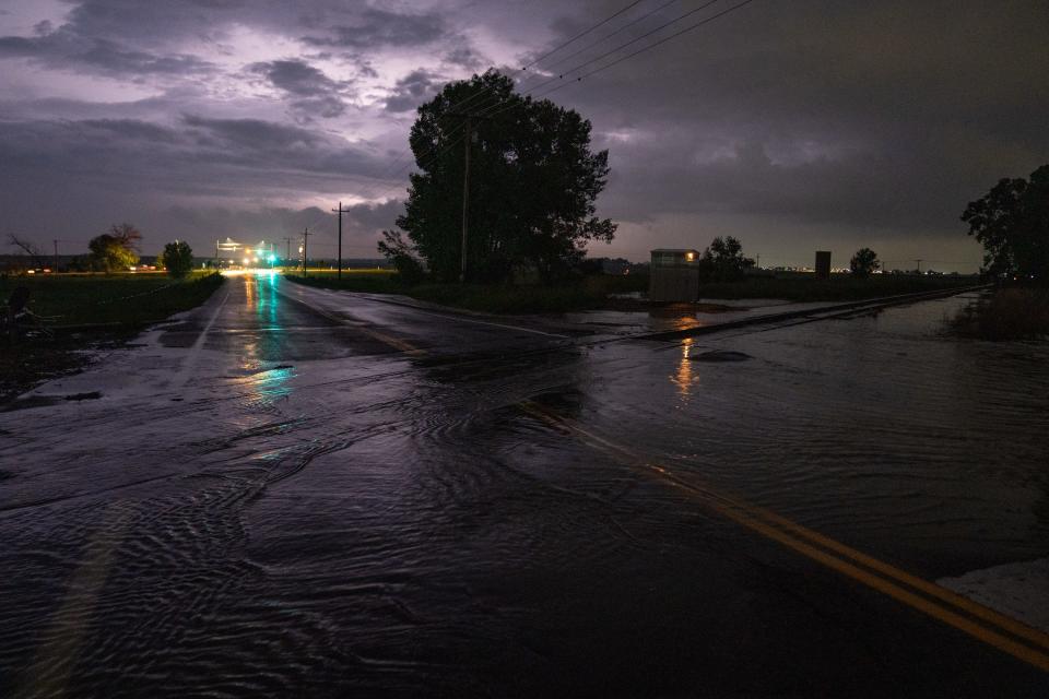
Another in a long line of June storms dumped nearly 5.5 inches of rain in southwest Timnath, 5 inches of rain in southwest Windsor and as much as 3.29 inches in southeast Fort Collins, causing flooding in low-lying parts of the area Sunday night into Monday.
Russ Schumacher, professor in CSU's Department of Atmospheric Science and Colorado's state climatologist, said it was likely the city's most intense rainstorm since Aug. 2, 2007. He said another storm May 23, 2014, produced similar amounts of rain in Loveland.
"This was a localized, very intense storm on the south end of town,'' Schumacher said.
Consider these soggy numbers:
The city reported 1.18 inches of rain Sunday and Monday at its official weather station on the main CSU campus as of Monday, according to the Colorado Climate Center. The city averages 1.90 inches of rain in June but has already recorded 4.06 inches this June.
The city has received 11 inches of precipitation this year. Fort Collins area averages about 15 inches of precipitation a year.
The city has received at least a trace of rain all but one day in June with more rain in the forecast for the rest of the week.
Here is a look at rainfall totals in and around the Fort Collins area after Sunday's deluge
These reports are from the National Weather Service:
Timnath: 1.24 to 5.5 inches (the highest reported rain total in Larimer County on the weather service's data)
Windsor: 1.33 inches to 4.95 inches
Fort Collins: 1.03 inches to 3.29 inches
Loveland: 1.49 inches to 2.35 inches
Northern Colorado Regional Airport: 2.51 inches
Wellington: 1.18 inches to 1.92 inches
These reports are from the Community Collaborative Rain, Hail and Snow network and city of Fort Collins utilities rain gauges from Sunday's storm:
Windsor (2.9 miles southwest): 4.26 inches
Windsor (3.7 miles west-southwest): 3.70 inches
Fort Collins (4.1 south-southeast): 3.29 inches
Windsor (1.3 miles west): 3.05 inches
Windsor (1.5 miles west-northwest): 2.99 inches
Fort Collins (5.3 miles south): 2.70 inches
Fort Collins (Preston Middle School): 2.68 inches
Fort Collins (4.7 miles south): 2.15 inches
Fort Collins (Trilby Road and Fossil Creek Parkway): 2.13 inches
Fort Collins (2.4 miles east-southeast): 1.93 inches
Indian Creek Reservoir (4 miles northeast of Wellington): 1.93 inches
Greeley (3.4 miles south-southwest): 1.82 inches
Fort Collins (5.6 miles east): 1.51 inches
Fort Collins (0.7 miles south-southwest): 1.34 inches
Loveland (1.2 miles east): 0.91 inches
Fort Collins (4.3 miles north): 0.90 inches
Loveland (3.2 miles east): 0.80 inches
Fort Collins (2.8 miles west): 0.78 inches
Greeley: 0.75 inches
Fort Collins (3.1 miles west-southwest): 0.58 inches
Wellington: 0.38 inches
Bellvue (2.3 miles south-southwest): 0.11 inches
Here are some other impressive rainfall totals from around the state
These are as reported by the National Weather Service or the Community Collaborative Rain, Hail and Snow network:
A reporting station at Peckham in Weld County reported 2.48 inches of rain between 9-10 p.m. Sunday.
Hugo reported 3.7 inches
Limon reported 2.68 inches
Kiowa reported 2.07 inches
Northern Colorado precipitation amounts from 5-11pm last night, from the MRMS radar/gauge analysis; @CoCoRaHS, and @ColoradoMesonet. Biggest total so far is 4.26" SW of Windsor. (I'm assuming rain at CoCoRaHS sites fell in this time window for plotting purposes) #cowx @NWSBoulder pic.twitter.com/Y4A7Lhdqjv
— Russ Schumacher (@russ_schumacher) June 12, 2023
Chance of thunderstorms to persist through the week in Fort Collins
Those looking for a reprieve from June's soggy weather might have to wait until the weekend. The National Weather Service is predicting a significant chance of showers and thunderstorms through Thursday and possibly into Friday. A warming trend is expected to boost daytime highs into the 80s Saturday and Sunday, when mostly sunny skies are expected. Here's a more detailed look at the daily forecast, as of midday Monday:
Tuesday: A 60% chance of precipitation with an increasing chance of showers and thunderstorms in the afternoon. Mostly cloudy with a high near 68 degrees and a low near 49.
Wednesday: A 40% chance of showers and thunderstorms after noon. High near 77; low near 53.
Thursday: A 60% chance of precipitation with sowers likely after noon. High near 77; low near 51.
Friday: Mostly sunny with a high near 76, but thunderstorms possible after noon. Low near 52.
Saturday: Sunny with a high near 83 and a low near 54.
Sunday: A slight chance of showers and thunderstorms; mostly sunny with a high near 84 and a low near 53.
It's pretty far out to say anything definitive, but next week looks to be drier and warmer with daytime highs creeping into the mid-80s.
This article originally appeared on Fort Collins Coloradoan: Fort Collins rain totals: Storm floods parts of Fort Collins, Windsor

