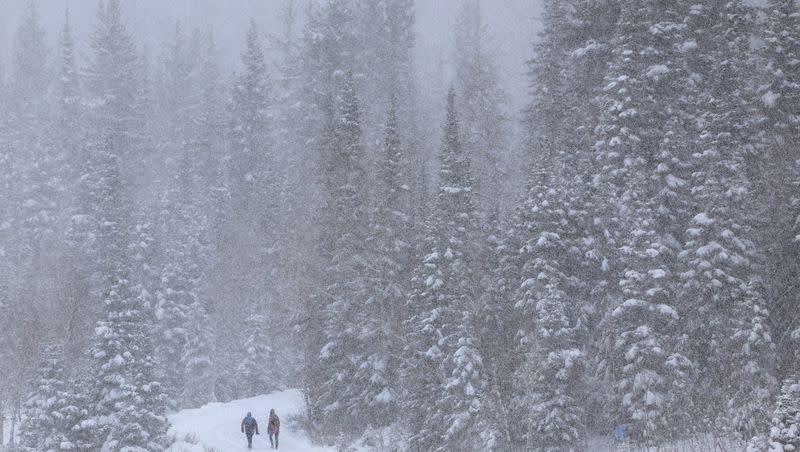
Here's what Utah's snowpack looks like at the start of 2024
Utah's 2024 snowpack remains below normal at the unofficial halfway point of the collection season.
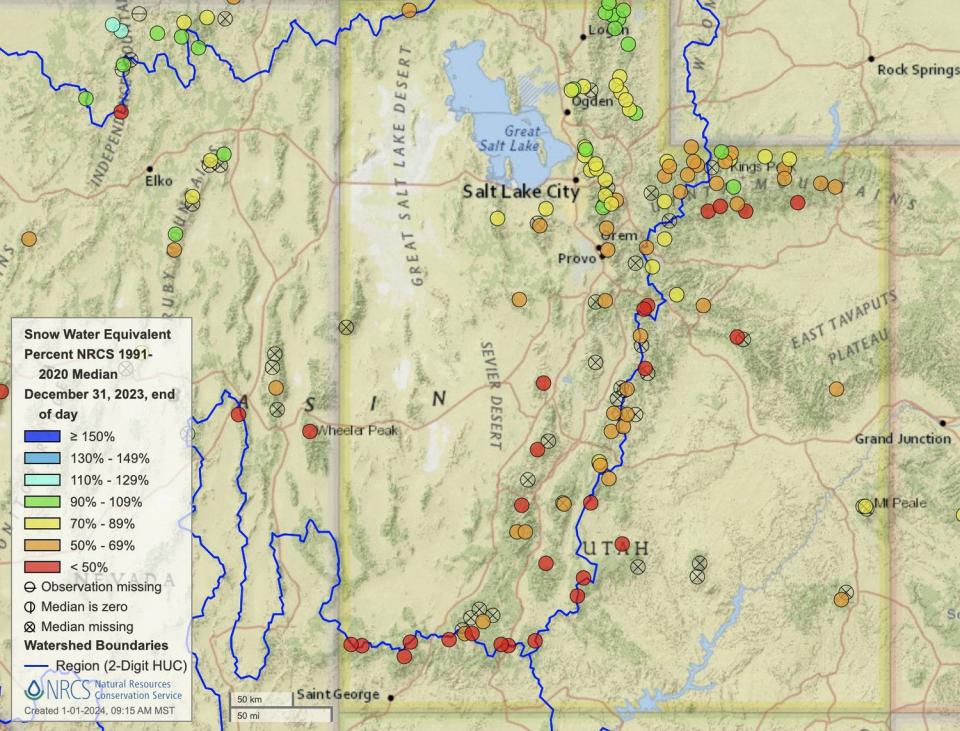
Its statewide average is 3.9 inches of snow water equivalent, about 69% of the median average for New Year's Day, according to Natural Resources Conservation Service data. The holiday is almost the exact halfway point in Utah's snow collection season, as the state's water year begins on Oct. 1 annually and the median snowpack collection peak date is April 3, based on data collected between 1991 and 2020.
The current figure, based on data collected at more than 100 different mountain sites spread out across the state, is half of what Utah had collected to begin 2023 and the third-lowest New Year's Day total over the past decade. The snowpack collection and spring snowmelt cycle account for about 95% of Utah's water supply.
What's interesting is that every basin in the state is in a different place to begin the 2024 calendar year. Basins in the northern half of the state are generally closer to normal than basins across central and southern Utah.
The Bear River basin in northeast Utah has collected 5.6 inches of snow water equivalent, about 83% of its median average for New Year's Day, which is the highest percentage of normal among basins that feed into Utah water sources. The Southwest Utah basin, on the other hand, is listed as having 1.3 inches, about 33% of normal and the lowest percentage of normal among the basins.
This is where the other primary Utah basins stand as of Monday morning:
• Weber-Ogden: 5.9 inches (79% of normal)
• Provo-Utah Lake-Jordan: 4.8 inches (69% of normal)
• Tooele Valley-Vernon Creek: 3.6 inches (63% of normal)
• Northeastern Uintas: 2.6 inches (63% of normal)
• Duchesne: 3.1 inches (60% of normal)
• Southeastern Utah: 2.5 inches (60% of normal)
• San Pitch: 3.3 inches (59% of normal)
• Price-San Rafael: 2.9 inches (56% of normal)
• Dirty Devil: 2.2 inches (52% of normal)
• Beaver: 3 inches (51% of normal)
• Lower Sevier: 2.6 inches (48% of normal)
• Upper Sevier: 2.3 inches (47% of normal)
• Escalante-Paria: 1.4 inches (37% of normal)
Utah water managers acknowledged this sluggish first half in an update to Utah's water conditions on Dec. 20. Candice Hasenyager, director of the Utah Division of Water Resources, said the agency is "planning for all possibilities" when it comes to this year's snowpack.
"It's early in the season, and I'm hopeful Mother Nature will deliver some much-needed snow," she said in a statement. "We need to be vigilant to changing conditions and ready for whatever amount of snow the state receives from now until April."
While Utah's snowpack remains below normal about halfway into the season, there are some conditions still in the state's favor.
Its soil moisture levels are slightly above normal for this time of the year, according to Natural Resources Conservation Service data. That means the state is still on pace to have an efficient spring runoff period, meaning more water ends up in streams, rivers, lakes and reservoirs.
Utah's reservoirs are also about 80% full to begin 2024, per Utah Division of Water Resources data. That's about 22 percentage points above the January median level and 34 percentage points ahead of the average level this time last year.
That means most reservoirs won't need much to fill up this spring, but a below-normal season could mean less additional water to send to bigger bodies of water that remain well below full capacity, like Lake Powell and the Great Salt Lake.
What's in store for the second half of the season?
The other good news is that the season is far from over.
High-pressure systems kept storms at bay over the past week, but weather models indicate that a storm will bring valley rain and mountain snow to at least central and southern Utah beginning as early as Wednesday night, says KSL meteorologist Kristen Van Dyke.
"It doesn't do a whole lot for northern Utah, but our central and southern mountains (will) certainly get some snow," she said. "(There's) a chance by Thursday that we'll have just enough moisture to get some snow going in our mountains and maybe a flurry or two for the Wasatch Front."
She adds that the models also indicate that a "series of disturbances" may follow the first storm system, providing widespread mountain snow over the weekend. There's the potential for even more moisture next week, all of which could help Utah's snowpack get back on track.
The National Weather Service's Climate Prediction Center lists all of Utah as having slightly stronger odds for above-normal precipitation this month. The same goes for the next three months with southern Utah having the strongest odds in the state.
"The odds are starting to favor we get into a more active weather pattern through the second half of the winter," National Weather Service meteorologist Sam Webber told KSL-TV last week.
So the second half of the season may end up much more productive than the first half was.

