High Desert roads closed due to flooding. Find out areas to avoid
City leaders have announced the closure of some number of streets and roads in the High Desert due to flooding caused by storm.
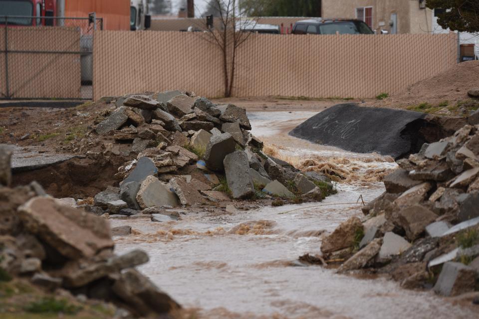
San Bernardino County officials declared a state of emergency late Sunday in anticipation of extreme rain and snow from a powerful, slow-moving, atmospheric river-fueled storm that moved into Southern California over the weekend.
The National Weather Service “predicted catastrophic and life-threatening flooding” Sunday through Tuesday, across Southern California, including the San Bernardino Valley and coastal slopes of the San Bernardino Mountains
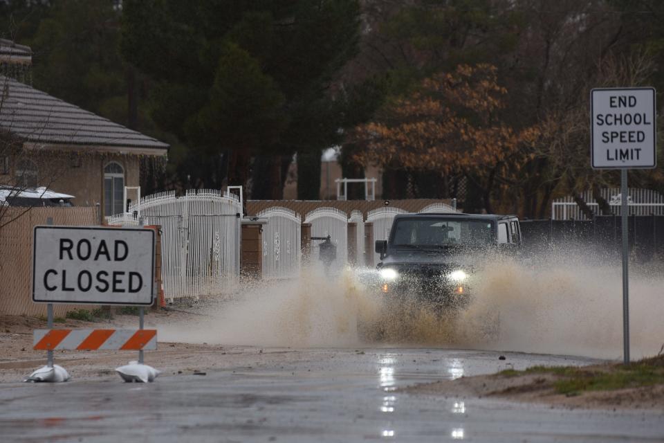
Road closures
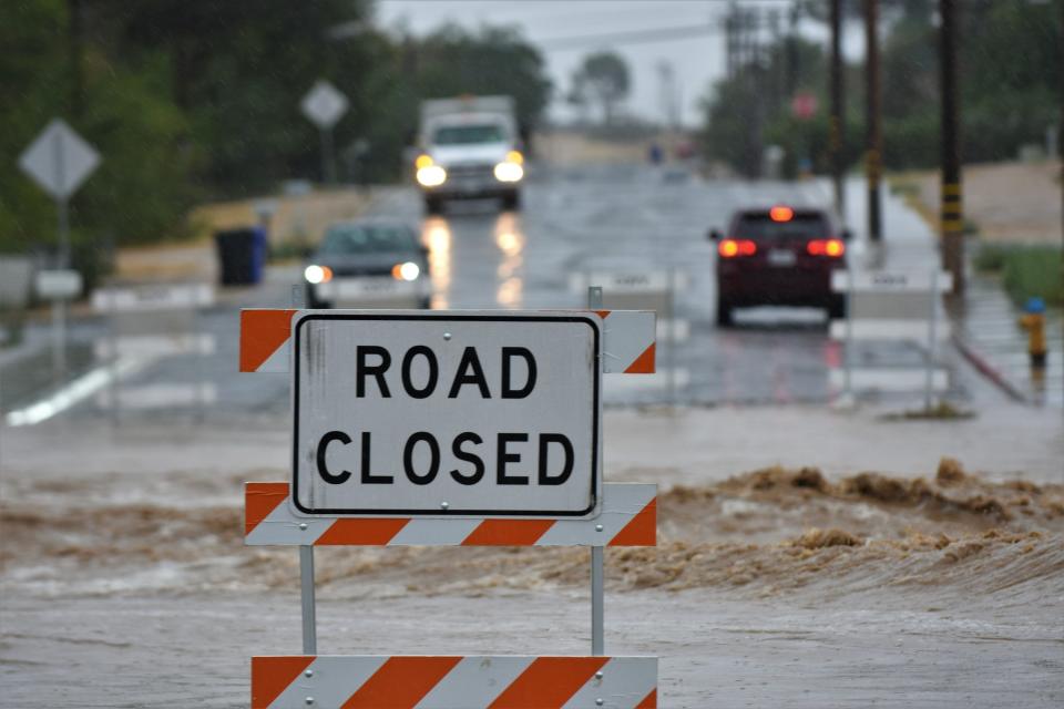
The temporary road closures went into effect on Monday at the following locations :
Apple Valley
On Friday afternoon, the Apple Valley Fire Protection District reported that Rock Springs Road was closed between Glendale Avenue in Hesperia and Deep Creek Road in Apple Valley.
Fire official are requesting drivers do not go around road closed barriers.
Victorville
Hughes Road from Avalon Road to Austin Road
Avalon Road from Hughes Road to Molino Drive
Pebble Beach Drive from Arrowhead Drive to Riviera Drive
Del Gado Road from Palmdale Road to Anacapa Road
Calgo Lane from Village Drive to Barranca Way
Rancho Road from Manning Street to El Evado Road
Balsam Avenue from Nisqualli Road to Lone Eagle Street (One lane closed)
Eto Camino Road from Cazadero Road to Barranca Way
Eucalyptus Street from Cloverly Avenue to Oro Grande Wash
Updates for Victorville roads will be available at VictorvilleCA.gov. For more information, call 760-955-5158.
Hesperia
Tamarisk Avenue at Valencia Street
Mission Street between Bangor Avenue and Alston Avenue
Live Oak St at Datura Rd 3rd Ave between Mauna Loa Street and Mojave Street
Lincoln Avenue between Ranchero Road and Rodeo Street
Orchid Avenue between Eucalyptus Street and Lilac Street
Choiceana Avenue between Covina Street and Choiceana Court.
Caltrans
On Monday, the Caltrans District 8 website showed the partial closure of Highway 138 from Interstate 15 to Hwy. 173, and the full closure of Hwy. 173 from Hwy. 138 to Arrowhead Lake Road in Hesperia.
Caltrans District 8 reported chain control is already present on Highway 18 from Stanfield Cutoff in Big Bear to the northwest of Running Springs.
According to the Caltrans Quickmap site, the California Highway Patrol has closed Highway 18 at 13 Curves. This is north of Arrowbear Lake and Running Springs.
Travelers should expect road closures and chain control throughout the mountain communities during and after the storm.
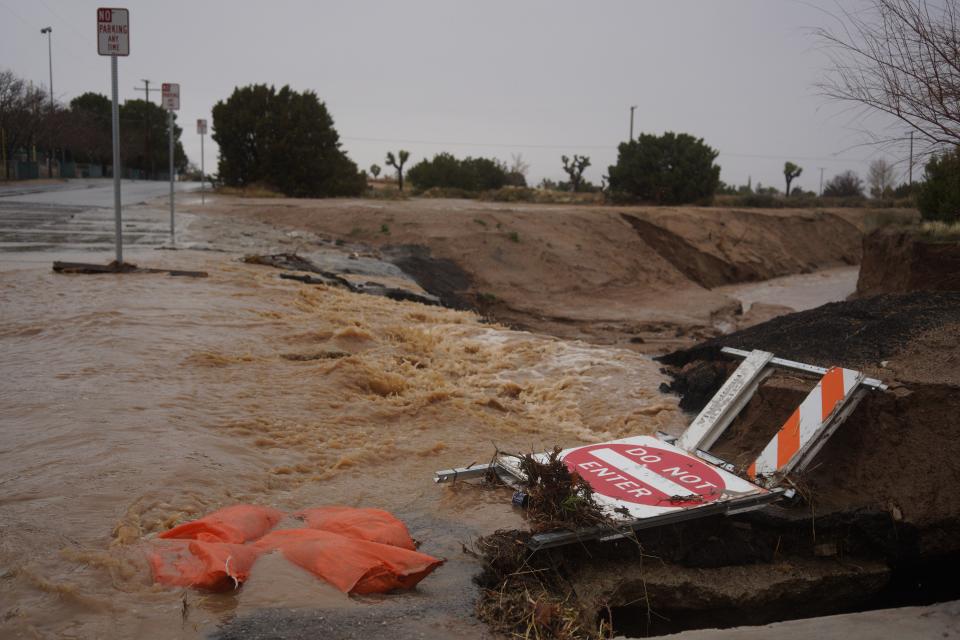
Additional road closures are possible throughout the county.
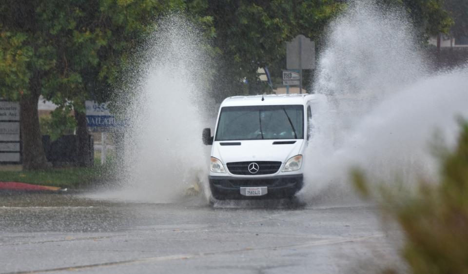
Motorists should use extreme caution and never drive through standing water due to the safety risk.
Motorists should monitor road conditions carefully and adjust speed accordingly to arrive at their destinations safely.
The National Weather Service forecasts that through Tuesday, the storm will bring up to 4 inches of rain to the High Desert, with heavier rainfall in places like the Cajon Pass and portions of Hesperia.
A flood watch will be in effect in southwest California, including Apple Valley, Lucerne Valley, Hesperia, and the San Bernardino Mountains.
More rain
In the High Desert, moderate rainfall is expected through Tuesday morning, followed by light rain showers through Wednesday.
In the San Bernardino Mountains, heavy rain is expected through Tuesday morning, followed by a mix of moderate rain and heavy snowfall through Wednesday.
The Inland Empire is expected to receive heavy rain through Tuesday morning, followed by moderate rain through the evening. Light rain showers are expected on Wednesday.
This story is developing and will be updated as more information becomes available.
Daily Press reporter Rene Ray De La Cruz may be reached at 760-951-6227 or RDeLaCruz@VVDailyPress.com. Follow him on Twitter @DP_ReneDeLaCruz
This article originally appeared on Victorville Daily Press: Heavy rain causes road closures in the High Desert

