When will Highway 1 reopen near Big Sur? Here’s the latest estimate
Highway 1 could reopen between Ragged Point and Big Sur in about four weeks — if weather and the terrain cooperates, Caltrans announced Tuesday.
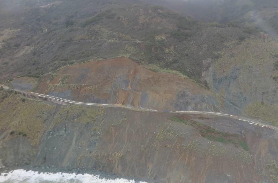
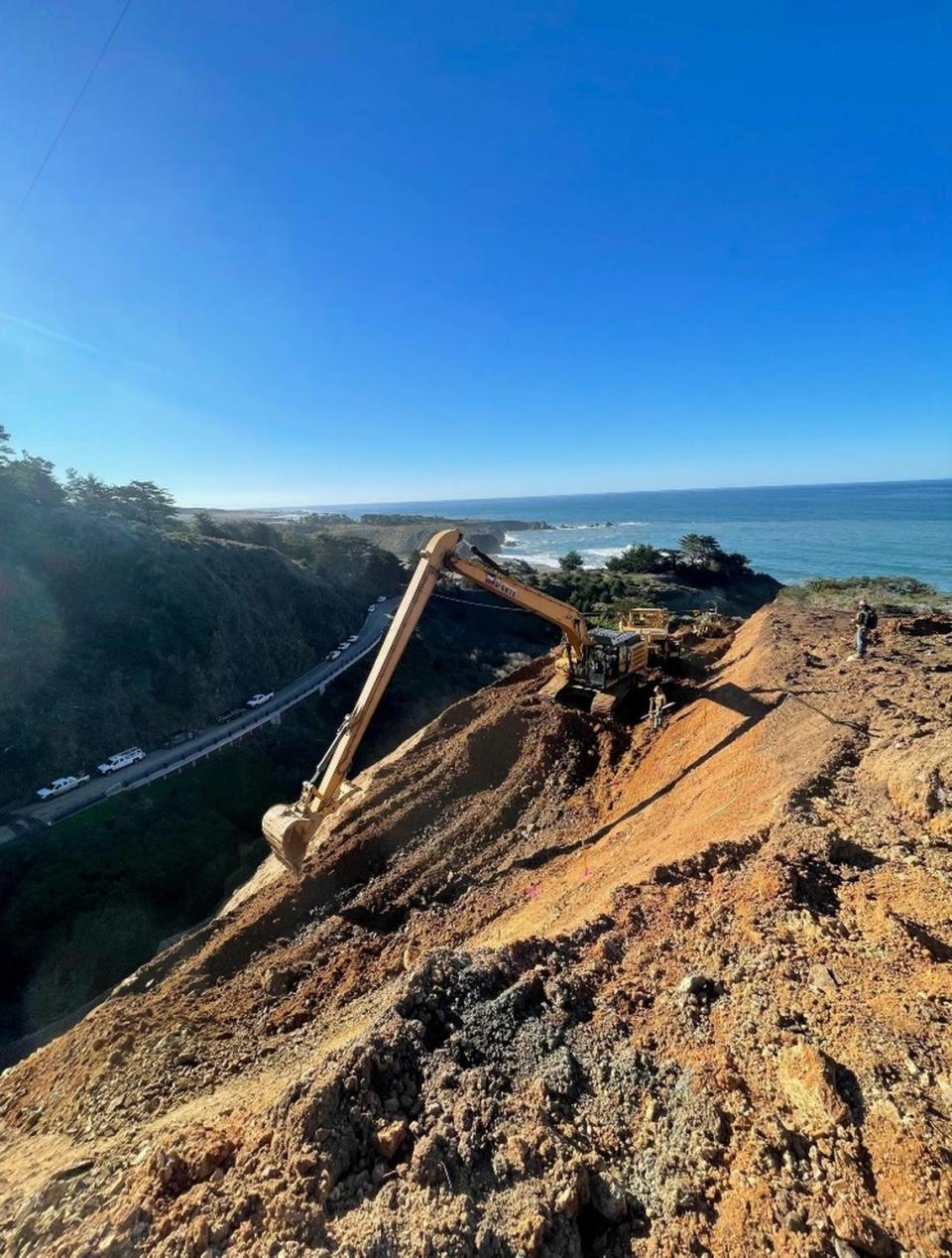
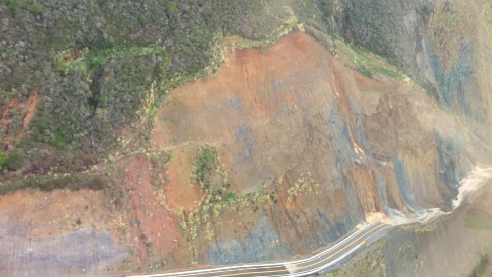
Caltrans is working to clear three major blockages caused by landslides, the agency said in a news release. Weeks of rainfall caused the slopes above those areas to give way, and more movement could happen at any time.
When those areas finally open to traffic again, at least one is expected to have traffic control and lane closures.
The slides, which took all took place within a 12-day period in January, are Polar Star, about a mile south of Ragged Point, Mill Creek, located about 18 miles north of the border between Monterey and San Luis Obispo counties, and Paul’s Slide, about 22 miles north of the border line.
The Polar Star slide came first on Jan. 4, followed by Paul’s Slide on Jan. 14 and the Mill Creek slide on Jan. 15
Caltrans has closed the scenic highway from the Piedras Blancas elephant seal viewing area, four miles north of San Simeon, to Lime Creek, about 14 miles south of Big Sur.
“Anyone attempting to pass through these slide areas are advised that they are not only putting themselves at grave risk,” Caltrans said in the release, “but they are also transferring that risk to public safety and first responder teams who would have to respond to any incidents.”
Convoys supply people affected by Highway 1 closure
Caltrans and Monterey County Emergency Operations Center are running resupply convoys to bring food, medicine and other items to residents and businesses in the affected areas. One was set for Tuesday, with a second scheduled on Friday.
Each convoy will depart from the north gate at Paul’s Slide (PM 22.5) at 8 a.m. and travel to the north closure limit at Lime Creek (PM 32), Caltrans said. The convoy will then turn around and head south to the gate at Paul’s Slide.
The convoys will then repeat the route, starting at the north gate of Paul’s Slide at noon and 4 p.m.
The agency asked residents to wait at their driveways if they want to join the convoy as it passes.
Slides continue to evolve
According to Caltrans, each of the slides has its own hazards and challenges — from a failed rockfall fence at Paul’s Slide to water and mud actively pumping onto the highway at Mill Creek and slopes that could fail at Polar Star.
“Caltrans is committed to providing access to the roadway as soon as road conditions permit,” the agency said in its release.
Caltrans said it will provide updates whenever new information is available.
For updates, follow Caltrans’ District 5 on Facebook, Twitter and Instagram.