Hot days expected rest of the week, year as La Nina continues to influence patterns in SWFL
In honor of temperatures hovering in the 80s, pick your favorite '80s cheesy rock song to describe today's weather: "The Heat is On"; "Can You Feel the Heat"; "The Heat on the Streets"?
They all apply as meteorologists with the National Weather Service in Miami say Naples Wednesday will fall just shy of the record high of 87 (set in 1986, one year before the Bryan Adams song "Heat of the Night" was released).
"Right now what we have for Naples at the airport, we have a high of 85," said Jennifer Simmons, a meteorologist with the National Weather Service in Miami, which covers the Naples-Collier area.
Just average? Deadly Ian dominated 2022 hurricane season, which otherwise was routine
And: Advocates still concerned after FWS proposes more than 1 million acres of bonneted bat habitat
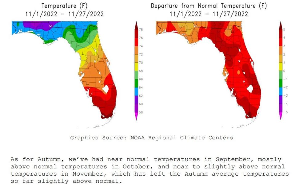
Recent highs have been running anywhere from a couple of degrees to six or eight degrees above average as a high pressure ridge has been sitting over the Sunshine State.
"It has been above-average and a lot of it has to do with the way that the systems have been moving through the U.S.," Simmons said. "We had really cool air down from Canada, but it kept mostly to the continental United States. And the tip of Florida has been real warm, with above average temperatures."
So cold fronts that in some years hit Southwest Florida have stalled before reaching our region.
"And part of that is due to La Nina, and that may play a factor because for the next month we should be above average," Simmons said. "Right now we're under the influence of high pressure and we actually have above-normal temperatures for this time of year."
Simmons said the National Oceanic and Atmospheric Administration, or NOAA, is calling for a 76% chance of La Nina to continue to be a trend that impacts weather in Florida between December and February (which is what NOAA considers to be the winter season).
NOAA released its latest climate report Tuesday.
More: In region of natural beauty and harmful algae blooms, FGCU celebrates new water school
Previously: Fishery reportedly great in aftermath of Hurricane Ian, going down hill with spreading red tide
"It's cooler for other areas but our region tends to be the warmest in the U.S. in the winter and the La Nina years it's even warmer," Simmons said.
The average high for a Nov. 30 in Fort Myers is 77 degrees, according to the National Weather Service in Ruskin, which covers the Fort Myers-Lee County area.
NWS is calling for a high of 86 degrees in Fort Myers Wednesday, nearly 10 degrees above average conditions.
"Right now with that high pressure, there will be no rain," said Yidiana Zayas, an NWS meteorologist in Ruskin, the office which covers Lee County. "(Wednesday) there's another cold front, but it won't change the temperatures too much. There's a slight chance of rain, and then the high pressure will continue to take place the rest of the week."
The latest NWS climate report says: "We’ve seen a wide range in our temperatures this November, with a couple of cold fronts moving through, along with (Hurricane) Nicole which brought some heavy rainfall to parts of the region."
"Most of these fronts were uneventful, bringing just a few showers, but the rainfall from Nicole in many areas was more in one day then we usually see during the entire month of November," the report continued.
Connect with this reporter: @ChadEugene on Twitter.
This article originally appeared on Fort Myers News-Press: SW FL weather: Hot conditions to continue as highs fall just shy of records

