Winter storm mess: Iowa DOT plows back on roads; Iowa State among schools with canceled classes
This article has been updated.
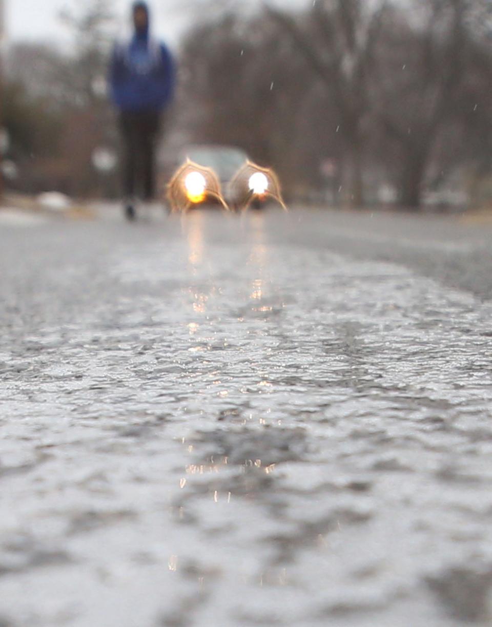
Wednesday certainly was not a pleasant day in Des Moines, with gusts pushing wind chills to sub-freezing lows as temperatures plunge to single digits Thursday.
But you didn't have to go far north of the metro to encounter extreme conditions, as an epic winter storm extending across the nation from the Southwest to the Northeast concentrates the worst of its fury on the upper Midwest.
Northwest Iowa roads improving with Iowa DOT plows' return
In the extreme northwest corner of Iowa, conditions late Wednesday deteriorated to the point that the Iowa Department of Transportation pulled snowplows off the roads.
The area extending from the Iowa Great Lakes to the South Dakota border and north from Iowa Highway 3 is under a blizzard warning, and Iowa 511 said that by nightfall, many roads there had become impassable, covered with snow and blowing snow. The state transportation department, ordering snowplows off the roads, warned residents that any that had remained open would "quickly become impassable" and remain that way until crews can head back out in the morning as the storm subsides.
Plows had returned to roads by early Thursday morning, but many roads were still listed as at least partially covered, with some highways in the northwest corner still listed as travel not advised.
On U.S. 59 near Sanborn, an Iowa State Patrol trooper earlier in the day recorded dash cam video showing snow quickly covering the roadway.
Due to dangerous conditions, we're pulling plows in extreme NW Iowa, the roads will quickly become impassable. We will have crews back out as soon as we can tomorrow morning. Thanks for your patience, stay safe, and check https://t.co/gt4AdbKOoW and the Iowa 511 app. pic.twitter.com/N4x4lb4TLS
— Iowa DOT (@iowadot) February 22, 2023
Iowa State University moves classes virtual due to icy conditions in Ames
Students and professors at Iowa State University will hold classes virtually on Thursday due to the icy conditions in Ames. Employees of the university are advised to work from home and check their emails for more information,
Students in Ames Public Schools will have classes delayed two hours.
Many other school districts north of Highway 30 have delays in place. Check with your local school district for delays or school closings.
Iowa State Patrol responds to 134 calls for service
The Iowa State Patrol said it had responded to 134 calls for service around the state as of 10 p.m. Wednesday Those calls included 48 for crashes, 38 for property damage and 10 involving personal injury, according to spokesperson Sgt. Alex Dinkla. The department also responded to 86 calls for motorist assists.
Dinkla said the majority of calls originated from I-80 and from northern Iowa.
Ames gets glazed with freezing rain
Farther south, Ames, under an ice storm warning, by Wednesday afternoon was seeing streets coated with a glaze of ice. Ames police reported they were helped clear a jackknifed semi tractor near the 13th Street interchange of I-35, which Iowa 511 warned was partially covered in ice at the time.
Ice also was creating hazardous conditions on roads in and around Waterloo and Denison. Near the Minnesota border, I-35 was under snow and blowing snow.
TRAVEL NOT ADVISED in NW Ia due to drifting and whiteout conditions. Please stay home!
This is near Sanborn on Hwy 59 - Video taken by Sergeant Vince Kurtz. #iawx pic.twitter.com/GqV6vkAjx7— Iowa State Patrol (@iowastatepatrol) February 22, 2023
Conditions bound to get worse
The vast winter storm system extends from the Grand Canyon of Arizona to Maine's Bar Harbor. At the storm's heart across much of western and central Minnesota and into northwestern Wisconsin.
The vast winter storm system extends from the Grand Canyon of Arizona to Maine's Bar Harbor. At the storm's heart across much of western and central Minnesota into northwestern Wisconsin, and including most of South Dakota and the neighboring northwest tip of Iowa ― the National Weather Service reported blizzard conditions with extreme snowfall. It said snow accumulation could reach 18 inches or more in those areas, with whiteouts and deep drifts "making travel nearly impossible," including along the I-35 corridor leading to the Twin Cities.
In Sioux Falls, South Dakota, the airport was closed until Thursday and the weather service cautioned residents that they should be prepared to shelter in place for up to three days before roads can be cleared.
More: Traveling in Iowa this week? Be prepared for ice, blizzard conditions in some areas
Don't get too comfortable
While Des Moines is being spared the worst of the storm, the weather service said there's a chance slick spots will form on roads if temperatures drop rapidly enough after sunset. There's a possibility that another hazardous weather system could form as February ends and March arrives.
"Overall, a very active weather pattern is expected next week," the weather service said in its forecast guidance.
Previously: Mile Long Bridge over Saylorville Lake looks haunted as winds pick up during snow storm
Snow totals in Iowa and the surrounding Midwest so far
Mason City: 3.5 inches
Spirit Lake: 4.3 inches
Rock Rapids: 2 inches
Garretson, South Dakota: 6.2 inches
Rapid City, South Dakota: 6 inches
Mandan, North Dakota: 5.5 inches
Chanhassen, Minnesota: 6.5 inches
Rochester, Minnesota: 8 inches
Sheboygan, Wisconsin: 6.5 inches
Benoit, Wisconsin: 13 inches
This article originally appeared on Des Moines Register: Iowa winter storm makes hazardous road conditions, snow, ice Wednesday

