Hurricane center tracking three waves, and one is near Florida. What the forecast says
UPDATE: The hurricane center is tracking a tropical wave in the Atlantic that is likely to become a tropical depression named Emily. Here’s the Saturday advisory.
The tropics erupted overnight with two new systems popping up on the National Hurricane Center’s map.
The earlier system in the Central Atlantic has a better chance of developing into a tropical depression. A new one on Florida’s coast east of Jacksonville is bringing rain to an already rainy state. And there’s another newcomer in the southwestern Caribbean.
Here’s what the National Hurricane Center’s 8 p.m. Friday advisory has to say about the trio.
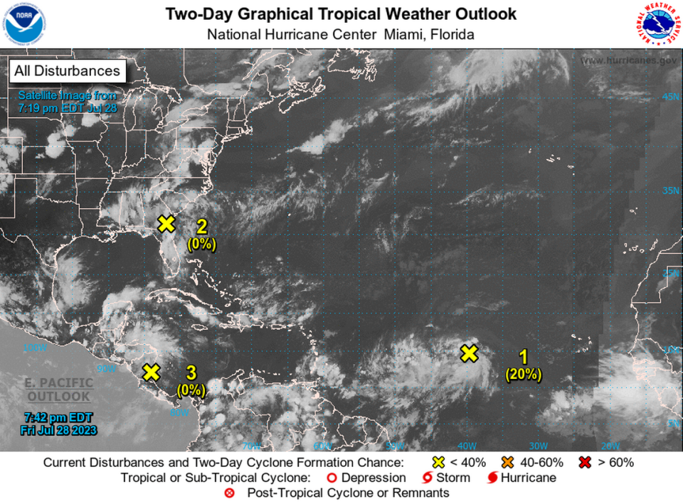
Southwestern Atlantic wave
The new wave, marked as Disturbance 2, that formed as a weak area of low pressure just east of Jacksonville near the coasts of northeastern Florida and Georgia moved farther inland over southeastern Georgia, according to the advisory.
The wave is not expected to develop.
▪ Formation chances through 48 hours and seven days, both low at near 0%.
Will Disturbance 2 affect Florida?
The disturbance could bring heavy rains to portions of northeastern Florida, eastern Georgia and eastern South Carolina during the next day or so., hurricane specialist Jack Beven wrote in the advisory.
Central Tropical Atlantic Disturbance 1
This tropical wave midway between the Cabo Verde Islands and the Lesser Antilles that rolled off Africa’s coast has been around for several days. Shower and thunderstorm activity has increased since Thursday. The system was producing disorganized showers and cloudiness into the afternoon.
Environmental conditions are expected to be favorable for gradual development of this system during the next few days, and a tropical depression could form early next week while the disturbance moves west-northwestward to northwestward at about 15 mph., according to Beven.
▪ Formation chance through 48 hours, low at 20%.
▪ Formation chance through seven days, high at 70%.
Will Disturbance 1 affect Florida?
While it remains too early to tell if this tropical wave will have any impact in Florida or the U.S. some experts suggest perhaps not.
Southwestern Caribbean Sea Disturbance 3
The second new system, Disturbance 3, is a large area of disorganized showers and thunderstorms over the southwestern Caribbean Sea and is associated with a tropical wave.
According to the advisory, this system is moving inland over Central America, with no development expected. However, it may cause heavy rains over portions of Nicaragua, Honduras and El Salvador.
▪ Formation chance through 48 hours and seven days, both at 0%.
Will Disturbance 3 affect Florida?
This disturbance in the Caribbean is not expected to make landfall in Florida or the U.S. at this point.
Rainy Florida
NEW RECORD DAILY RAINFALL for JULY 27th at FLL ️Ft. Lauderdale Airport received 6.19" of rain yesterday! FLL has now received 65.64" of rain since January 1. That is more than double normal (30.54") for Jan 1 - July 28th. pic.twitter.com/qbiqGZspI0
— NWS Miami (@NWSMiami) July 28, 2023
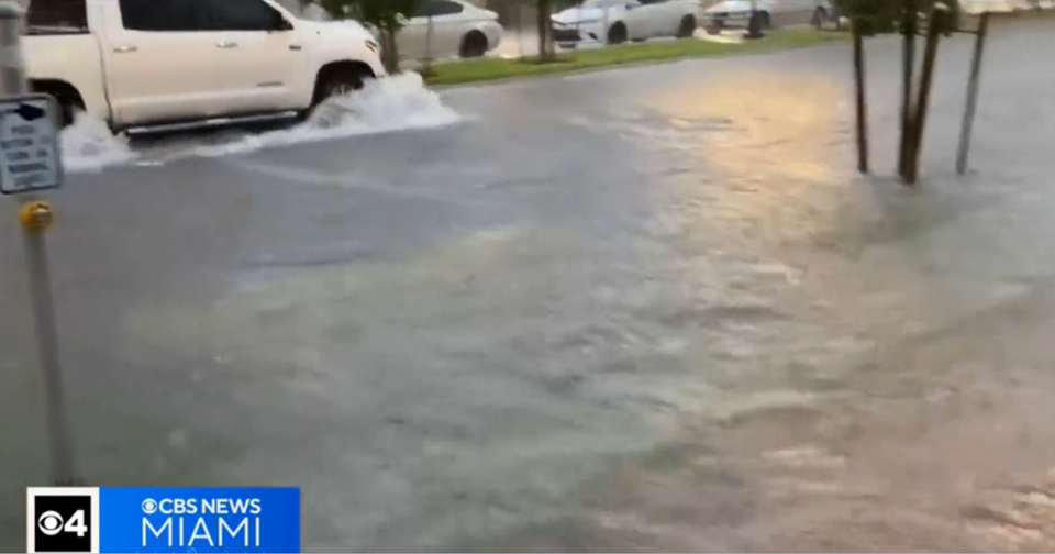
The tropics are driving moisture to the state, including the Miami and Fort Lauderdale areas. The National Weather Service in Miami issued a flood watch through 6 p.m. Friday and thunderstorms are in the forecast into the weekend.
Will floods that swamped airport and roads give way to more heat? What the forecast says

