
Hurricane Harvey from space: devastating before-and-after satellite images

A great flood is a disaster visible on many scales at once. In microcosm, the water creeping up the living room walls, the pictures and the furniture set afloat, the tangible evidence of several million lives drifting away to the sea. In medium view, the lampposts and treetops poking up out of the water, the wake of the motorboats as they cruise down streets, past houses that no one may ever live in again.
And then there is the view from space, from 400 to 600 miles above, where remote-sensing satellites make their silent rounds, repeatedly mapping the planet at resolutions measured in inches, or in panoramic views that span miles.
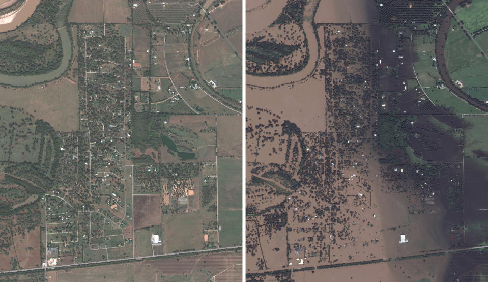
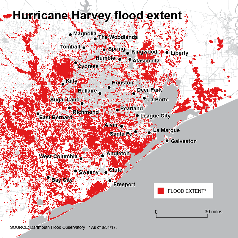
And it is this macrocosmic perspective that most accurately conveys the devastation of Hurricane Harvey: the smooth brown surface of water overlying the fields, roads and houses that were visible just a week ago, or, in 2016, in this stunning series of before-and-after pictures from the satellite imaging company DigitalGlobe, covering Houston, Beaumont, and the small town of Simonton, in the exurbs of Houston on a bend in the Brazos River. As of noon on Friday, it was sunny and 87 degrees in Simonton, and the last posting on the town’s website, dated Thursday, said the mandatory evacuation order was still in place.
_____
Read more from Yahoo News:
Senior citizens in viral photo pose after rescue from Harvey floodwaters
‘We’re alive’: Texas woman describes what matters to her after fleeing Harvey’s floodwaters
Animal lover rescues bats trapped under bridge by Hurricane Harvey
Photos: ‘Catastrophe Unfolds’: How newspapers covered Harvey
Photos: Dramatic aerial views of the flooding in Harvey’s aftermath
Photos: Explosions rock Harvey-flooded Arkema chemical plant in Crosby, Texas

