Hurricane Hilary bringing unprecedented storm warnings to Southwest
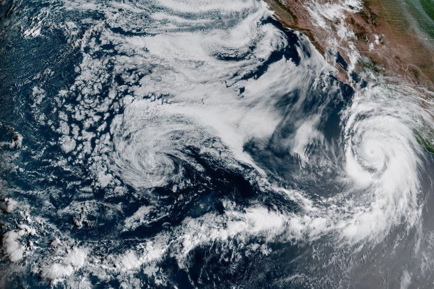
The Southwest United States and parts of Mexico are preparing for the unprecedented landfall of Hurricane Hilary this weekend, as the storm prepares to batter the West Coast in an almost unheard-of event.
The hurricane, which is currently listed as a Category 2 storm, is expected to make landfall on Saturday night near the Baja California coast. Hilary is expected to still be a hurricane at that time, according to the National Weather Service (NWS), but will likely continue to dissipate as it moves inland.
Hilary will bring "flash, urban and arroyo flooding" to the region, the National Hurricane Center (NHC) said, adding that residents should expect "dangerous and locally catastrophic impacts." Hurricane-like conditions are expected along most of the Baja California peninsula, and the NHC said that preparations for heavy rainfall and flooding "should be completed as soon as possible."
Southern California is expected to see up to 10 inches of rain in some areas — a storm of such magnitude has not been seen in the state in 84 years. Los Angeles, Anaheim and San Diego are all expected to receive at least four inches of rain throughout the weekend. However, meteorologists are not expecting the kind of outright devastation seen in Atlantic hurricanes, as Hilary is expected to lose its hurricane status by Saturday night and devolve into a tropical storm by Sunday.
Despite this, massive rainfall is expected into next week, and officials have placed Southern California under a tropical storm watch for the first time ever. Some areas in California and eastern Nevada could see a year's worth of rainfall in just a few days, the Los Angeles Times reported. One report from AccuWeather even said that Death Valley National Park, one of the hottest and driest places on Earth, could receive up to four inches of rain.

