Hurricane Hilary live updates: Newsom declares State of Emergency; road closures announced
- Oops!Something went wrong.Please try again later.
Looking for the latest updates? The Desert Sun is tracking the storm as it makes landfall on Sunday.
As Hurricane Hilary comes closer to making landfall, the National Weather Service placed the Coachella Valley under a tropical storm warning, emphasizing the potential for high winds and extreme flooding rain that “may prompt numerous evacuations and rescues.”
Hurricane Hilary preparations in valley: How to get help, sandbags
Coachella Valley could see year's worth of rain over a few days
'A potentially catastrophic situation'
In the National Weather Service-San Diego's 4 p.m. update, meteorolgist Elizabeth Adams said Hurricane Hilary is currently off the coast of Baja California, some 600 miles south of San Diego. The NWS expects the storm to make landfall sometime Sunday, when heavy rainfall is expected.
"We have a very serious situation here, folks," said Adams, describing the increasing chances and rate of rain that will hit the Coachella Valley and the rest of Southern California's mountain and desert region.
She said rain in the valley, like in Palm Springs, had been delayed compared to what they were expecting Saturday afternoon. But the chances are certainly increasing into the evening, estimating a likely 3/4 inch of rain for the area Saturday night.
Sunday is when conditions are expected to worsen considerably. Sunrise to lunch time, is when "precipitation starts to get really heavy," she added. The chance of rain increases to 90-100% during this period, and around that time, she said we can expect an inch to an inch and a half of rain in a six-hour period.
During Sunday afternoon, Adams said the rate of rain could increase to two inches an hour, resulting in possible "widespread, very life-threatening flash flooding"
"This will become a potentially catastrophic situation developing in the deserts and eastern mountains tomorrow afternoon,” said Adams.
Between Saturday evening and Monday night, Adams said people can expect "over five inches of rain in the mountains, and potentially over seven inches of rain on the eastern slopes."
She urged people to pay close attention Sunday for if officials announce potential evacuations.
Residents offer mixed reactions to the impending storm
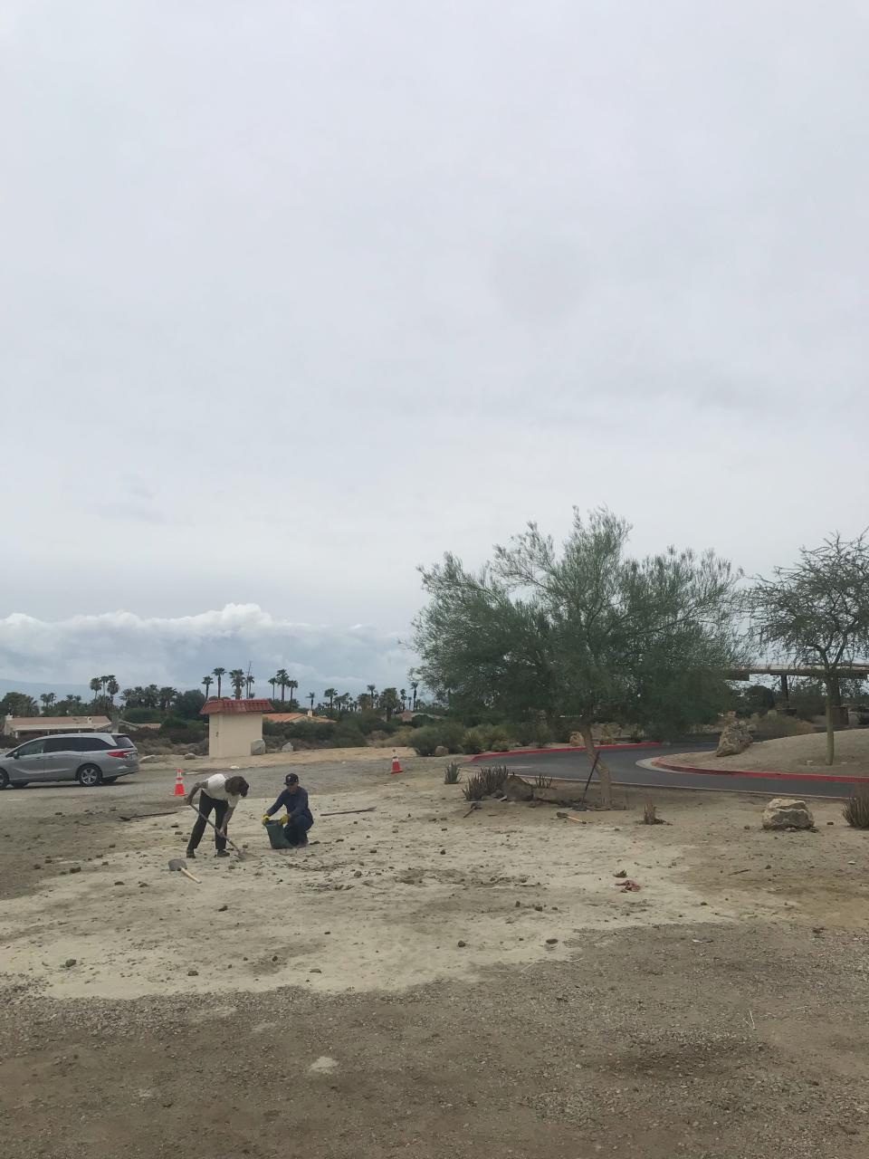
As Anna Holt of Palm Springs put three sandbags into the back of her SUV Saturday, the Florida native — who is used to preparing for hurricanes — said having some sandbags is better than having none. She’s most concerned about the potential for flooding as Hurricane Hilary heads toward Baja California and the Southwestern U.S., but added she's doing the best she can to prepare.“It’s strange to think I left Florida to get away from the hurricanes and all that weather," Holt said. "I moved to the desert and was like ‘Surely, that will never be a problem.’ But here we are. It’s definitely weird."
Although most of the desert's nine city governments urged their residents to prepare for the storm by filling city-provided sandbags and stocking up on food — enough to get through several days stranded at home if flooding causes major road closures — several residents didn't feel the need to buy extra bottled water or non-perishable food Saturday.
One resident waved off a reporter outside the Desert Hot Springs Stater Bros. asking her about her bottled water purchase, saying she's "not worried" about the storm and was just doing a typical grocery run. The sentiment was echoed by several desert residents outside the Palm Springs Home Depot who said they were just there to get items for home and business improvement projects and didn't want to comment on the storm.
—Niki Kottmann and Brian Blueskye
Palm Springs Police Department announces pre-emptive road closures to start at midnight
Starting at midnight tonight, Indian Canyon Drive, Gene Autry Trail and Vista Chino Street at the washes will be closed until further notice in preparation of potential flooding due to Hurricane Hilary, Palm Springs Police Department announced late Saturday.
—Niki Kottmann
Emergency alert sign-ups recommended
With heavy rainfall expected early Sunday, officials urged Riverside County and Coachella Valley residents to subscribe to emergency alerts to ensure they receive information quickly.
No evacuations have been issued for the area as of 7 p.m. Saturday night. But if they are needed, the Riverside County Emergency Management Department said residents can be notified through the county's emergency notification system. People can sign up for the notifications with an email address or a phone number at https://rivcoready.org/alert-rivco
—Chris Damien
Newsom declares State of Emergency

In advance of the storm, Gov. Gavin Newsom issued a State of Emergency for much of Southern California Saturday evening to support the Hurricane Hilary response and recovery efforts as the state continues mobilizing and coordinating resources ahead of the storm's forecasted impacts.
Heavy rainfall and high winds were expected to begin Saturday and last through Monday. At the governor's direction, there were currently more than 7,500 boots on the ground deployed to help local communities protect Californians from the impacts of Hilary.
The governor also signed an emergency proclamation in San Diego while visiting with California National Guard troops. He met with first responders and local officials, including San Diego Mayor Todd Gloria. He was also in touch with federal officials, including the White House.
The Emergency Medical Services Authority has assets on standby, including California Medical Assistance Teams to augment local capacity, aid in evacuations and support medical needs in communities impacted by flooding. The EMSA was ready to assist with Ambulance Strike Teams as necessary to support local communities. The Flood Operations Center is activated and has prepositioned flood-fight materials should they be needed.
—City News Service
Sandbag availability low, exhausted in some valley cities
Sand and sandbags are no longer available at local fire stations in Palm Desert as of Saturday afternoon. Instead, residents can find these resources at the Palm Desert Civic Center, 43-900 San Pablo Ave., Palm Desert.
Rancho Mirage ran out of sand at its distribution site at the Rancho Mirage Library & Observatory parking lot, so many people took their empty bags to a nearby empty lot to fill them with sand straight from the ground. Empty sandbags are still available for Rancho Mirage residents at Fire Station 69 at 71-751 Gerald Ford Drive. Proof of Rancho Mirage address is required.
Indian Wells announced mid-afternoon on Saturday that sandbags are no longer available from that city, and residents are encouraged to seek supplies from local home improvement stores, instead.
—Niki Kottmann
Some businesses choose to close, others open as usual

For most Palm Springs businesses on Saturday, it was business as usual. Most retail stores and restaurants were open and said they had no plans to close.
Michael Weems, owner of the Michael Weems Collection and Autoerotica on North Indian Canyon Drive, said he isn't concerned.
“I’ll put the sandbags in front of my door when I leave this evening, and that’s the extent of it. I don’t think it’s going to be a horrendous storm,” Weems said.
But others were taking precautions.
GayMart on Arenas Road had a sign on its door stating it would be closed on Sunday. Employees behind the counter said it was the decision of the owner for the safety of the store’s staff members.
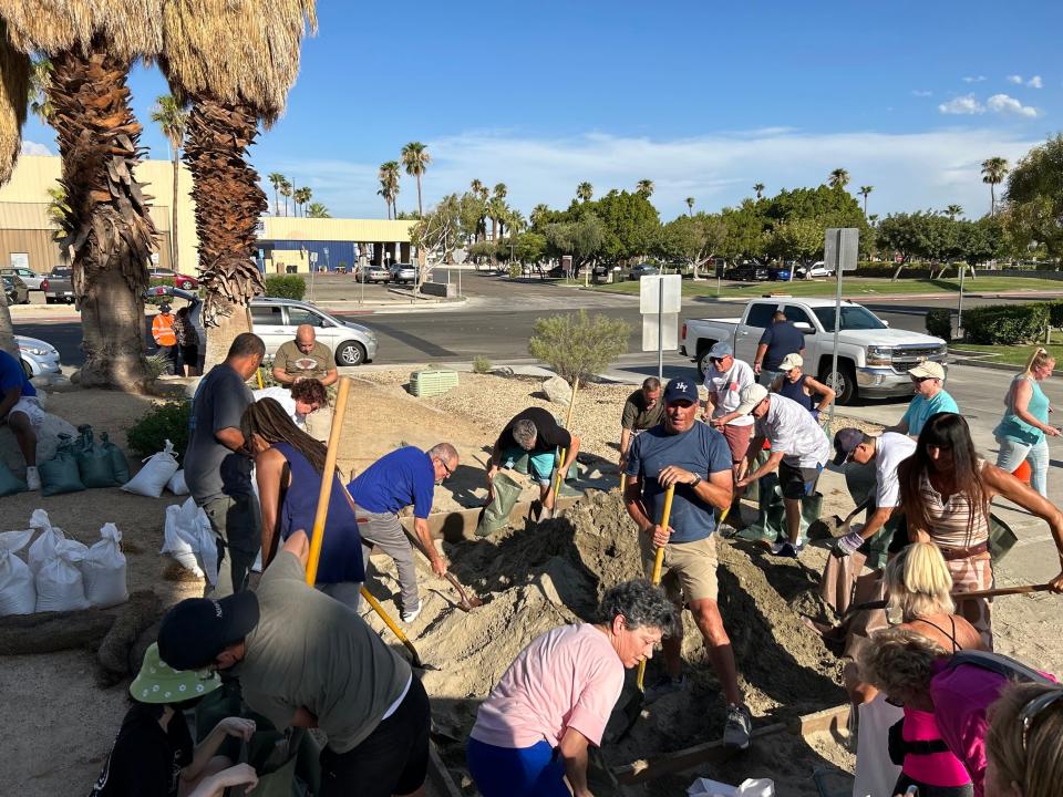
The Best Bookstore in Palm Springs owner Paul Carr also made the decision to close his East Tahquitz Canyon Way store at 2 p.m. for the safety of this employees. He spoke to The Desert Sun by phone while helping local residents prepare sandbags at Palm Springs City Hall and said “This is not how we expected to be spending our summer.”
“The most important thing is climate change is real, and we have lots of books at the store on the subject,” Carr said. “As a local business, we look at the weather the best we can, make sure everyone is safe and get our books a little higher off the ground (in case of flooding).”
Carr described the storm as “once in a generation” but added it's also brought out the generosity of the community.
“I’m amazed by how prepared the city was for something there was no reason to be prepared for, a tropical storm in Palm Springs? When I see the chief of police and his wife shoveling sandbags down at city hall, I feel like we’re doing OK.”
Palm Springs city councilmember Jeffrey Bernstein, who also owns Destination PSP on North Indian Canyon Drive, said he plans to close on Saturday when the rain starts and “most likely” on Sunday.
“We want to make sure there’s no property damage, which is less important than people getting hurt. Thats why we’re going to stay on the store until the rain starts, make sure we’re sandbagged and everything is protected,” Bernstein said.
—Brian Blueskye
Storm knocks down 45 power poles
A thunderstorm Friday evening downed about 45 power poles in Thermal, cutting power for hundreds as Coachella Valley residents prepared for what will likely be much fiercer rain and wind as the remnants of Hurricane Hilary approach on Sunday.
Imperial Irrigation District, the power provider for the area, posted Saturday on its Facebook page photos of the power poles snapped and scattered on a paved road, high voltage lines still mostly attached. Robert Schettler, the department’s spokesperson, said that the poles were on Harrison Street between Avenues 58 and 63, a stretch of about 2 1/2 miles of roadway.
Initially, he said, about 680 customers were without power around 7:30 p.m. Friday, but by 11 a.m. Saturday, power had been rerouted to all but 65 customers. Those customers, he said, will likely be without power for “several days.” Area residents can go to Desert Mirage High School on 66th Ave in Thermal, where a storm shelter has been set up for anyone without power or who otherwise feels unsafe.
“If anyone sees a downed power line, do not approach it,” Schettler said by phone Saturday. “Please give us a call to report it as soon as you can.”
To report downed power poles or lines to IID, call 1-800-303-7756.
—Chris Damien
Palm Springs International Airport activates its comprehensive storm event plan
Deputy Director of Aviation, Marketing & Air Service Daniel Meier said in a press release Saturday and confirmed seperately to The Desert Sun that Palm Springs International Airport has activated its comprehensive storm event plan to ensure the safety of passengers, staff and operations. The plan includes measures such as bringing in additional staff, activating tested backup systems and establishing plans to guarantee safety in case of power outages or other storm-related incidents.
Additionally, all backup power generators have been tested and are ready to go if needed. To mitigate potential flooding concerns, thorough inspections and clearing of storm drains around the airfield, airport roadways and terminal were conducted. Sandbags were also strategically placed around the property.
It's impossible to predict how many flights will be delayed or canceled, Meier said, but the Palm Springs International Aiport team does expect several flights to be canceled or delayed over the next couple of days. PSP requests that all passengers check with their respective airlines for the most up-to-date information concerning their flight status before heading to the airport.
"Our dedicated airport staff is fully prepared to meet the challenges of the impending tropical storm," Harry Barrett, executive director of Aviation at PSP, said in a statement. "Our team's efforts underscore our determination to ensure the safety and well-being of all passengers, staff, and operations throughout this storm."
—Niki Kottmann and Brian Blueskye
Several flights canceled due to the storm
Southwest Airlines has already canceled afternoon flights on Saturday into Palm Springs from Sacramento, Denver, Las Vegas and Oakland as well as its full schedule into Palm Springs on Sunday, including its one daily flight from Denver as well as flights from Las Vegas and San Jose.
Southwest Airlines is the only airline so far to cancel Saturday or Sunday flights at Palm Springs International Airport.
A quick check of the American Airlines website showed all three flights from Phoenix to Palm Springs and both flights from Dallas to Palm Springs for Sunday were still on time.
United Airlines' website indicated that both daily flights from Denver and three flights from San Francisco were still on time for Sunday arrival into Palm Springs.
Anyone flying should check ahead with their airline for schedule changes.
—Matt Solinsky
Hurricane Hilary: Storm weakens as rain starts in Coachella Valley
Southern California is bracing for significant heavy rainfall and extensive flooding as Hurricane Hilary reaches the region, forecasters say.
Hurricane Hilary headed for Mexico’s Baja California on Saturday as a downgraded Category 2 storm that the U.S. National Hurricane Center predicted will bring “catastrophic” flooding for the peninsula and for the southwestern United States, where it was forecast to cross the border as a tropical storm on Sunday.
Meteorologists expect the storm also to churn up “life-threatening” surf conditions and rip currents — including waves up to 40 feet high — along Mexico’s Pacific coast.
While it’s still likely to enter the history books as the first tropical storm to hit Southern California in 84 years, Hilary weakened from a Major Category 3 hurricane down to a Category 2 storm at midday Saturday and is expected to weaken further as it treks northward.
The forecasted strength of Hilary when it reaches Southern California has remained unchanged for two days now.
Located about 235 miles west of the southern tip of Baja California on Saturday morning, Hilary was considered "large and powerful" by the National Hurricane Center with maximum sustained winds of 125 mph.
National Weather Service meteorologist Adam Roser said on Saturday that a large area of showers and thunderstorms are coming in from the east of Palm Springs. The area could see a quarter of an inch of rainfall during the afternoon and early evening. But the heaviest rainfall is likely to occur on Sunday during the day.
"We could see a few inches of rain (on Sunday), so it'll increase tonight and a lot tomorrow, then taper off on Monday morning," Roser said. "If we get some thunderstorms in the area, it will be heavy downpours, but it's going to be off and on for two days."
Roser said as Hilary moves through the Southern California area on Sunday, winds will increase during the late morning into the afternoon with the potential of gusts up to 60 mph.
Forecasters said the storm could bring heavy rainfall to the southwestern United States, dumping 3 to 6 inches in places, with isolated amounts of up to 10 inches, in portions of southern California and southern Nevada.
—Brian Blueskye and USA TODAY
Rare Tropical Storm Warning issued for Coachella Valley
The Coachella Valley has been upgraded to a Tropical Storm Warning as tropical storm-force winds from current Hurricane Hilary are expected to move into Southern California within the next 36 hours.
The entire valley is under the warning from Palm Springs and Desert Hot Springs in the west to Palm Desert and La Quinta in mid-valley and to Indio and Coachella in the east valley.
This is the first tropical storm warning ever issued for the Coachella Valley.
The National Weather Service warns that significant impacts from strong winds, heavy rains and possible tornadoes could impact the area.
Latest forecasts are for tropical storm force winds of 45-55 miles per hour with gusts to 75 mph are possible in the Coachella Valley from Sunday afternoon until Monday morning.
The weather service advises the strong winds could cause damage to porches, awnings, carports, sheds, and unanchored mobile homes. Unsecured lightweight objects could be blown about and many large tree limbs broken off.
In addition to the wind, flooding rain of 3-6 inches with locally higher amounts are possible in the Coachella Valley.
The weather services warns emergency plans should include the potential for extreme flooding from heavy rain. Evacuations and rescues are likely.
In addition the threat for tornadoes remains possible across all of the Coachella Valley.
—Matt Solinsky
Unincorporated communities especially at risk
Thousand Palms, Thermal, Mecca, and other unincorporated communities north of the I-10 and surrounding the Salton Sea are especially at risk because they “are not fully protected from regional flooding and residents in those areas should take extra precautions when it rains,” the Coachella Valley Water District warned on Friday afternoon.
CVWD’s 16 stormwater protection channels span about 135 miles, and run along dry creekbeds that flow from the surrounding mountains into the Whitewater River/Coachella Valley Stormwater Channel, which serves as the backbone of the valley’s stormwater protection and stretches 50 miles from the Whitewater area to the Salton Sea.
But this stormwater protection is funded primarily by local property taxes, which is why unincorporated areas have lagged behind when it comes to storm protection and other important infrastructure.
The Thousand Palms area and rural areas in the eastern Coachella Valley, such as Oasis and Salton City, do not currently have flood protection, although efforts are underway to change this. Flood control projects in North Indio and the Thermal/Mecca areas are currently under construction, and CVWD is in the land acquisition phase for flood control projects in Thousand Palms and North Cathedral City.
CVWD also warned drivers across the valley to take additional precautions this weekend, with a reminder that a number of roads cross stormwater channels or washes and that as little as two feet of water can cause a car or truck to lose traction and float downstream.
During heavy storms in the Coachella Valley, streets can quickly transform into “well-functioning but rapid flood channels” and low-lying neighborhood lots into retention basins, according to CVWD.
—Erin Rode
How first responders are getting ready
First responders will, of course, do their jobs during the storm. But a top Palm Springs public safety official said response times could be delayed, depending on the severity of the storm and any major issues that arise.
Daniel DeSelms, the city's emergency management coordinator, added that if past storms are a guide, residents can count on wash arteries such as Indian Canyon Drive and Gene Autry Trail to be closed. However, he said it is difficult to anticipate the extent of the storm's impacts or how long closures could last.
“We're in a desert, so water is going to hit the ground, it's going to get saturated very quickly, and it's just going to run following gravity," he said. "And we won't have a good picture of what that's going to look like until it actually starts raining and water starts moving.”
However, he noted the city was mostly operational within a couple of days of the 2019 Valentine’s Day flood, even if cleanup continued for days afterward.
The city fire department has prepared for the storm by getting rafts and other rescue equipment ready to go, Capt. Nathan Gunkel said. He said he was hopeful residents would heed signs telling them not to go around barriers on flooded roadways, which he said is the department’s biggest challenge during flooding. Doing so, he said, puts at risk not only that person but the firefighters who have to rescue them.
While this storm could be bigger than most, Gunkel said the department is no stranger to flooding events. One concern, however, is that departments often rely on aid from neighboring cities in major emergency events.
“The problem with this one is it's going to affect a lot of Southern California so you might not be able to ask for assistance,” he said. “Everyone might be overwhelmed as well, which is where it is a little concerning.”
—Paul Albani-Burgio
Police warn homeless people to leave washes for higher ground
The Palm Springs Police Department is warning people living along the Dinah Shore flood channel, the Gene Autry wash, and in the open desert at Gateway Drive west of Highway 111 to evacuate for higher ground before the storm rolls in.
With help from the Riverside County Sheriff’s Office, police are making announcements every 90 minutes via helicopter, drones with speakers, officers on foot and in patrol cars. The Coachella Valley Rescue Mission and Martha’s Village are also “working to get people sheltered with any available beds,” police said.
Palm Springs currently has one summer overnight homeless shelter through Sept. 30 on El Cielo Road, which is operated by Martha’s Village and has 20 beds. This year’s homeless count identified 239 unsheltered people living in Palm Springs.
Across Southern California, unhoused people often set up camp along washes and flood channels as a way to stay away from public areas and businesses. But this strategy has proven deadly in past storms. Last year, three homeless people were found dead in a wash in Ontario following a Nov. 8 storm.
—Erin Rode
Doubleheaders Saturday for Angels, Dodgers, Padres
Due to the impending storm, the Los Angeles Dodgers, Los Angeles Angels and San Diego Padres — who by a bad stroke of luck all have home series this weekend — have canceled their Sunday games will all play doubleheaders on Saturday instead.
The Saturday schedule now looks like this: The Dodgers host the Miami Marlins at noon and 6:10 p.m. The Angels host the Tampa Bay Rays at 1:07 p.m. and 6:07 p.m. The Padres host the Arizona Diamondbacks at 12:10 p.m. and 5:40 p.m.
—Shad Powers
Picking up sandbags at firehouse? Be patient
Some residents in Palm Springs complained online that no one was around when they went to firehouses to pick up sandbags the city is offering.
“It's not that they're not trying to be helpful, it's they're out potentially saving a life,” said the city's emergency management coordinator, Daniel DeSelms. “They will be there unless they are on an emergency call trying to help.”
The city asked residents to be patient and either wait at the station for firefighters to return or try another station. They also reminded people not to block emergency vehicles with their cars as it hinders their ability to respond to emergencies.
When asked why the sandbags could not be kept outside for residents to take, DeSelms said the city was concerned that a few people would take all of the bags. He compared it to Halloween, when people put out a bucket of candy with a sign saying “take one.”
“Sure, some people might take one, but there are a lot of people who say, 'That whole bucket is mine,'” he said.
DeSelms said the city is limiting each household to 10 bags because of the high demand. He said the city started with 6,000 bags, but ran out when it had simply let people take what they wanted. On Friday, he said, the city was able to get 15,000 more sandbags.
—Paul Albani-Burgio
Plunge pool party canceled for Saturday
The Palm Springs Leather Order of the Desert announced Friday that its Plunge pool party has been canceled due to the impending storm.
The Plunge event, a pool party with live music, was scheduled for Saturday afternoon and evening at CCBC Resort Hotel, an LGBTQ+ destination. Organizers said in an email they had been “looking forward to a great event,” but that possible rainfall on Saturday would have affected the celebration “just as we were planning to start the party.”
Those who purchased advanced tickets will receive a refund via the website Eventbrite, according to the organization.
— Ema Sasic
Hurricane Hilary: How experts say you should prepare
Two Palm Springs emergency officials have some advice for valley residents on how they can prepare their homes and themselves for the storm. The officials are Capt. Nathan Gunkel of the city fire department and Daniel DeSelms, Palm Springs’ emergency management coordinator.
To protect yourself:
They said residents should make sure they have enough food and water to make it through a few days, including food that can be eaten if the power goes out.
They also recommended preparing for the power outages by charging their cellphones and making sure they have flashlights and batteries on hand. DeSelms said he generally recommends using flashlights rather than candles because of the fire risks that come with candles.
In general, they said residents should be prepared to remain at home for multiple days as it will likely be unsafe to go out during the storm and roads could potentially remained closed or impassable even after it passes.
Gunkel recommended that residents make sure they know how to get out of their neighborhoods in the event the city does need to evacuate, keeping in mind that roads like Indian Canyon Drive and Gene Autry Road will likely be impassable. However, he said people should remember it is impossible to anticipate which other roads may be closed.
To protect your home:
Both DeSelms and Gunkel recommend residents make use of the free sandbags Palm Springs and other cities and agencies are providing, particularly if their homes have ever experienced flooding in the past. It often makes sense to place sand bags in front of the front door or other places where water might pool, Gunkel said.
DeSelms also said those with leaky roofs can put a tarp over them. However, he cautioned that it is important to try to make sure the tarp will be secured enough to withstand the strong expected winds.
— Paul Albani-Burgio
Joshua Tree National Park, Mojave National Preserve closing
Joshua Tree National Park and the Mojave National Preserve both announced Friday they'll be fully closed to visitors in response to Hurricane Hilary.
A Flash Flood Watch is in place for Joshua Tree National Park from Saturday at 11 a.m. through Monday at 5 p.m. Park staff said Friday they would spend the next 36 hours initiating the closure ahead of when the storm's worst impacts are expected.
"Park staff will continue to monitor the park and assess conditions as needed. Visitors are encouraged to seek shelter and have a safety plan. ... Reconsider outdoor activities for this weekend, be prepared to turn around if you experience moving water on roadways and be alert for lightning," stated a news release from park officials.
Mojave National Preserve will also be closed to visitors starting Friday at 2 p.m., with officials particularly concerned about potential debris flow from the recent York Fire.
“Travel in the preserve and the surrounding region is definitely not advised during these tropical storm landfall events,” said Acting Superintendent Debra Hughson in a statement. “Debris-laden water can rise rapidly on area roads and can quickly become lethal.”
—Erin Rode
Where Imperial Valley residents can get sandbags
Farmers are postponing crop plantings in advance of the expected storm, and residents are encouraged to bring in or tie down all loose yard furniture, trash cans or anything that can blow away or cause damage.
Imperial County Fire Department and the Office of Emergency Services are also offering free sandbags and sand to residents who live in the unincorporated areas of the county and whose properties are prone to flooding.
People will need to bring their own shovels.
The agencies have an interactive map showing which county fire stations and cities are distributing sandbags and sand. See below for addresses of the station locations:
Imperial (City): Imperial County Fire Station #1 & #4, Imperial, 2514 La Brucherie RoadHeber: Imperial County Fire Station #2, Heber, 1078 S. Dogwood RoadSeeley: Imperial County Fire Station #3, Seeley, 1828 Park StreetPalo Verde: Imperial County Fire Station #5, Palo Verde, 112 California 78Ocotillo: Imperial County Fire Station #6, Ocotillo, 1157 Imperial HighwayNiland: Imperial County Fire Station #7, Niland, 8071 Luxor AvenueWinterhaven: Imperial County Fire Station #8, Winterhaven, 496 3rd AvenueSalton City: Imperial County Fire Station #9, Salton City, 2256 W. Cleveland Ave.
Sandbags can be picked up from 7 a.m. to 8 p.m., but people can call their nearest station and check to see if bags can be picked up outside those hours. The limit is 10 bags per household.
Officials said the supply of sand and bags is limited and asked residents to consider their own situation first, so the sandbags can go to people whose properties are especially at risk.
—Janet Wilson
Latest forecast: 5 to 7 inches of rain in desert
National Weather Service meteorologist Samantha Connelly said Friday morning that the anticipated track of the hurricane had changed very little in the past 24 hours. She added that it was not yet clear if the hurricane will make landfall in Baja California or southern California. But regardless, she said, a substantial amount of rain should be expected in the region, especially in the Coachella Valley and surrounding desert.
The forecast called for five to seven inches of rain to fall in the desert between Saturday morning and Monday evening, which will bring a significant threat of flash floods as well as heavy winds.
Connelly said rainfall and flooding are assured at this point, but their intensity will depend on how much the storm weakens before arriving in the valley.
“It’s a pretty strong hurricane right now, but as it comes north into the colder waters it will be weakening,” she said. “It could arrive here as a tropical storm or it could be post-tropical.”
A tropical storm must have winds of between 39 and 73 mph, while a hurricane has winds of 74 mph or more.
Rainfall amounts could vary substantially depending on how the storm and the bands within it that carry the heaviest moisture move across the region.
“We are not looking at a steady kind of rain here,” she said. “It’s going to be coming in bursts.”
In the weather service’s morning discussion, they advised the heaviest rainfall will occur along the desert (east-facing) slopes Sunday evening into Monday morning, where rain rates could reach 3 inches per hour. Elsewhere, rain rates, even in short bursts, could top one to two-inches per hour in any rain band.
—Paul Albani-Burgio
Splash House says it'll carry on amid storm
Organizers of the Palm Springs music festival and pool party Splash House announced Friday the event will go on as scheduled.
Splash House returns this weekend at the Renaissance, Margaritaville Resort and Saguaro Palm Springs hotels. After Hours programming at the Palm Springs Air Museum starts Friday, featuring performances by Franklyn Watts, Lubelski and Chris Lake.
In a statement posted on Instagram, organizers advised attendees to download the Splash House app for "real-time updates" through the weekend.
Some rejoiced in the comment section, but not all agreed with the organizers' move. One user replied with the comment "Hurricane House" and another said "This is a damn hurricane and y'all are encouraging us to make it out — your greed is showing."
—Brian Blueskye
Valley cities hand out sandbags. Here's where to get and fill them
As preparations continued, several valley cities announced that they were opening sites where residents could get and fill free sandbags. Here's the most up-to-date list of sites:
Palm Springs
Empty sandbags can be picked up at all five city fire stations from 7 a.m. to 8 p.m. Here are their locations:
Fire Station 1: 277 N. Indian Avenue
Fire Station 2: 300 N. El Cielo
Fire Station 3: 590 E. Racquet Club Drive
Fire Station 4: 1300 La Verne Way
Fire Station 5: 5800 Bolero Road
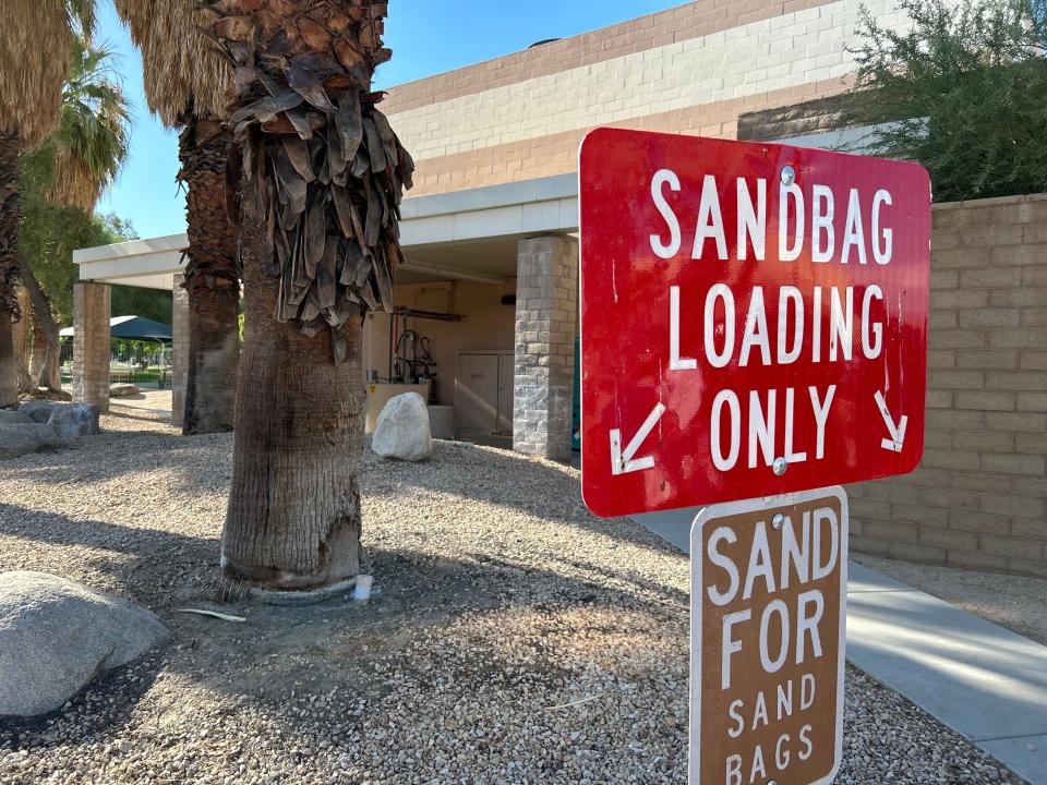
Residents can pick up sand to fill the bags with at Palm Springs City Hall, which is located at 3200 East Tahquitz Canyon Way.
Cathedral City
The city announced that empty sandbags will be available from 7 a.m. to 8 p.m. at Fire Station 412, which is located off of Ramon Road at 32100 Desert Vista. Shovels are also being provided on site to make it easier for residents to scoop sand to fill the bags with.
Rancho Mirage
Sandbags, shovels and sand will be available starting at noon on Friday at two locations:
The Rancho Mirage Library and Observatory at 71100 Highway 111 in a dirt lot on the west side of the parking lot
Fire Station 69 at 71751 Gerald Ford Drive
Other cities
The Riverside County Fire Department said limited quantities of unfilled sandbags are available at its stations. There are over 20 stations in the Coachella Valley and surrounding cities, including stations in Palm Desert, La Quinta, Rancho Mirage, Desert Hot Springs, Indio, Coachella, Indian Wells, Mecca, Banning and Idyllwild.
The department has created an online tool for residents to find the closest station to their home. It can be accessed here.
—Paul Albani-Burgio
What to expect with a tropical storm watch
The service said a storm watch, which was issued at around 8:30 a.m. Friday, means that tropical storm-force winds — sustained speeds of 39 to 73 mph — are possible within the next 48 hours.
The current forecast calls for peak winds of around 40 to 55 mph, with the highest winds expected between Sunday afternoon and early Monday morning.
The service says the winds could cause some weaker trees to snap or be uprooted and be enough to blow away objects such as awnings, sheds and even unanchored mobile homes. It also warned that roads could become impassable from debris.
However, the biggest threat from the storm is expected to be the rain and potential flooding, which could make it necessary to evacuate people from flooded areas and rescue those who become stranded.
The weather service cautioned that “in mountain areas, deadly runoff may rage down valleys while increasing susceptibility to rockslides and mudslides. Flood control systems and barriers may become stressed.” The storm will also have the potential to flood and even wash away structures while escape routes could also be covered by water.
The storm even brings a limited risk of tornados and warned that people should be prepared to shelter quickly in the event of one.
—Paul Albani-Burgio
This article originally appeared on Palm Springs Desert Sun: Hurricane Hilary live updates: Palm Springs PD announces road closures

