Hilary updates: I-10 near Palm Springs area closed until further notice
Hurricane Hilary is advancing toward California and Arizona, with the potential to bring storms and flooding. Here's what you need to know about where it's heading and what to expect.
U-Haul offering free storage to Southern California residents
Residents in Southern California who have been impacted by the storm are being offered 30 days of free self-storage from U-Haul, according to a press release from Andi Batchelor, a spokesperson for the company.
Portable U-box storage containers are also being offered. These can hold household items and furniture that fill an average room to an average room and a half, according to U-Haul’s website.
“Having accessibility to secure and dry self-storage is always beneficial to communities affected by natural disasters,” Batchelor wrote.
Seven U-Haul facilities across five regional companies are extending this offer, according to the release.
— Elena Santa Cruz
Hilary estimated to cause between $7 and $9 billion dollars worth of damage
In a press release from AccuWeather's Global Weather Center, preliminary estimates of the damage and economic loss from Hilary were estimated between $7-$9 billion dollars.
Widespread flooding in southern California, washed out roads and bridges, shutting down businesses in major cities like Los Angeles and San Diego. Heavy rain is also being seen up the Western Coast of the United States as far north as Nevada and the northern Rockies.
Costs of evacuations, relocations, emergency management and cleanup were also taken into account for the estimates.
― Fernando Cervantes
I-10 near Palm Springs area closed on Monday
Interstate 10 is closed near the Palm Springs area, according to CalTrans. Closures are in place on both the east and westbound sides from Haugen Lehmann to Bob Hope and would remain closed until further notice.
Trained weather spotters reported water flowing across I-10 in multiple locations on both the eastbound and westbound lanes.
Many other roads are closed due to storm damage and flooding across the Coachella Valley, leaving significant clean-up work to allow residents to travel across the valley again.
Heads up for those traveling to/from Arizona on I-10 through the Palm Springs area. https://t.co/xs10XC2ncl
— Arizona DOT (@ArizonaDOT) August 21, 2023
“This storm has been unlike anything our community has faced before. We want to thank our residents, businesses, and members of the community for their patience as we work to clean up downed trees and mitigate flooding. Not everything is a quick fix, but our team is doing our best to have Palm Desert up and running tomorrow,” the City of Palm Desert said in a statement on its Facebook page Sunday evening.
—Desert Sun reporter Erin Rode
Page residents advised not to travel in the next few days
The Page Police Department asked people in the Page area who have travel plans to reconsider them or postpone them for a couple of days.
If people are planning to travel toward Las Vegas or Southern California in the next 48 hours, Page police advised them to avoid hitting the road due to hazardous weather conditions on those highways.
"We beg you to adjust your travel plans," police said. "If you do decide to travel in those areas, you're potentially risking your life, the lives of others, and the lives of first responders. Please, stay put, stay safe and don't become part of the problem."
― Laura Daniella Sepulveda
57K without power in Southern California as Hilary downgraded to post-tropical cyclone
Hilary brought intense rainfall to Southern California on Sunday, leaving thousands of residents without power as the storm took out power lines.
As of 3:50 a.m. Pacific, there are over 57,000 reported outages in California, according to Poweroutage.us.
Over 23,000 of those outages are reported in Los Angeles County and over 6,000 are reported in San Bernardino County.
Hilary, which was downgraded to a post-tropical cyclone overnight, was the first tropical storm to cross into California from Mexico since Nora in 1997, the National Weather Service office in San Diego said Sunday night.
If Hilary had come in off the ocean in a landfall in California, it would have been the first tropical storm to do so since 1939.
Hilary is still expected to bring heavy rain and significant flooding to the Southwestern portion of the U.S. as it heads northward, the National Hurricane Center said.
President Joe Biden, who is traveling to Hawaii on Monday to survey damage from devastating wildfires in Maui, urged "everyone in the path of this storm to take precautions and listen to the guidance of state and local officials."
― USA Today
Southern Arizona sees minimal rain, strong winds on Sunday
Strong winds and overcast skies were present over Elgin in Santa Cruz County in southern Arizona on Sunday.
Gusty winds were expected throughout the evening in the community roughly 60 miles southeast of Tucson on Sunday. Minimal rainfall had been reported as of Sunday evening.
― José Ignacio Castañeda Perez
Storm hazards expected, isolated tornadoes possible in Arizona
A more intense array of hazards is expected to sweep across the state on Sunday night and Monday as Tropical Storm Hilary passes northward, according to the National Weather Service.
High rain amounts, severe storms and strong winds were expected to develop overnight Sunday, with the highest impacts forecast for the northwestern parts of the state.
"Even an isolated tornado or two cannot be ruled out as Hilary continues moving north across the region," the weather service said in a forecast update on Sunday evening.
According to the weather service, strong to severe winds associated with Hilary coming east from the Lower Colorado Valley would make an isolated tornado possible northwest of the Valley.
Flash-flooding chances were also heightened with storms forming in northern Arizona. Additional flood watches were issued across the higher terrains of eastern Maricopa County and central to southern Gila County.
― Laura Daniella Sepulveda
Weather service cautions motorists about dangerous driving conditions in Yuma County
According to the National Weather Service in Phoenix, Phoenix Sky Harbor Airport recorded temperatures 3 degrees below normal at a high of 102 degrees.
Meanwhile, in southwest Arizona, Yuma County is seeing wind gusts of more than 60 mph. With reduced visibility, travelers are urged to change plans. The weather service cautioned drivers in the region that dangerous driving conditions would last through at least 7 p.m. Sunday.
Today's high at PHX Sky Harbor Airport has been 102 degrees. That's 3 degrees below normal/average for the date. #azwx pic.twitter.com/osPsceU3ll
— NWS Phoenix (@NWSPhoenix) August 20, 2023
Hilary closes Southern California schools
Still heavily impacting the region, Tropical Storm Hilary was closing schools across Southern California.
The Los Angeles Unified School District, the nation's second-largest school system, said all campuses would be closed on Monday.
“There is no way we can compromise the safety of a single child or an employee, and our inability to survey buildings, our inability to determine access to schools makes it nearly impossible for us to open schools," LA schools Superintendent Alberto Carvalho said at a media briefing.
All schools will be closed Monday in two of the Coachella Valley's three districts, Desert Sands Unified and Palm Springs Unified.
San Diego schools postponed the first day of classes from Monday to Tuesday.
― Associated Press and The Desert Sun
National Weather Service issues wind advisory for Phoenix area
According to the National Weather Service in Phoenix, a wind advisory is in effect until 7 p.m. Sunday. South winds are expected to reach 15 to 25 mph, gusting up to 40 mph.
Visibility could decrease to less than 1 mile and light objects can become airborne, according to the weather service.
The following areas are impacted by the weather advisory: Buckeye, Avondale, Cave Creek, New River, central Phoenix, Deer Valley, East Valley, Fountain Hills, east Mesa, north Phoenix, Glendale, northwest Valley, Scottsdale, Paradise Valley, South Mountain, Ahwatukee Foothills, southeast Valley and Queen Creek.
— Bahar Anooshahr
5.1-magnitude earthquake shakes parts of Southern California
A 5.1 magnitude earthquake was reported in Ojai in California as Tropical Storm Hilary brings torrential rainfall and heavy wind to Southern California, according to the United States Geological Survey.
The epicenter of the quake was in Ojai, which is between Santa Barbara and Ventura, a bit north of Los Angeles.
There were no immediate damages reported, according to a post from the Ventura County sheriff.
At least two aftershocks were reported, and the quake was felt throughout parts of Los Angeles, according to a USGS tool that allows residents to report their experiences.
― Ellie Willard
Crews work to clear boulders from I-8 near In-Ko-Pah
Caltrans officials caution drivers to avoid desert roadways in California, including Interstates 8 and 10.“All rural highways are considered extremely hazardous to travel on,” according to Caltrans.
Crews were working to clear boulders from the road on I-8 near In-Ko-Pah on Sunday afternoon. The agency cautioned people to stay home.
The National Weather Service in Phoenix reported rockslides, flooded roads and water rescues throughout southeast California.
Extremely hazardous conditions on the roadways in the California deserts including I-8, I-10, and all rural highways. Alter your travel plans. #cawx https://t.co/qzxwDYx16p
— NWS Phoenix (@NWSPhoenix) August 20, 2023
Jeremy M. Edwards, press secretary and deputy director of public affairs for the Federal Emergency Management Agency, tweeted: "At FEMA, we continue to monitor the impacts of #HurricaneHilary and remain in close coordination with our state and local partners. We stand ready to support California and other states affected by this storm should they request assistance to address any unmet needs."
FEMA also asked those affected by the storm to not "walk, drive, or swim through flood waters" or "drive around the barricades" as it takes only 6 inches of water to cause your car to lose control.
— Bahar Anooshahr
Newsom, Palm Springs officials discuss storm preparedness in Sunday visit
California Gov. Gavin Newsom stopped in Palm Springs on Sunday as Tropical Storm Hilary wreaked havoc on the Coachella Valley. He met with Palm Springs City Council members and staff in the city’s emergency operations center.
Newsom declared a state of emergency for much of Southern California on Saturday to support the Hilary response and recovery efforts as the state continues mobilizing and coordinating resources ahead of the storm's forecasted impacts.
The city posted photos of the visit on its Facebook page on Sunday, explaining that city staff updated the governor on the city’s storm preparations while Newsom offered “whatever assistance he could provide to the city.” The post noted that Newsom had been “instrumental in bringing Oakland Urban Search and Rescue and Swift Water California OES Task Force teams to Palm Springs," where they were going to be used to assist with rescues during the storm.
City officials said they also discussed a request for an elevated bridge on North Indian Canyon Drive over the Whitewater Wash. The Coachella Valley Association of Governments has been trying to secure funding for such a bridge, which would reduce the need for rain and wind-related closures.
— Desert Sun reporter Paul Albani-Burgio
Thousands without power around Yuma
More than 7,700 people in the Yuma area are without power, Arizona Public Service reported. The electrical utility company said it experienced 20 power outages in the area.
Yuma is still under a high wind warning through 11 p.m.
— Sean Holstege
Flood watch in effect for parts of northwest Arizona
As of 2:26 pm flood watch is in effect for portions of northwest Arizona, including Lake Mead National Recreation Area, Lake Havasu and Fort Mohave, Northwest Deserts and Northwest Plateau until Monday afternoon.
Portions of Arizona, including La Paz and Yuma counties and Imperial and Riverside counties in California are at risk for flooding until 6 p.m. So far, the following areas have had 0.5 inches of rain:
The following areas are expected to have major flooding: Senator Wash, Hemlock Canal, South Alamo Canal, Araz Wash, Crazy Woman Wash, Gavilan Wash, Little Picacho Wash, West Fork Yuma Wash, Iris Wash, Alamo River, Unnamed Wash, Carrizo Wash, Lopez Wash, Mission Wash, Ferguson Wash, McAllister Wash, Milpitas Wash, Yuma Wash, Hart Mine Wash, Marcus Wash, Clip Wash, Julian Wash, Picacho Wash, Vinagre Wash, Colorado River and Seco, Arroyo.
Here are the drainages that will experience flooding: Holtville, Algodones Dunes, Gordon`s Well, Andrade, Cibola, Palo Verde, Calipatria, Slab City, Glamis, Wiest, Alamorio, Bonds Corner and Niland. Authorities advise drivers to turn around when coming upon flood areas.
— Bahar Anooshahr
Yuma's triple storm threat being felt
As of 1 p.m. Sunday, the National Weather Service had three weather warnings in effect for the Yuma area: a flood watch, a blowing dust advisory and a high wind warning.
The heart of Tropical Storm Hilary was reported as being 145 miles southwest of Yuma, according to AccuWeather, which said 1 to 2 inches of rain had fallen over the area.
The weather service reported light rain and blowing dust, with winds from the southeast gusting at 40 mph.
— Sean Holstege
Lake Mead Recreation Area is closed
The National Park Service has closed Lake Mead National Recreation Area. The closure will remain in effect “at least through Monday,” a Park Service advisory said.
“The park has already experienced multiple power and utility outages. Due to a storm event on Friday evening August 18, one marina experienced dock separation and access to the marina, vessels, and fuel is uncertain. This includes access to emergency response vessels and therefore emergency response will be extremely limited, if at all,” the advisory noted.
The Park Service added that the storm has prevented air support in Clark County, Nevada, making aerial search, rescue or evacuation missions impossible.
“Multiple park areas rely on ‘one road in’ access which have low water crossings and likely will be washed out, disconnecting entire communities from service and rescue,” the Park Service warned.
— Sean Holstege
Hilary has claimed its first life
One person drowned Saturday in the Mexican town of Santa Rosalia, on the peninsula’s eastern coast on the Gulf of California, when a vehicle was swept away in an overflowing stream. Rescue workers managed to save four other people, said Edith Aguilar Villavicencio, the mayor of Mulege township.
Weather authorities in United States have warned about what they called catastrophic and life-threatening flooding in the Southwest. The Phoenix Fire Department sent a search-and-rescue team to Yuma as a precaution and in parts of California, notably in San Bernardino County, authorities have issued stay-home and evacuation orders as the storm bears down.
— Sean Holstege and Associated Press
Hilary causing misery at Western airports, including Sky Harbor
Airports throughout California and in the U.S. Southwest have been hard hit by storm-related disruptions.
According to data at FlightAware, 165 flights in and out of Harry Reid International Airport in Las Vegas have been canceled, with another 44 delayed. In San Diego, 44% of flights were canceled, totaling 130 flights. Another 297 flights in and out of major California airports were canceled.
Phoenix Sky Harbor International Airport reported 66 cancelations early Sunday afternoon.
— Sean Holstege
Phoenix Fire crews sent to Yuma to assist emergency response teams
On Sunday afternoon, the Phoenix Fire Department sent a team of 16 water rescue specialists to Yuma in preparation for intense flooding and increased emergency response due to Tropical Storm Hilary.
"We know that there's a storm coming so we're just trying to pre-plan and get our resources there to assist other fire departments with an overwhelming response," said Phoenix Fire spokesperson Kimberly Quick-Ragsdale.
The team is supplied with three motorized inflatable boats to prepare for a swift water response and two Jon boats to assist Yuma Fire teams with water rescues.
"Once they arrive in Yuma, they'll meet with other agencies, their local police, fire, EMS, and they will determine what is needed at that time," Quick-Ragsdale said. "If they need to deploy more resources, we will surely do that."
— Ellie Willard
Hilary makes landfall over Mexico's northern Baja California Peninsula
The National Hurricane Center declared that Tropical Storm Hilary made landfall over the northern Baja California Peninsula of Mexico, according to its 11 a.m. Pacific time advisory.
The advisory stated Hilary was moving northwest at 25 mph.
While Hilary was downgraded from a hurricane to a tropical storm, the National Weather Service cautioned that Hilary is still carrying so much rain that forecasters believe it could be “catastrophic and life-threatening.” Flooding is likely across a broad region of the southwestern U.S., according to the weather service.
— Lillian Boyd
Carnival Cruise route modified in Mexico due to Hilary
A Carnival cruise, Panorama, has modified its schedule for the upcoming week due to Hilary's onset.
The seven-day cruise, which departed from Long Beach, will call on Cabo San Lucas, Mexico on Tuesday instead of Puerto Vallarta, Mexico. The call to Mazatlán, Mexico on Wednesday has been canceled; instead, the ship will call on Puerto Vallarta.
"As the safety of our guests and crew is our priority, we are continuing to monitor the storm and factor in guidance from the National Hurricane Center, U.S. Coast Guard and the local port authorities to provide timely updates to our guests as more information becomes available," Carnival Cruise Lines said in a statement.
— Ellie Willard
Hilary, downgraded, is in California closing parks
Weakened by landfall in Baja California, Hilary has been downgraded to a tropical storm and is now moving north through the California desert.
There, Joshua Tree National Park and the Mojave National Preserve are closed to visitors in response to Hurricane Hilary.
A flash flood watch is in place for Joshua Tree National Park through Monday at 5 p.m. Park staff said Friday they would spend the next 36 hours initiating the closure ahead of when the storm's worst impacts are expected.
"Visitors are encouraged to seek shelter and have a safety plan," park officials warned in a news release. "Reconsider outdoor activities for this weekend, be prepared to turn around if you experience moving water on roadways and be alert for lightning."
— Sean Holstege and The Desert Sun
Where did Hilary come from?
Hurricane Hilary formed as a tropical storm on Wednesday off Mexico's southern Pacific coast of Manzanillo.
The National Hurricane Center elevated Hilary to a Category 4 hurricane on Friday morning and reduced it to Category 3 on Saturday morning. By Saturday afternoon, Hilary was reduced to Category 1.
The storm began moving west-northwest toward Baja California as it strengthened.
— Lillian Boyd
Hilary made landfall in the middle of the night
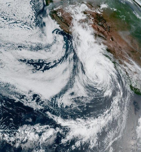
It looks like Hurricane Hilary has made landfall in Baja California.
Satellite imagery from the National Oceanic and Atmospheric Administration shows that the storm clipped the peninsula at Bahia Tortugas, about 350 miles south of Ensenada sometime in the dead of night, possibly around 2 a.m., Arizona time.
It reentered the Pacific Ocean and then made landfall again in the vicinity of San Quintin, about 200 miles farther north.
— Sean Holstege
Wind warnings and storms, but milder conditions for central Arizona
The National Weather Service is calling for a breezy Sunday with a slight chance of showers in the metro Phoenix area, developing into showers and windy conditions in the afternoon and into the evening.
Thunderstorms are possible after 3 p.m. Gusts could reach 35 mph, and the expected high temperature could reach 103, according to the latest weather service forecast. There is a 70% chance of rain, but “new rainfall amounts of less than a tenth of an inch” are called for in the Valley.
By Sunday night, the low is expected to drop to 79 with winds of up to 20 mph before midnight. The rainfall outlook is the same as during the day.
The weather service has posted a high wind warning for western Arizona, for parts west of Dateland. This includes Yuma, Kingman and the entire Colorado River area bordering California. It calls for gusts up to 70 mph from 11 a.m. to 11 p.m.
A wind advisory is in place for a swath of the state east of that region. It includes Tucson, Casa Grande, Phoenix and Prescott. It calls for gusts up to 55 mph from 11 a.m. to 10 p.m.
— Sean Holstege
Hurricane Hilary nearing San Diego
By daybreak in Arizona, Hurricane Hilary was sliding up the west coast of Baja California at 21 mph, packing maximum sustained winds of 80 mph, the National Hurricane Center reported. Tropical storm-force winds were expected to reach the international border in Southern California shortly after 8 a.m.
"Catastrophic and life-threatening flooding likely over Baja California and portions of the southwestern U.S. through Monday.
The effects of the storm in Arizona will be most felt along the Colorado River and around Yuma in particular.
"In the Southwestern United States, the potentially historic amount of rainfall is expected to cause flash, urban and arroyo flooding, including landslides, mudslides and debris flows," the Hurricane Center warned.
As of 7 a.m. the weather forecast for Yuma called for thunderstorms, a 75% chance of rain, up to a quarter inch.
— Sean Holstege
'A potentially catastrophic situation': Southern California braces for storm impact
Hurricane Hilary roared toward Mexico’s Baja California peninsula late Saturday as a downgraded but still dangerous Category 1 storm, the Associated Press reported.
The National Weather Service in Phoenix said light showers are tracking over southwest Arizona on Saturday evening. Heavier showers were expected to begin Sunday morning.
In San Diego, meteorologist Elizabeth Adams said as of 4 p.m. Saturday, Hurricane Hilary was off the coast of Baja California, some 600 miles south of the region. The weather service expects the storm to make landfall sometime Sunday, when heavy rainfall is expected.
"We have a very serious situation here, folks," said Adams, describing the increasing chances and rate of rain that will hit the Coachella Valley and the rest of Southern California's mountain and desert region.
She said rain in the valley, like in Palm Springs, had been delayed compared with what they were expecting on Saturday afternoon. But the chances are increasing into the evening, and she estimated a likely 3/4 inch of rain for the area Saturday night.
Sunday is when conditions are expected to worsen considerably. Sunrise to lunchtime, is when "precipitation starts to get really heavy," she added. The chance of rain increases to 90% to 100% during this period, and about that time, she said the region can expect an inch to an inch and a half of rain in a six-hour period.

During Sunday afternoon, Adams said the rate of rain could increase to 2 inches an hour, resulting in possible "widespread, very life-threatening flash flooding"
"This will become a potentially catastrophic situation developing in the deserts and eastern mountains tomorrow afternoon,” Adams said.
She urged people to pay close attention on Sunday to whether officials announce potential evacuations.
― Desert Sun staff, Lillian Boyd and Associated Press
California Gov. Gavin Newsom declares state of emergency
Saturday night, as Hurricane Hilary approached the Mexican Pacific coast in Baja California, Gov. Gavin Newsom of California declared a state of emergency.
The proclamation, released on Saturday afternoon, comes as Hurricane Hilary was classified as a Category 2 storm, with catastrophic flooding being forecast on Sunday for much of the southwestern United States. Meteorologists warned that despite weakening, the storm remained treacherous, with the potential to bring flash floods, mudslides, isolated tornadoes, high winds and power outages.
According to the Governor's Office, more than 7,500 personnel have been deployed in response to the proclamation. Hurricane Hilary is expected to make landfall between Saturday night and Sunday morning.
The forecast also prompted authorities to issue an evacuation advisory for Santa Catalina Island, urging residents and beachgoers to leave the tourist destination 23 miles off the coast.
Forecasters warned the storm could dump up to 10 inches — a year's worth of rain for some areas — in Southern California and southern Nevada.
― Fernando Cervantes and Associated Press
Valley forecast: Phoenix, Tucson areas to see rain, thunderstorms this weekend
Flooding potential increases for Sunday in Arizona, California
Potential for flooding will increase Sunday for communities in Arizona and California impacted by Hurricane Hilary, according to the National Weather Service in Phoenix.
Much of Arizona, including most of the Valley, faces a “marginal,” or 5%, chance of excessive rainfall starting at 5 a.m. Sunday. Those areas are shaded green on the map provided by the National Weather Service. Portions of western and northwestern Arizona have a “slight,” or 15%, chance of excessive rainfall, represented in yellow.
309pm: Flooding potential increases Sunday as a weakened form of Hurricane Hilary moves through (focused over CA). The map shows the potential for excessive rain from 5am Sunday through 5am Monday. Note, localized heavy rain can occur even in the green areas (2) #cawx #azwx pic.twitter.com/qmS1vZVsd9
— NWS Phoenix (@NWSPhoenix) August 19, 2023
“Note, localized heavy rain can occur even in the green areas,” the National Weather Service in Phoenix wrote in a post on X, formerly known as Twitter.
Southern California will see a higher risk of excessive rainfall as Hurricane Hilary makes its way up the West Coast.
Winds also were expected to increase Sunday, the National Weather Service said. Gusts of up to 65 miles per hour may be possible along and south of Interstate 8 in southwestern Arizona. Areas of western Maricopa County can expect to see gusts of up to 50 miles per hour, and wind gusts could top out at 40 miles per hour in the Valley.
― Sasha Hupka
Hurricane Hilary downgraded to a Category 2 storm
Hurricane Hilary has weakened from a Category 3 to a Category 2 storm as it approaches the West Coast, according to the National Hurricane Center.
“Hilary appears to be weakening quickly,” wrote John Cangialosi, a senior hurricane specialist with the center, in a memo. “The eye is filling and the cloud tops in the eyewall and rainbands have been warming during the past several hours."
The storm was moving north-northwest toward the Baja California peninsula on Saturday afternoon. It was producing winds of up to 110 miles per hour.
While Hurricane Hilary is expected to continue weakening as it moves northward, Cangialosi wrote that it is still expected to cause “dangerous to locally catastrophic” flooding in the Southwest through early Monday.
“Hilary is still expected to be a hurricane when it makes landfall or moves very near the central portion of the Baja California Peninsula,” he wrote. “There is high confidence that Hilary will move into southern California as a tropical storm.”
― Sasha Hupka
Gov. Hobbs monitoring Hurricane Hilary, in touch with federal and tribal officials
Gov. Katie Hobbs is keeping tabs on Hurricane Hilary as it barrels toward landfall, according to the Governor’s Office.
“The governor is actively monitoring the situation and is prepared to take action to address the situation,” said spokesperson Christian Slater.
Slater confirmed that state officials are in touch with the Federal Emergency Management Agency and U.S. Customs and Border Protection to prepare for the storm. Arizona’s Department of Emergency and Military Affairs is coordinating with federal, local and tribal officials on the ground, Slater said.
― Sasha Hupka
High temperature in Phoenix below 100 for first time in 2 months
For the first time in more than two months, the Valley failed to reach triple-digit temperatures. On Saturday, the high temperature recorded by the National Weather Service at Phoenix Sky Harbor only reached 95 degrees.
The last time highs did not reach 100 degrees was on June 13.
“We’ve been clouded over for most of the day, and we’ve also had convection out in the west so we’ve had some rain-cooled air that’s moved into the area,” said Alex Young, a meteorologist with the weather service.
With Hurricane Hilary moving through the Baja California peninsula over the weekend, the effects of the storm are expected to have an effect on Arizona on Sunday, according to Young.
FEMA director urges residents to be prepared for 'dangerous storm'
Officials with the Federal Emergency Management Agency said Saturday that they are preparing for “heavy impacts from rain and flooding” to communities in Hurricane Hilary’s path.
“As you heard from the president yesterday at Camp David, he is fully briefed and he has encouraged everyone to make sure that they are aware of what this dangerous storm is potentially going to bring, and to listen to their local officials on the steps they can take to make sure they are keeping safe,” said FEMA Administrator Deanne Criswell.
Criswell said she has been in touch with California Gov. Gavin Newsom and Nevada Gov. John Lombardo about their preparations for the storm. As of midday Saturday, she said she had not reached out to Arizona Gov. Katie Hobbs.
“That’s certainly something I can do as I continue to get updates on what the significance and severity of this storm will be,” Criswell said. “I’ll look with my team and see if they have something scheduled for the day. The important part is, I always like to reach out to the governors to open up that line of communication.”
The agency also has staff embedded in local emergency management offices as the Southwest braces for the storm.
Criswell urged residents to be prepared. She highlighted three immediate steps they should take to ensure they are hurricane ready:
Have a plan to communicate with family and friends before, during and after the storm.
Set up emergency weather alerts and ensure you can receive them on your mobile phone.
Follow the direction of local officials. They are most familiar with immediate conditions in your area.
Sky Harbor sees flight delays and cancellations as Hurricane Hilary nears landfall
Nearly 20 flights had been canceled and about 70 were delayed from Phoenix Sky Harbor International Airport as of midday Saturday, according to the airport’s website.
Saturday’s canceled flights included several to Las Vegas, Los Angeles and Los Cabos, Mexico. About 25 additional flight cancellations had already been announced for Sunday, with destinations ranging from Denver to St. Louis.
The travel interruptions came as Hurricane Hilary prompted even more delays and cancellations at other Southwestern hubs.
Los Angeles International Airport and San Diego International Airport were experiencing flight delays averaging 45 minutes as of midday Saturday, per the Federal Aviation Administration. Delay times at both airports are expected to increase as Hurricane Hilary barrels toward Southern California.
Hilary's path in northern Arizona shifts westward
Much of northern and central Arizona could be spared the worst of Hurricane Hilary's impacts as radar suggests the storm is moving further west.
Scattered storms are expected today in Flagstaff and heading west with isolated storms elsewhere across northern and central Arizona, according to the National Weather Service in Flagstaff. But while the moisture looks to be moving further west, the agency warns that any of the weekend's storms still have the potential to produce heavy rainfall and subsequent flash flooding.
Rain is expected to pick up tonight through Sunday, mostly confined to far western Arizona including much of Mohave County.
With up to an inch of rain projected to fall in the area through the weekend, large swaths of the county including Kingman, Lake Havasu, Fort Mohave and Bullhead City are all under a flood watch until 5 p.m. Monday.
Far western, southwest Arizona to face brunt of Hurricane Hilary
The greatest impact from Hurricane Hillary is expected in Southern California, far western and southwest Arizona, according to the National Weather Service. Currently a Category 3, the hurricane is expected to make landfall midday Sunday on the northwest Baja California coast, moving across southern California in the afternoon and night.
The weather service is also saying that Sunday will see strong and severe thunderstorms in southwest Arizona — generally along and southwest of Flagstaff, Phoenix and Tucson. There will be intense rainfall and flash flooding, along with damaging winds and isolated spin-up tornadoes.
Hurricane Hilary downgraded to Category 3 storm
Hurricane Hilary weakened from a Category 4 to Category 3 storm as it headed toward the West Coast, according to The National Hurricane Center.
On the morning of Aug. 19, Hurricane Hilary was about 235 miles southwest of the Baja California peninsula, moving north northwest and producing powerful winds of up to 125 mph.
The National Hurricane Center expected Hilary’s impact would produce “catastrophic and life-threatening flooding likely over Baja California and the southwestern U.S. through Monday.”
— The Republic staff
Flood watch in effect for southern Arizona
A flood watch in Yuma and La Paz counties was in effect from Saturday morning until Monday 5 p.m., as flash flooding could be caused by excessive rainfall over the weekend.
According to the National Weather Service in Phoenix, Saturday through Sunday will see most of Hilary's impact for southwestern Arizona, describing the conditions as "deteriorating" for areas such as Yuma and La Paz counties.
Strong storm activity in Yuma County was reported as early as Saturday at 6 a.m., according to the weather service.
— Joanna Jacobo Rivera
Where to get sandbags in Pinal County
Pinal County asked residents to call ahead to pick up sandbags at various locations in preparation for monsoon weather that could hit Arizona. Here is where residents can get sandbags:
Apache Junction: 305 E. Superstition Boulevard, Apache Junction, AZ 85119
Arizona City: 7945 W. Battaglia Drive, Arizona City, AZ 85123
Casa Grande: 22539 W. Peters Road, Casa Grande, AZ 85193
Hidden Valley: 43910 W. Meadowview Road, Maricopa, AZ 85138
Oracle: 1410 N. Justice Road, Oracle, AZ 85623
Riverside: 54970 E. Florence-Kelvin Highway, Kearney, AZ 85137
San Tan: 3535 E. Hunt Way, San Tan Valley, AZ 85143
Waste Tire: 12725 E. Adamsville Road, Florence, AZ 85132
— The Republic staff
Hurricane Hilary creeps toward landfall
Located about 240 miles west-southwest of the southern tip of Baja California on Saturday morning, Hilary was considered "large and powerful" by the National Hurricane Center with maximum sustained winds of 130 mph.
Hilary sped up and took a slight eastward shift in its track, the National Weather Service in San Diego said early Saturday, meaning its most significant impacts will be from Sunday morning through the evening.
— Anthony Robledo and Jeanine Santucci
Bullhead City provides sandbags ahead of storm
The Bullhead City Police Department asked residents to prepare as Hurricane Hilary continued on its path toward California and Arizona on Friday evening.
In a post shared on X, formerly Twitter, the Police Department said heavy rainfall was expected over the weekend. The agency asked residents to:
Secure items in yard.
Reconsider outdoor activities.
Avoid unnecessary travel.
The city also said residents could obtain sandbags to help stay safe. Sand and sandbags will be available under the large ramada at Rotary Park by the intersection of Lakeside and Balboa drives from 7 a.m. to 7 p.m. Saturday.
— Joanna Jacobo Rivera
Hilary isn't Arizona's first massive storm
Hilary is not the first large hurricane to hit Arizona.
In the last 10 years, the remnants of three other hurricanes dumped record-breaking loads of rain on the state. None were still named storms, but they left widespread havoc, just the same.
One of them turned parts of Interstate 10 into a lake of floating cars. Do you remember?
— Elena Santa Cruz
Southern Arizona counties prepare for possible deluge
Hurricane Hilary is expected to impact parts of Arizona this weekend, affecting mostly the southernmost areas of the state, including Yuma, La Paz and Pima counties.
According to the National Weather Service, Saturday through Sunday will see most of the impact for southwestern Arizona, describing the conditions as "deteriorating" for areas such as Yuma and La Paz County.
Here's how each county is preparing.
— Kye Graves
Mohave County prepares for potential storms, flooding
Cities and towns across the western border of Arizona are preparing for the arrival of Hurricane Hilary with Kingman, Bullhead City and Lake Havasu City estimated to see 1 to 2.5 inches of rain between Friday afternoon and Monday, according to the National Weather Service.
“Please be safe out there,” Bullhead City Mayor Steve D’Amico told residents on Friday. “Please stay home if you can, don’t drive anywhere unless it’s necessary and don’t let the brief periods of calm weather between pockets of storm activity fool you into thinking it's safe to be outdoors.”
In anticipation of flash flooding, self-fill sandbag stations have been set up across Mohave County, in addition to the Bullhead City Fire Department giving away up to 20 sandbags per household throughout the day on Friday.
Mohave County residents can find sandbags at the following locations, while supplies last:
Lake Havasu City
Fire Station 1: 96 Acoma Blvd. S. (Around north side of the station by the generator)
Fire Station 2: 2065 Kiowa Blvd. N. (West side parking lot area near chain link fence)
Fire Station 3: 3620 Buena Vista Ave. (East side of the station by the trash bin)
Fire Station 4: 3270 Paloverde Blvd. S. (East side of the station by the trash bin)
Fire Station 5: 145 Lake Havasu Ave. N. (Southeast corner of the rear parking lot)
Bullhead City
Up to 10 self-fill sandbags per household will be available at the large Rotary Park Ramada by the intersection of Lakeside and Balboa drives starting at 2 p.m. Friday and continuing from 7 a.m. to 7 p.m. Saturday.
Kingman
Fire Station 22 on the corner of Harrison Street and Andy Devine Avenue.
— Lacey Latch
Arizona rainfall amounts estimated
The National Weather Service office in Phoenix estimated rainfall amounts for southwestern Arizona as Hurricane Hilary moves closer.
Flood watches are already in effect for southwestern Arizona and southeastern California from Saturday morning through Monday morning, the weather service tweeted Friday afternoon.
"Rain amounts of 1 to 5 inches with locally higher amounts in this area will potentially result in widespread significant and localized catastrophic flooding," the tweet stated.
Yuma and Blythe are forecast to see 2 to 3 inches under current models, while Gila Bend, Wickenburg, Sedona and Prescott could see up to an inch, according to the weather service. Phoenix and Casa Grande could receive up to a half-inch.
— Michelle Cruz
Yuma opens sandbag station for residents
Yuma will provide a self-serve sandbag filling station in the Civic Center's east parking lot, at 1440 W. Desert Hills Drive, according to a city statement sent Thursday.
People can fill sandbags from 7 a.m. to 7 p.m. through Sunday. The city will evaluate, based on weather forecasts, whether the station should stay open into next week.
The station will be stocked with sand and empty bags for residents to self-fill sandbags while supplies last. A limited number of bags and sand may be available after 7 p.m.
Shovels may be available at the station as well, but the city recommends residents bring their own shovels when visiting the sandbag station. Residents are allowed five sandbags per vehicle.
— Michelle Cruz
What will Hilary bring to Arizona?
The historic storm's effects are already being felt. Rain chances are increasing, with the National Weather Service forecasting strong to severe thunderstorms with concerns of local damaging winds and flooding starting Friday. Increased moisture levels spurred showers around parts of the state on Thursday.
"Think of it as a more widespread monsoon event," said Tom Frieders, warning coordination meteorologist with the National Weather Service. "We're expecting several rounds of storms, especially across northwest portions of the state."
A flood watch for western Coconino County went into effect early Friday morning and will last until 6 a.m. Saturday. For other regions ― Mohave, La Paz, Yuma, Yavapai and parts of Pima and Santa Cruz counties ― flood watches will run till 5 p.m. Monday.
― Kye Graves
This article originally appeared on Arizona Republic: Hurricane Hilary updates: Live coverage as storm hits AZ, CA

