Power outages begin in Brices Creek as Craven County remains in Tropical Storm Warning
Update 8:30 a.m. Friday
Power outages are starting to make their way through New Bern and Craven County early Friday morning. As of 7:18 a.m., customers with Duke Progress Energy in Brices Creek were left without power due to fallen trees or limbs damaging the equipment, according to the company's website.
As of 9:30 a.m. all customers had power restored to them, according to the company's website.
In Havelock, there are 457 customers without power who have Duke Progress Energy. The company's website says crews are trying to bring power back to those impacted and the estimated time is around 12:30 p.m.
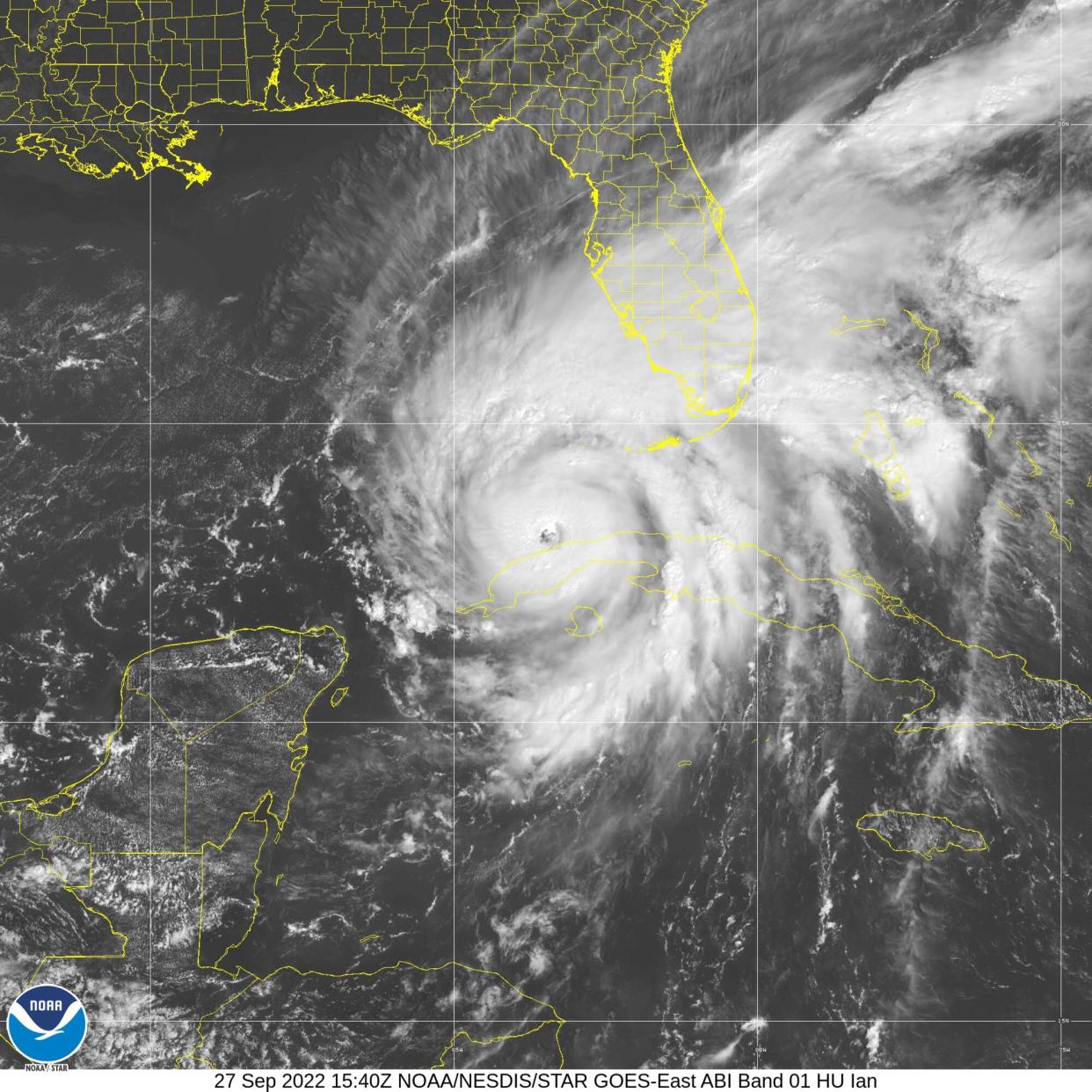
Residents are also feeling the effects of Hurricane Ian which remains a Category 1 storm early Friday. Ian is expected to weaken once it makes landfall near Charleston, South Carolina.
According to the National Weather Service in Newport, there have been minimal changes to the impacts of Ian on eastern North Carolina. However, due to a slight eastern shift in the storm's track, the entire area remains under a Tropical Storm Warning with some areas also under a Storm Surge Warning or Storm Surge Watch.
The main concern continues to be flooding, with higher confidence in 2-4 feet of inundation for the Neuse River.
Update 5 p.m. Thursday
Tropical Storm Ian has strengthened into a Category 1 storm as it continues its path up the east coast over the Atlantic Ocean.
Hurricane Ian has sustained winds at 75 mph and is expected to make a second landfall in the United States on the South Carolina coast.
Residents in Eastern North Carolina remain under a tropical storm warning.
Update 1:30 p.m. Thursday
Hurricane Ian has been downgraded to a tropical storm, however, meteorologists are now saying it could strengthen to a Category 1 storm again with its current path moving up the east coast and back over the Atlantic Ocean.
Tropical Storm Ian has now moved off the coast of Florida and will soon make its way NW towards South Carolina and Georgia, according to the National Weather Service in Newport. We will begin to feel the impacts of Ian tonight and through the weekend.
Deep tropical moisture from Ian will collide with a frontal boundary that will result in strong NE to E winds, heavy rainfall and coastal flooding across much of the Southeast, including eastern North Carolina.
More:After two severe accidents in the past four months, are these New Bern bridges safe?
More:Changes coming to historic Craven County Courthouse. Here is what it will look like
More:Fall's fear-filled festivities: 5 hair-raising Craven County attractions
Areas of Craven, Pamlico and Jones counties are still expected to see 4-6 inches of rain with gusts increasing to around 35 mph. Areas in Lenoir County are expected to see similar impacts.
Original Story
Hurricane Ian is expected to bring winds, heavy rains and possible flooding to Eastern North Carolina beginning late Thursday night.
Hurricane Ian strengthened to a major Category 3 storm as it headed toward Cuba early Tuesday morning. It is expected to make its impact along the central Florida west coast late Thursday into Friday morning.
Between 5 a.m. Monday and 5 a.m. Tuesday, the hurricane's maximum sustained winds increased from 75 mph to 125 mph, meeting the criteria for rapid intensification, the process in which a storm undergoes accelerated growth by intensifying by at least 35 mph in a 24-hour period.
Tom Lonka, a meteorologist at the National Weather Service in Newport said the storm will begin affecting eastern North Carolina on Thursday bringing strong winds to the area.
"What we're most confident about at this point in time is a lot of rain coming our way in all of Eastern North Carolina pretty much," he said.
Lonka said rain is expected to begin around the evening commute time Thursday evening and rain is expected to last all day Friday meaning coastal flooding could be a threat.
"We could see some coastal flooding, impacts up the Neuse River and along the Pamlico Sound, beach erosion and high surf," he said. "There could be a prolonged period of northeast winds developing as early as Wednesday night. Residents should have a hurricane plan in case the storm decides to come up the Atlantic Coast after hitting Florida," he said. "It's certainly a possibility. So prepare for power outages, a worst-case scenario if we get strong enough winds."
Areas such as New Bern, Havelock, Vanceboro and Jones and Pamlico counties are expected to see between 4-6 inches of rainfall with wind gusts of up to 30 mph throughout late Friday and early Saturday.
For residents in Lenoir County and Kinston, the NWS expects similar impacts from Hurricane Ian. Kinston's outlook for rainfall is between 4-6 inches with wind gusts up to 35 mph beginning late Thursday night through early Saturday morning.
This article originally appeared on Sun Journal: Hurricane Ian expected to bring heavy rainfall to Eastern NC

