Hurricane Ian to bring tropical storm force winds, flooding risks to Treasure Coast
Wherever Hurricane Ian makes landfall on the state's west coast, the Treasure Coast likely will experience tropical storm force winds and a moderate risk of flooding with anywhere from 4 to 6 inches of rain, meteorologists said.
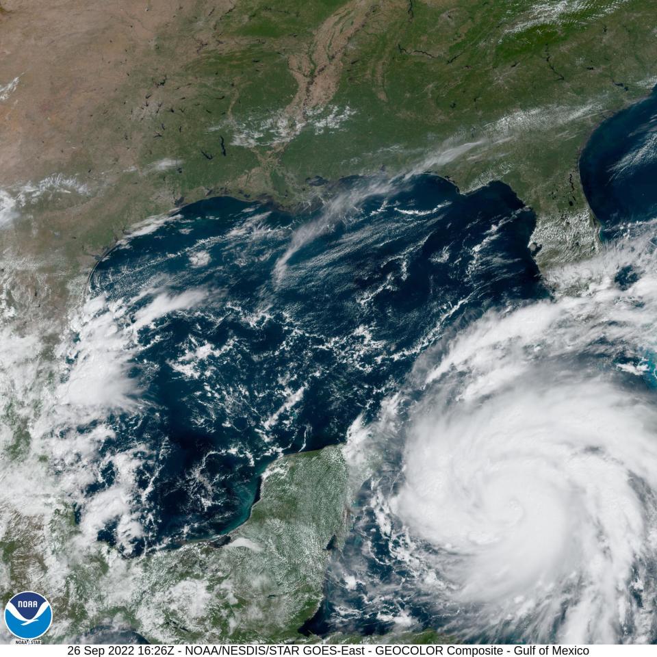
The storm is expected to be in the southeastern Gulf of Mexico by Tuesday morning after moving northwest past Cuba and the Cayman Islands at roughly 13 mph Monday, according to the National Hurricane Center.
It is expected to slow in the Gulf and continue north-northwest where it will approach the state’s west coast by Wednesday or Thursday.
National Weather Service tropical program coordinator Joel Cline said as it moves north out of the Caribbean, a variety of weather factors, like wind shear from fronts already in the Gulf, will ultimately determine where it makes landfall.
As of noon Monday, he said a northwest landfall is the “most likely,” but also said “there is a scenario where it does impact further south.”
He wouldn’t name a region where the storm might move onto land saying, “I think that’s a bit too specific for this far out in the future.”
Ian is expected to be a major storm before reaching western Cuba and reach its “peak intensity” within 36 hours of being in the Gulf, according to the National Hurricane Center. It is forecast to weaken, but should “remain at or near major hurricane strength” as it passes along the state’s west coast.
The latest National Hurricane Center projections show the cone of the storm’s anticipated path grazing the coast off St. Petersburg, Clearwater and Tampa before crossing the state north central part of the state into Georgia by Saturday.
“We’ll know a lot more tomorrow (Tuesday),” said Cline.
Cassie Leahy is a meteorologist with the National Weather Service in Melbourne.
“The track forecast is coming into better agreement as we get closer,” said Leahy. “This weekend the storm wasn’t fully developed ... It had at one point multiple centers as it was in the Caribbean.”
Although, Monday’s National Hurricane Center graphics kept the Treasure Coast out of the cone of uncertainty, Leahy said “little wobbles” to the east or west “can make a difference.”
“Any kind of shift back east that would increase impacts for the Treasure Coast,” she said.
Treasure Coast residents should prepare for days of rain and gusty winds from squall lines in Ian’s outer bands.
“We’re expecting quite a bit of moisture to be pulled up out of the tropics,” Leahy said. “Looks like the earliest reasonable time some tropical storm force winds to move into the Treasure Coast is Tuesday night, Wednesday morning.”
Tropical storm force winds start at 40 mph, she said.
Cline said the counties further north, like Indian River County, would likely see more of the effects with the storm’s current projected path.
"We’re still going to get rain bands from the storm no matter where it ends up tracking," Leahy said.
Both Leahy and Cline advised resident to continue storm preparations.
Asked about shuttering homes, she said it was a personal decision, but factors to consider are presence of trees and potential debris.
“People are just going to have to keep an eye on the forecast,” Leahy said.
Corey Arwood is a breaking news reporter for TCPalm. Follow Corey on Twitter @coreyarwood, or reach him by phone at 772-978-2246.
This article originally appeared on Treasure Coast Newspapers: Hurricane Ian to bring tropical storm force winds, flooding risks to Treasure Coast

