Hurricane Ian forecast cone may have been cone of confusion for some people
The hurricane forecast cone was introduced in 2002 as a way to communicate the track of an incoming storm to the public.
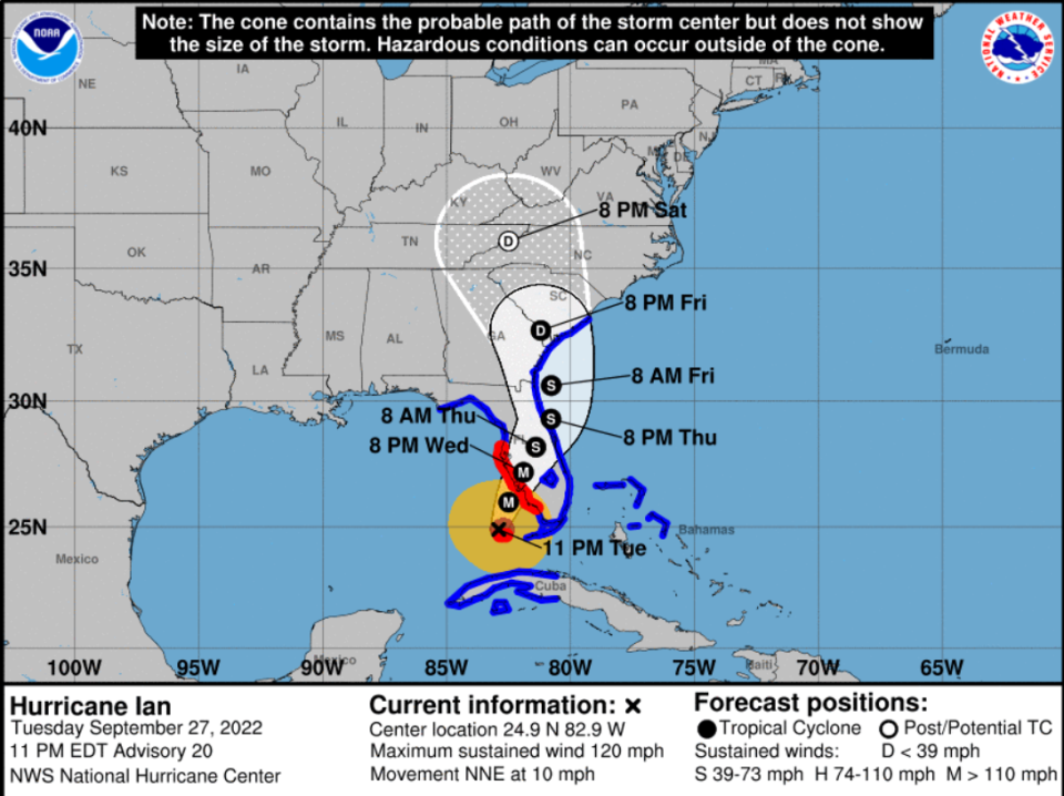
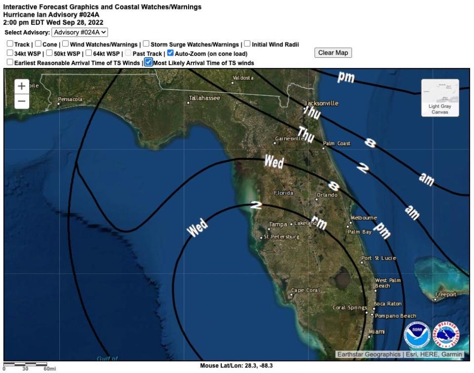
It has been maligned, misunderstood and regretted ever since. In Hurricane Ian, the cone swung significantly from Pensacola to Miami with the Category 4 storm eventually making landfall near its eastern edge where people may have thought they were safe.
“People don’t understand the cone, absolutely not,” said Bryan Koon, vice president of homeland security and emergency management for IEM, a company that works with government and private organizations to improve disaster preparedness, response and recovery.
Koon also was director of the Florida Division of Emergency Management from 2011 through September 2017. “It's nice people are paying attention to the cone, but they look at it and think that’s where the hurricane will impact and nowhere else.”
Why was Hurricane Ian so bad?: 3 factors created a 'worst-case scenario'
When Hurricane Ian came roaring in: How each county handled life-saving evacuations
Hurricane Ian: Forecasters still struggle to warn people of hurricane storm surge dangers
More: Hurricane Ian underwent an eyewall change, turning a disheveled mess into a monster
The cone is brilliant in its graphical simplicity — a high beam on a region destined for heartbreak.
But that is also its downfall as people fall into the trap of thinking a hurricane’s damaging winds, storm surge and flooding rain will fit neatly inside the confines of the fuzzy white funnel, and that the tropical cyclone will track down the middle.
Storm impacts can extend beyond the area in the cone
Instead, the center of a storm can track anywhere inside the cone with impacts far afield. Thirty-three percent of the time the storm travels outside the cone.
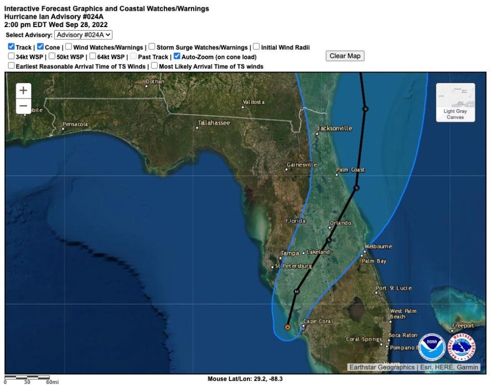
It’s a challenge for the National Hurricane Center, which got so frustrated by people focusing on the “skinny black line” down the center of the cone as the absolute path of the storm, it deleted the line from the main graphic. (You can still manually add the center forecast track line if you know which button to click.)
Related: Hurricane 'cone of uncertainty' gets everyone's attention; so will it change again this year?
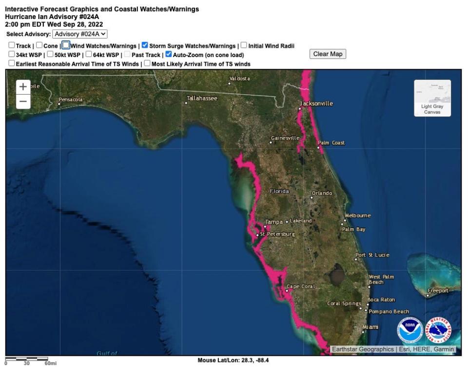
In 2017, the hurricane center gave the cone a makeover that included shaded areas encircling the center of a storm to show reach of tropical storm- and hurricane-force winds. It was hoped the change would be a better indication of how far away from the center hazardous winds might exist.
A year later, the Hurricane Forecast Improvement Project announced it planned to study the effectiveness of several of the hurricane center’s communication tools, including the cone.
"We know there are limitations with the cone graphic, and the concern is people think that if you're not in it, you're safe," said Ed Rappaport in 2018 when he was acting director of the National Hurricane Center. "The cone graphic is almost impossible to replace because it's so ingrained, but maybe we could add to it, or introduce something that could become even more popular."
Rappaport retired in 2021 after 33 years at the hurricane center.
New graphics amplify projected storm impact, but cone is what people see
New graphics that show the extent of flooding and inundation levels of storm surge have also been introduced in recent years. But then people have to look at several different graphics to get a sense of the track of the storm, the wind field and the storm surge.
Hal Needham, an extreme weather and disaster scientist with the GeoTrek project, who studies storm surge, said instead of the hurricane forecast cone being emphasized in broadcasts, the storm impacts should take center stage.

“With the cone, you dig yourself into a hole that is hard to get out of,” he said. “People are busy and most of them aren’t weather nerds. They will look at one or two images and that’s what will influence them.”
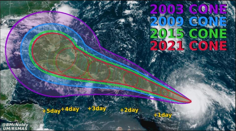
The size of the hurricane forecast cone is adjusted each year before June 1 based on the error rates of the previous five seasons. It has consistently gotten smaller as forecasts became more accurate, but that also means more impacts can occur outside of the cone.
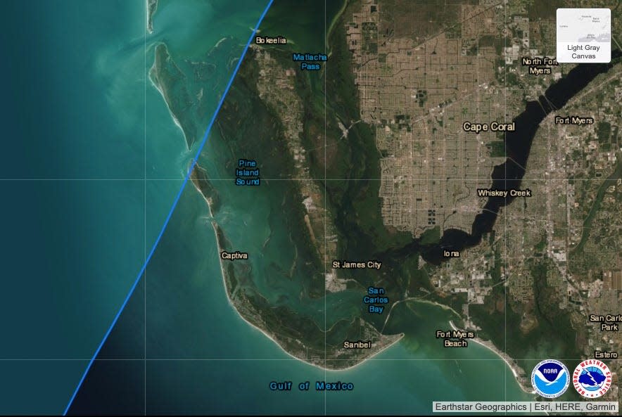
In defending evacuation decisions during Hurricane Ian, both Gov. Ron DeSantis and Lee County Sheriff Carmine Marceno said there were times when Lee wasn’t in Ian’s forecast track cone.
But at all times at least a sliver of Lee County, even if it was only Cayo Costa where Ian made landfall, was in the cone.
“Mother Nature taught us a lesson. It’s unpredictable,” Marciano said on Oct. 3, five days after Ian made landfall. “I am confident in the decisions that were made. I stand by them, and I wouldn’t change anything.”
This article originally appeared on Fort Myers News-Press: National Hurricane Center has modified forecast cone but to what end?

